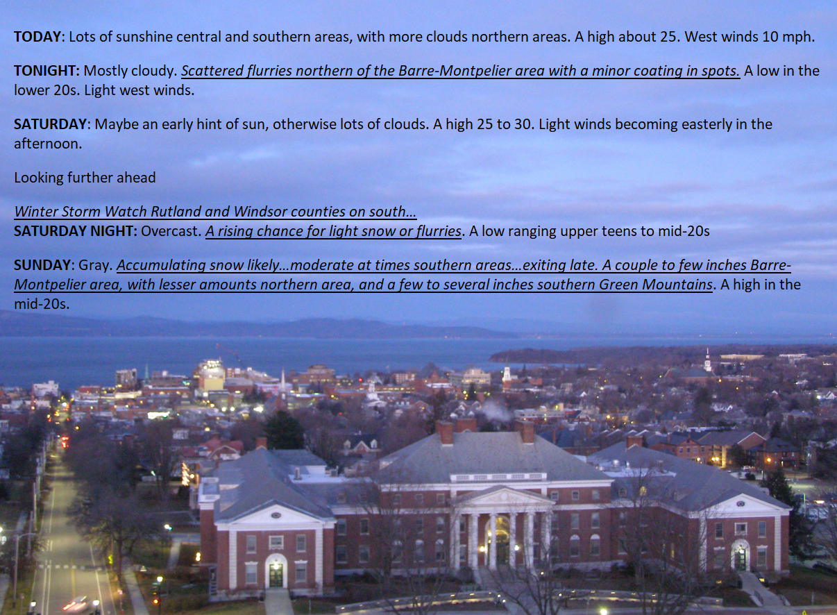
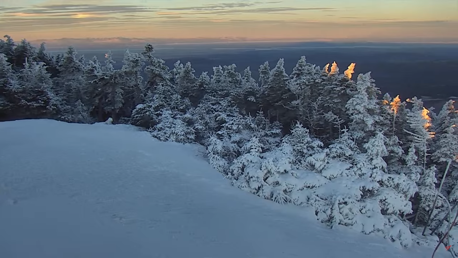
TONIGHT: Mostly cloudy.Scattered flurries with a minor coating central and northern areas. A low near 20. Light west to northwest winds.
TOMORROW: Maybe an early hint of sun, otherwise lots of clouds. A high mid to upper 20s. Light east to southeast winds.
Winter Storm Watch Rutland and Windsor counties on south…

SATURDAY NIGHT: Overcast. A rising chance for light snow or flurries. A low ranging around 20. Easterly winds 10 mph.
SUNDAY: Gray. Accumulating snow…moderate at times especially central and southern areas…winding down early evening. Accumulations of 1 to 4” far northern tier, 3 to 7” Barre-Montpelier, and 6 inches to locally a foot” across southern Green Mountains. A high in the low to mid-20s. Light northeast winds.
Looking further ahead

SUNDAY NIGHT: Lots of clouds. A few leftover flurries near the mountains especially in the evening.Lows upper teens to around 20
MONDAY: Mostly cloudy north, partly sunny central and south. A high 25 to 30.
TUESDAY: Brief hints of morning sun, then thickening clouds. Slight chance for light accumulating snow toward dark. A low 10 to 15. A high near 30.

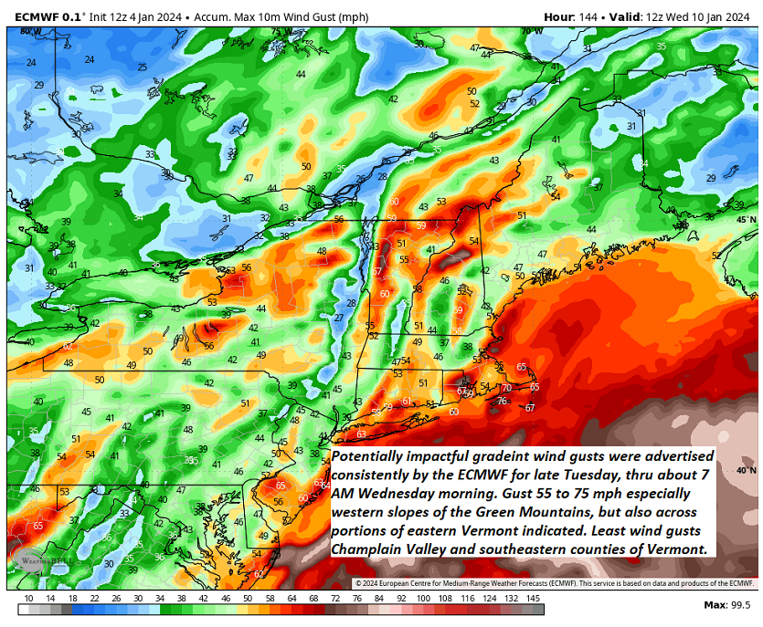
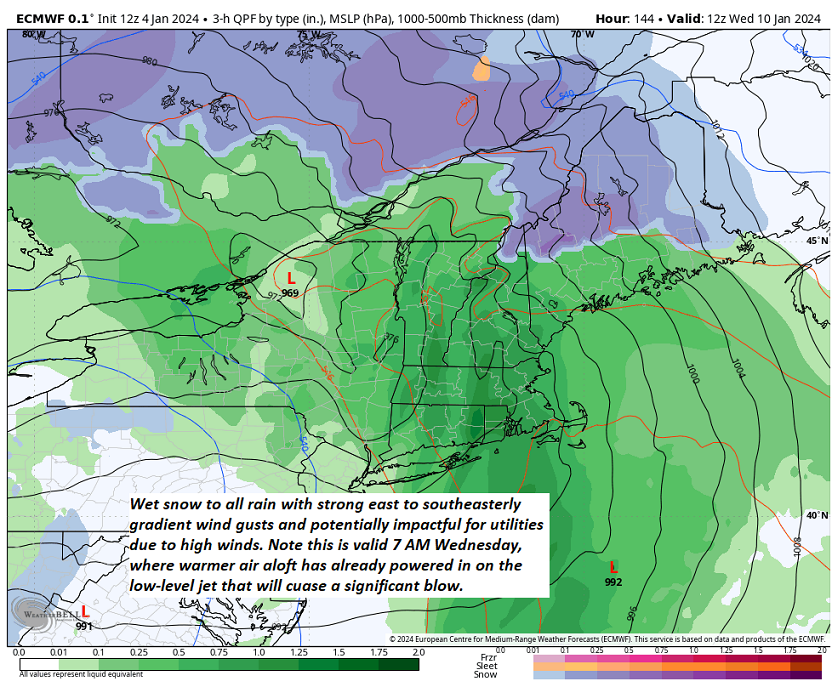
TUESDAY NIGHT – WEDNESDAY: Periods of wet accumulating snow…moderate to heavy at times transitions to mixed precipitation, then wind-blown rain, becoming lighter & showery in the afternoon. Breezy to windy with gusts exceeding 40 mph from the southeast. Temperatures near freezing Tuesday evening, rising into the 40s Wednesday afternoon.
Average lows single digits to around 10 above. Average highs mid-20s to around 30

RH/1-5forecast][end]