Updated Friday Evening Forecast — February 16th, 2024

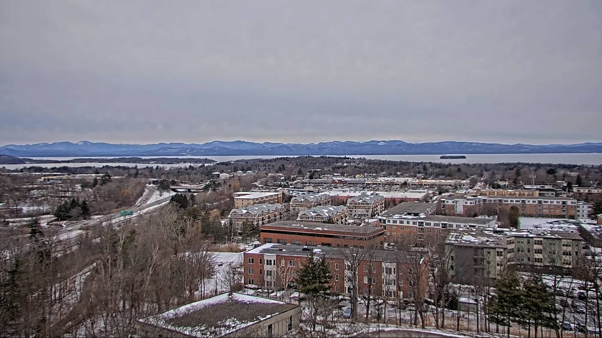
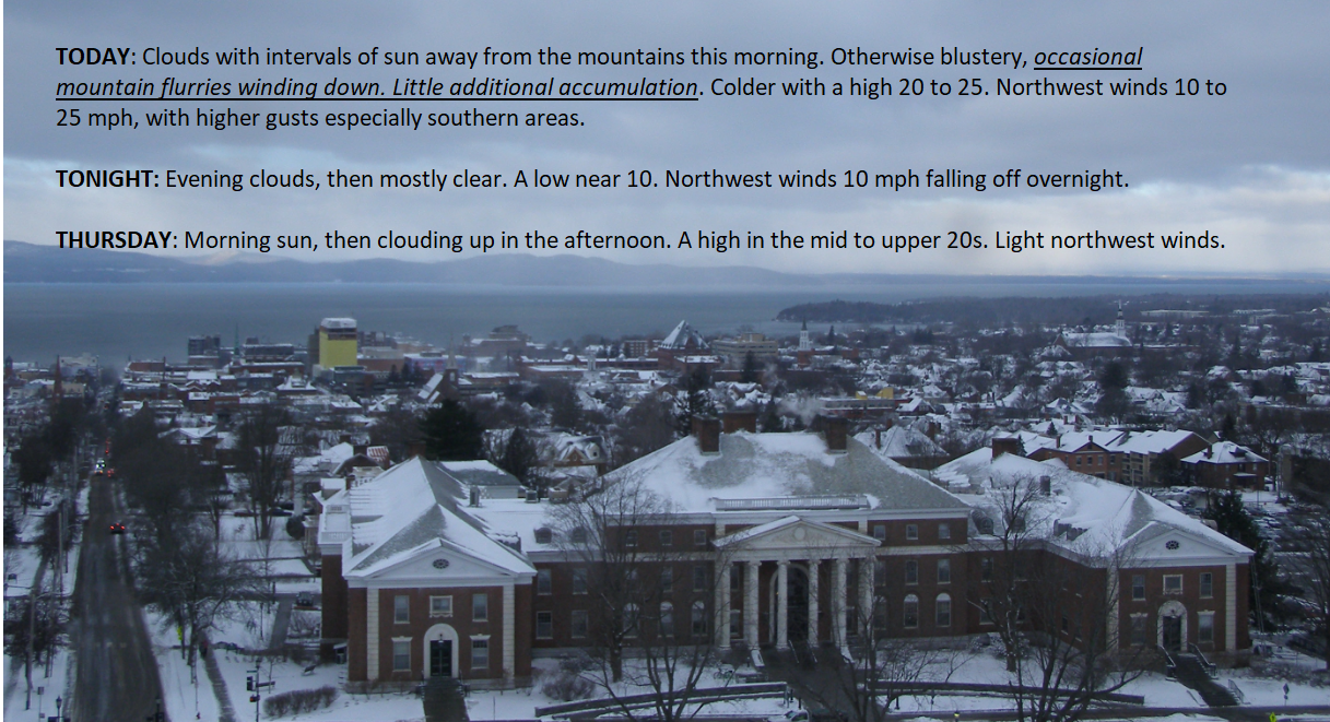
TONIGHT: Considerable cloudiness. Scattered mountain flurries. A low around 15. Light southwest winds.

TOMORROW: Lingering flurries or periods of light accumulating snow. A dusting to an inch accumulation. Otherwise cloudy with some late day breaks. A high in the mid-20s. Northwest winds 10 mph.

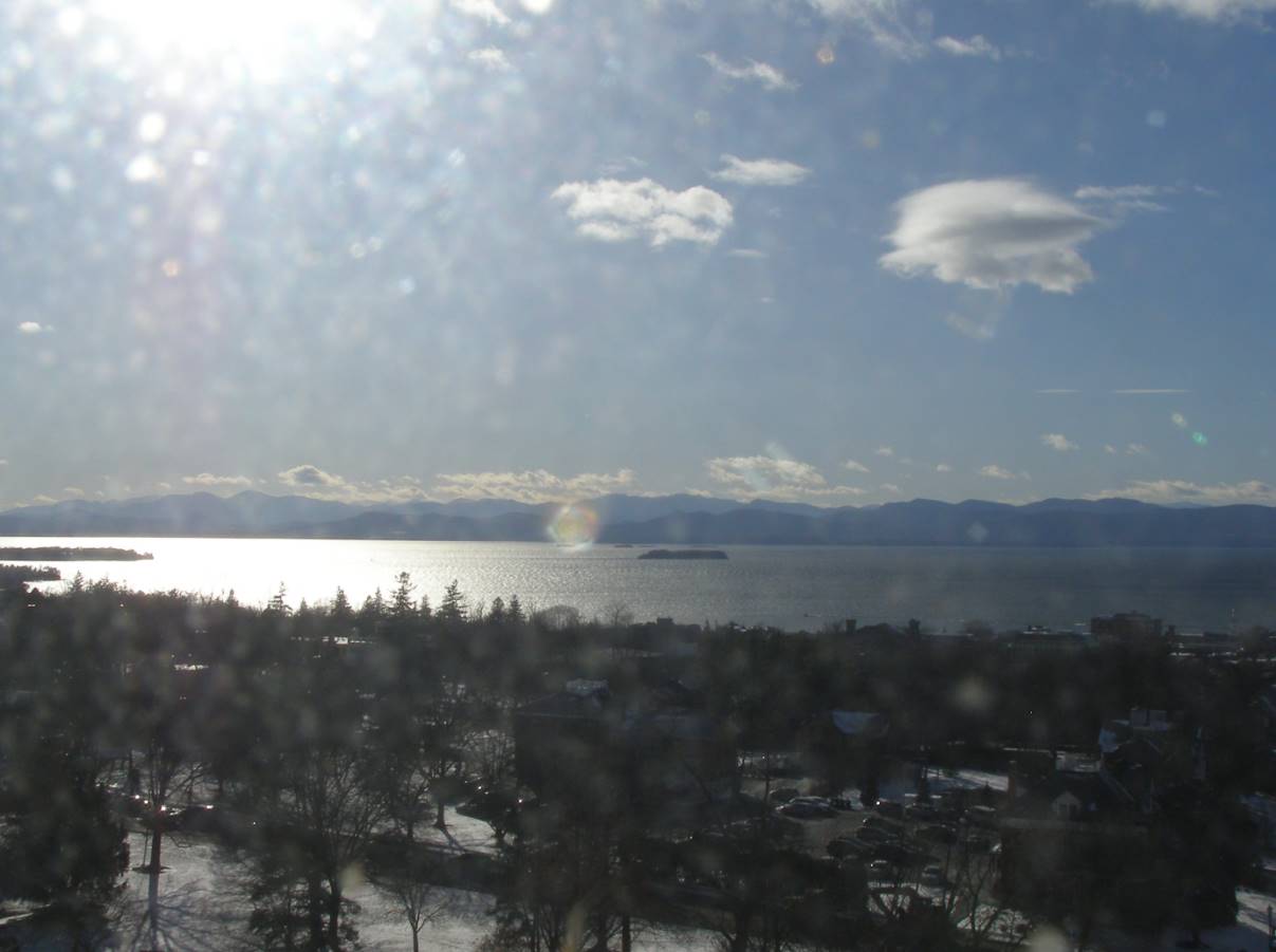
SATURDAY NIGHT: Becoming mostly clear.A low zero to 10 above. Light northwest winds.

SUNDAY: Partly sunny early, then lots of clouds with scattered mountain flurries. A high in the mid to upper 20s. South to southwest winds 10 to 15 mph.

Looking further ahead

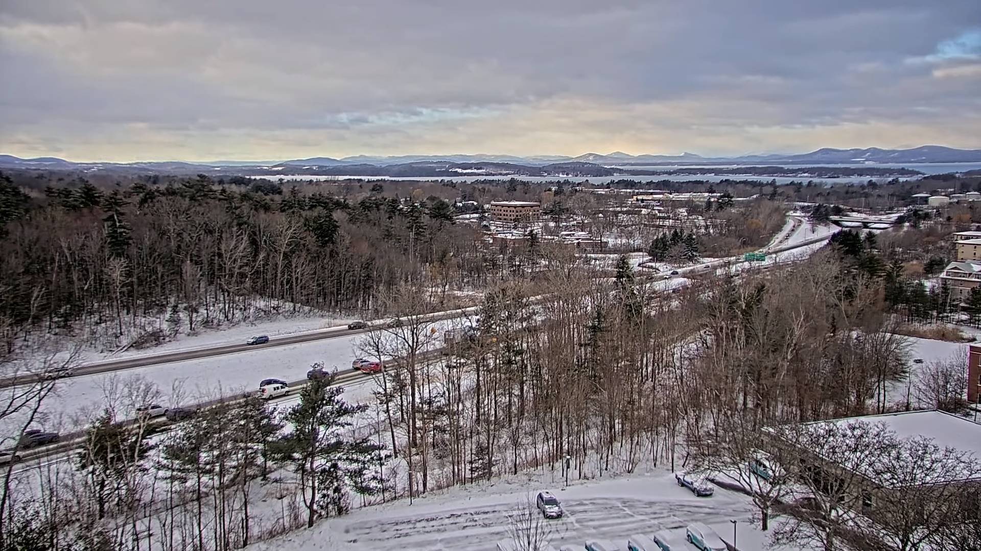
SUNDAY NIGHT: Mostly cloudy. Rising chance for scattered flurries. A low 10 to 15.

MONDAY: Chance for light accumulating snow showers or flurries in the morning with about an inch, partial afternoon clearing. A high near 25.

TUESDAY: Partly to mostly sunny. A low zero to 5 above. A high around 30.

WEDNESDAY: Partly to mostly sunny. A low in the mid-teens. A high around 45.

Average lows mid-single digits to mid-teens. Average highs upper 20s to mid-30s.

RH/2-15forecast][end]

Updated Friday Morning Forecast — February 16th, 2024

Winter Weather Advisory expires toward mid-day

TODAY: Accumulating light snow northern areas early with up to an inch additional accumulation, otherwise scattered flurries and becoming blustery. A high about 25. Winds becoming west to northwesterly 10 to 25 mph.

TONIGHT: Considerable cloudiness. Scattered flurries with minor accumulation. A low around 15. Light southwest winds.

SATURDAY: Lingering flurries. Otherwise, a few breaks of afternoon sunshine. A high in the mid-20s. Northwest winds 10 mph.

Looking further ahead

SATURDAY NIGHT: Becoming mostly clear.A low zero to 10 above.

SUNDAY: Sunshine giving way to afternoon clouds. A high in the mid to upper 20s.

MONDAY: Chance for light accumulating snow showers or flurries in the morning with about an inch, partial afternoon clearing. A low 10 to 15. A high near 25.

TUESDAY: Partly to mostly sunny. A low zero to 5 above. A high around 30.

WEDNESDAY: Mostly sunny. A low in the mid-teens. A high around 45.

Average lows mid-single digits to mid-teens. Average highs upper 20s to mid-30s.

RH/2-15forecast][end]

Updated Thursday Night Weather — February 15th, 2024

Winter Weather Advisory 4 PM this evening thru 1 PM Friday…

TONIGHT: Overcast. Light accumulating snow.About 1 to 3” with locally higher amounts in the mountains…and lesser amounts southern valleys.A low in the upper teens.Light southeast winds.

TOMORROW: Mainly gray. Accumulating light snow early…winding down to scattered flurries. An additional inch thru mid-day. A high about 25. Winds becoming west to northwesterly 10 to 20 mph.

FRIDAY NIGHT: Considerable cloudiness. Scattered flurries with minor accumulation. A low 10 to 15. Light southwest winds.

SATURDAY: Lingering flurries. Otherwise, a few breaks of afternoon sunshine. A high about 25. Northwest winds 10 mph.

Looking further ahead

SATURDAY NIGHT: Becoming mostly clear.A low 5 below to 5 above.

SUNDAY: Sunshine giving way to afternoon clouds. A high around 25.

MONDAY: Chance for light snow showers or flurries in the morning, partial afternoon clearing. A low 10 to 15. A high 20 to 25.

TUESDAY: Mostly sunny. A low 5 below to 5 above. A high 25 to 30.

Average lows mid-single digits to mid-teens. Average highs upper 20s to mid-30s.

RH/2-15forecast][end]

Updated Thursday Morning Forecast — February 15th, 2024

TODAY: Morning sunshine gives way to thickening clouds. A high upper 20s to near 30. Light northwest winds.

Winter Weather Advisory 4 PM this evening thru 1 PM Friday…

TONIGHT: Overcast. Light accumulating snow.About 1 to 3” with locally higher amounts in the mountains…and lesser amounts southern valleys.A low in the upper teens.Light southeast winds.

FRIDAY: Mainly gray. Accumulating light snow early…winding down to scattered flurries. An additional inch thru mid-day. A high in the upper 20s. Winds becoming west to northwesterly 10 to 20 mph.

Looking further ahead

FRIDAY NIGHT: Considerable cloudiness. Scattered flurries with minor accumulation. A low around 15.

SATURDAY: Lingering flurries. Otherwise, a few breaks of afternoon sunshine. A high around 25.

SUNDAY: Sunshine giving way to afternoon clouds. A low zero to 5 above. A high around 25.

MONDAY: Chance for light snow showers or flurries in the morning, partial afternoon clearing. A low around 15. A high in the upper 20s to around 30.

TUESDAY: Mostly sunny. A low 5 below to 5 above. A high around 30.

Average lows mid-single digits to mid-teens. Average highs upper 20s to mid-30s.

RH/2-15forecast][end]

Updated Wednesday Evening Forecast — February 14th, 2024

TONIGHT: Some evening clouds, then becoming mostly clear. A low upper single digits to around 10. Northwest winds 10 to 15 mph early, falling off overnight.

TOMORROW: Morning sunshine gives way to thickening clouds. A high 25 to 30. Light northwest winds.

THURSDAY NIGHT: Overcast. Periods of light accumulating snow.Accumulations of about 1 to 3” northern areas and a dusting 2” south.A low in the upper teens.Light southeast winds.

FRIDAY: Mainly gray. Accumulating light snow early…winding down to scattered flurries. An additional inch or so of accumulation. A high in the mid-20s. Winds becoming west to northwesterly 10 to 20 mph.

Looking further ahead

FRIDAY NIGHT: Considerable cloudiness. A stray mountain flurry. A low in the mid-teens.

SATURDAY: Partly to mostly cloudy. Widely scattered flurries. A high around 25.

SUNDAY: Sunshine giving way to afternoon clouds. A low in the single digits. A high around 25.

MONDAY: Mostly cloudy. Chance for flurries. A low 10 to 15. A high mid to upper 20s.

Average lows mid-single digits to mid-teens. Average highs upper 20s to mid-30s.

RH/2-14forecast][end]

Updated Wednesday Morning Forecast — February 14th, 2024

TODAY: Clouds with intervals of sun away from the mountains this morning. Otherwise blustery, occasional mountain flurries winding down. Little additional accumulation. Colder with a high 20 to 25. Northwest winds 10 to 25 mph, with higher gusts especially southern areas.

TONIGHT: Evening clouds, then mostly clear. A low near 10. Northwest winds 10 mph falling off overnight.

THURSDAY: Morning sun, then clouding up in the afternoon. A high in the mid to upper 20s. Light northwest winds.

Looking further ahead

THURSDAY NIGHT: Thickening clouds, leading to a good chance for light snow. A low in the upper teens.

FRIDAY: Mainly gray. Chance for accumulating snow in the morning, winding down to scattered flurries. Accumulations of 1 to locally 4”. A high in the mid-20s.

SATURDAY: Partly to mostly cloudy. Widely scattered flurries. A low in the mid-teens. A high around 25.

SUNDAY: Sunshine giving way to afternoon clouds. A low 5 to 10 above. A high around 25.

Average lows mid-single digits to mid-teens. Average highs upper 20s to mid-30s.

RH/2-14forecast][end]

Updated Tuesday Evening Forecast — February 13th, 2024

TONIGHT: Partly cloudy early then lots of clouds. Light snow showers or flurries developing late this evening. A light coating of snow.A low around 15. Light northwest winds increasing to 10 to 15 mph late.

TOMORROW: Mountain snow showers winding down to occasional flurries with up to an inch of accumulation. Blustery and much colder. A high in the lower 20s. Northwest winds increasing to 10 to 25 mph, with higher gusts southern areas.

WEDNESDAY NIGHT: Evening clouds, then mostly clear. A low 5 to 15 above. Northwest winds 10 mph lowering wind chills.

THURSDAY: Morning sun, then clouding up in the afternoon. A high in the mid-20s. Light northwest winds.

Looking further ahead

THURSDAY NIGHT: Thickening clouds, leading to a good chance for light snow. A low in the lower 20s.

FRIDAY: Mainly gray. Chance for accumulating snow in the morning, winding down to scattered flurries. Accumulations of 1 to locally 4”. A low upper teens. A high in the mid-20s.

SATURDAY: Partly to mostly cloudy. Widely scattered flurries. A low in the mid-teens. A high 20 to 25.

SUNDAY: Sunshine giving way to afternoon clouds. A low zero to 5 above. A high around 25.

Average lows mid-single digits to mid-teens. Average highs upper 20s to mid-30s.

RH/2-13forecast][end]

Updated Tuesday Morning Forecast — February 13th, 2024

TODAY: Lots of clouds. Isolated flurries this afternoon, mainly central and southern areas. Partial clearing developing late. A high near 35. Light northeast winds becoming northwesterly in the afternoon.

TONIGHT: Partial clearing this evening. More clouds after midnight. Snow showers developing overnight with a light coating of snow.A low upper teens to low 20s. Light west to northwest winds increasing to 10 to 15 mph late.

WEDNESDAY: Mountain snow showers winding down to occasional flurries with up to an inch of accumulation. Blustery and much colder. A high 20 to 25. Northwest winds increasing to 10 to 25 mph, with higher gusts southern areas.

Looking further ahead

WEDNESDAY NIGHT: Evening clouds, give way to clearing overnight. A low about 10 to 15 above.

THURSDAY: Morning sun, then clouding up in the afternoon. A high 25 to 30.

FRIDAY: Mainly gray. Chance for accumulating snow, moderate at times early, then scattered flurries. Light coatings but up to 3”. A low upper teens. A high in the mid-20s.

SATURDAY: Partly cloudy. A few stray flurries. A low in the mid-teens. A high 20 to 25.

Average lows mid-single digits to mid-teens. Average highs upper 20s to mid-30s.

RH/2-13forecast][end]

Updated Monday Night Weather — February 12th, 2024

TONIGHT: Becoming partly cloudy. A stray flurry far north. A low in the mid-20s. Light northeast winds.

TOMORROW: Gray. Scattered flurries southern areas. Partial clearing developing late. A high about 32. Light northeast winds becoming northwesterly in the afternoon.

TUESDAY NIGHT: Partly cloudy to mostly clear for a time, then cloudy. A rising chance for light accumulating snow showers or flurries. A dusting to a half inch.A low around 15. Light west to northwest winds increasing to 10 mph overnight.

WEDNESDAY: Mostly cloudy. Widely scattered mountain snow showers or flurries. Up to an inch in spots. Blustery at times. A high 20 to 25. Northwest winds 10 to 25 mph with higher gusts southern areas.

Looking further ahead

WEDNESDAY NIGHT: Lots of clouds. A low ranging thru the teens.

THURSDAY: Mixed clouds and sunshine. A high 25 to 30.

FRIDAY: Mainly gray. Chance for accumulating snow, moderate at times early, then scattered flurries. Light coatings but up to 3”. A low 15 to 20. A high in the mid-20s.

SATURDAY: More sun than clouds with a stray flurry or two. A low in the mid-teens. A high 20 to 25.

Average lows mid-single digits to mid-teens. Average highs upper 20s to mid-30s.

RH/2-12forecast][end]