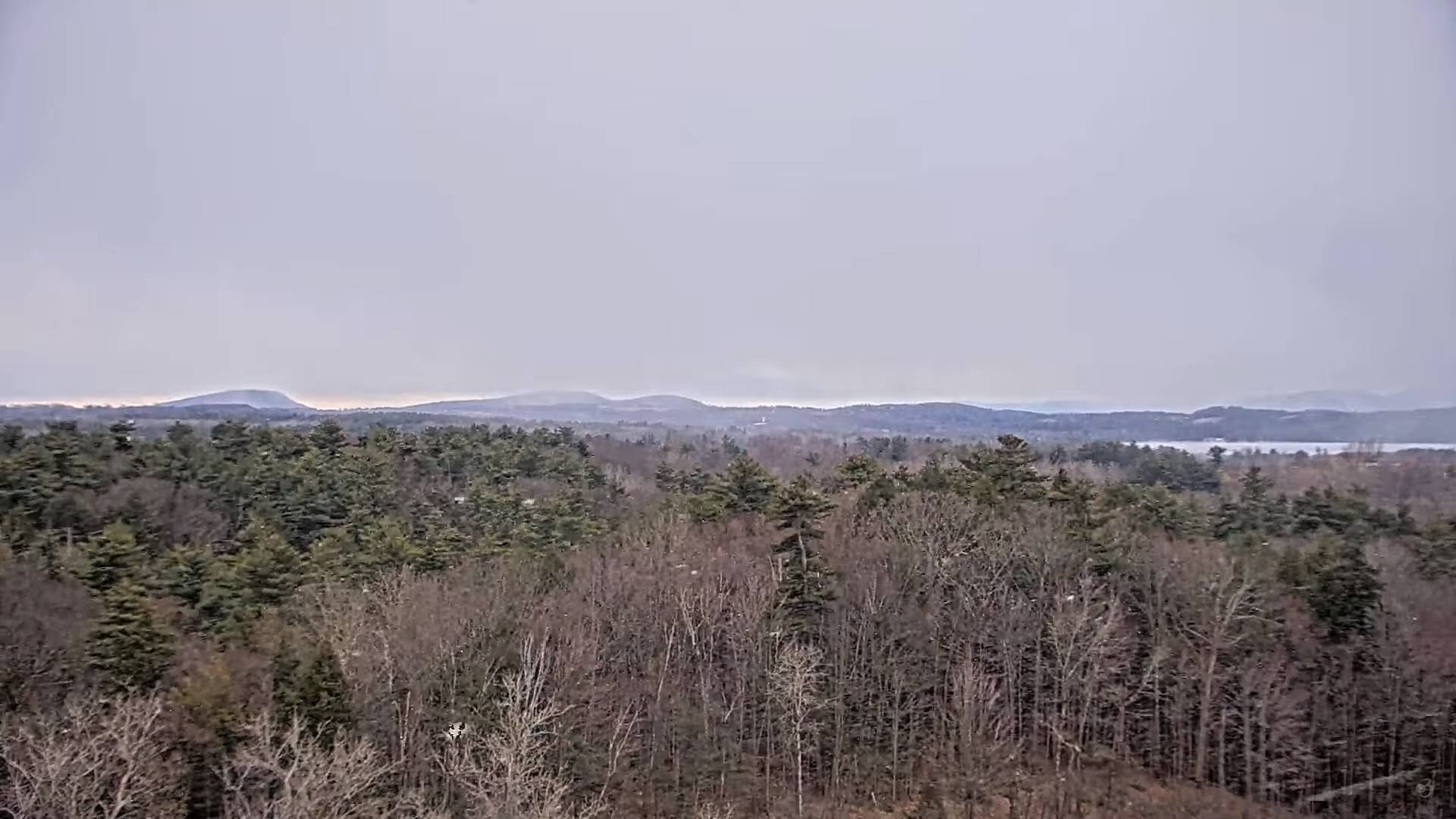
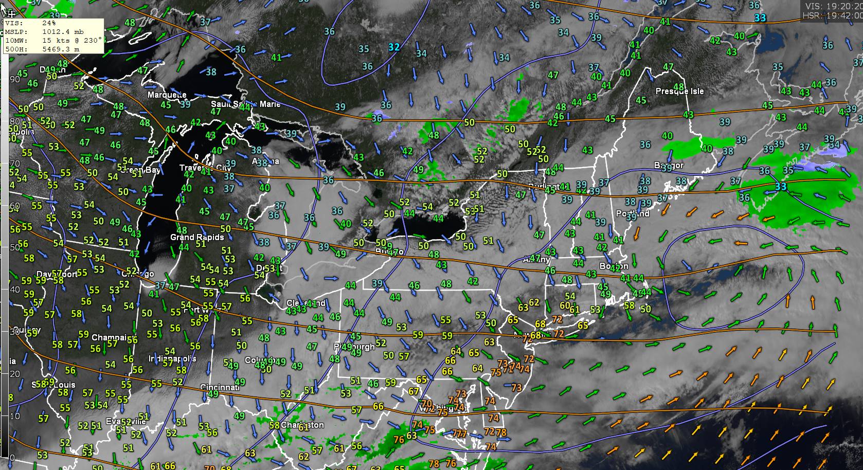
Unsettled weather with frequent bouts of flurries lighter mountain snow showers ahead, but also throw in some rain drops western Vermont valley floors and occasional gusty winds. Could be some intervals of sun as well.


TONIGHT: Mainly cloudy northern mountains, otherwise partly cloudy. Scattered accumulating snow showers and valley flurries. A dusting to 2” most on western slopes of the central and northern Green Mountains. A low in the mid-20s. Northwest winds 10 mph.
TOMORROW: Scattered accumulating snow showers early, then intervals of afternoon sun with a stray flurry. Blustery. A high around 35. Gusty northwest winds 10 to 20 mph.
TUESDAY NIGHT: Mostly cloudy.Scattered flurries. A minor coating down to valley floors. A low 25 to 30. Light south winds.
WEDNESDAY: Variable cloudiness. Good chance for light accumulating snow showers and valley flurries. A light coating higher terrain. A high upper 30s near 40. Southwest winds 10 to 15 mph.
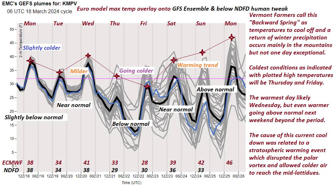
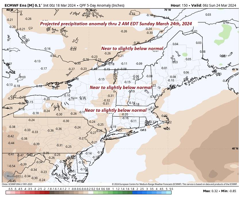
Looking further ahead

WEDNESDAY NIGHT: Lots of clouds.Scattered mountain snow showers or flurries. A dusting in spots.A low around 25.
THURSDAY: Mixed sun and clouds & blustery. A few mountain flurries. A high upper 20s near 30. Gusty northwest winds.
FRIDAY: Mixed sun and clouds then mostly cloudy later on. Slight chance for a flurry southern areas. A low 10 to 15 above. A high upper 20s near 30.
SATURDAY: Mainly cloudy. Chance for accumulating early snow exiting to a few flurries. A low 15 to 20. A high 35 to 40.

Average lows upper-teens to mid-20s. Average highs low to mid 40s
RH/3-18forecast][end]
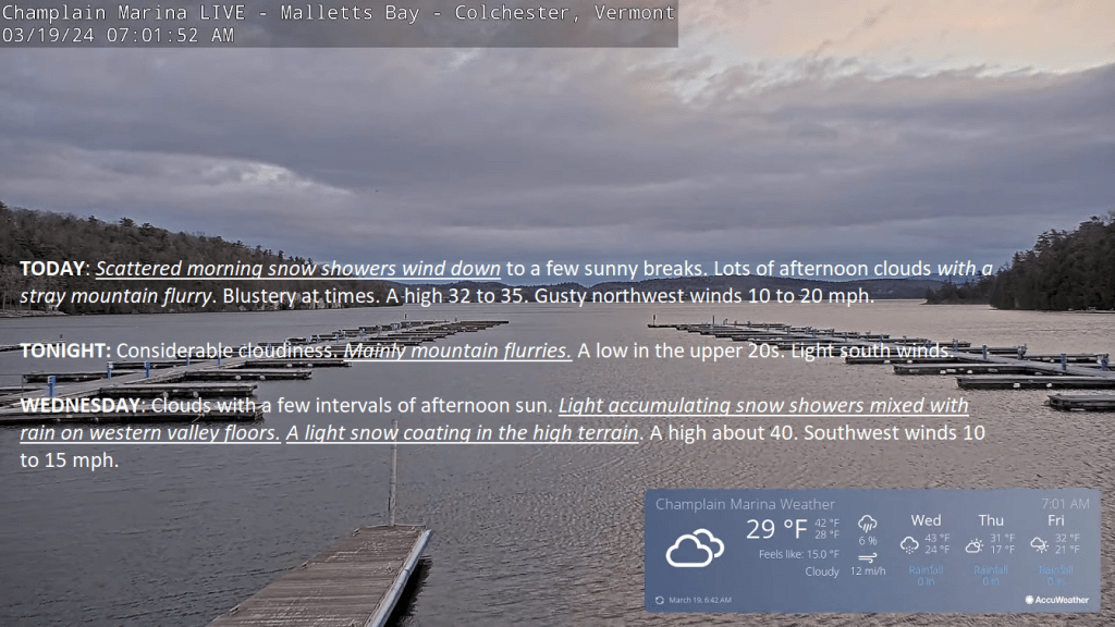
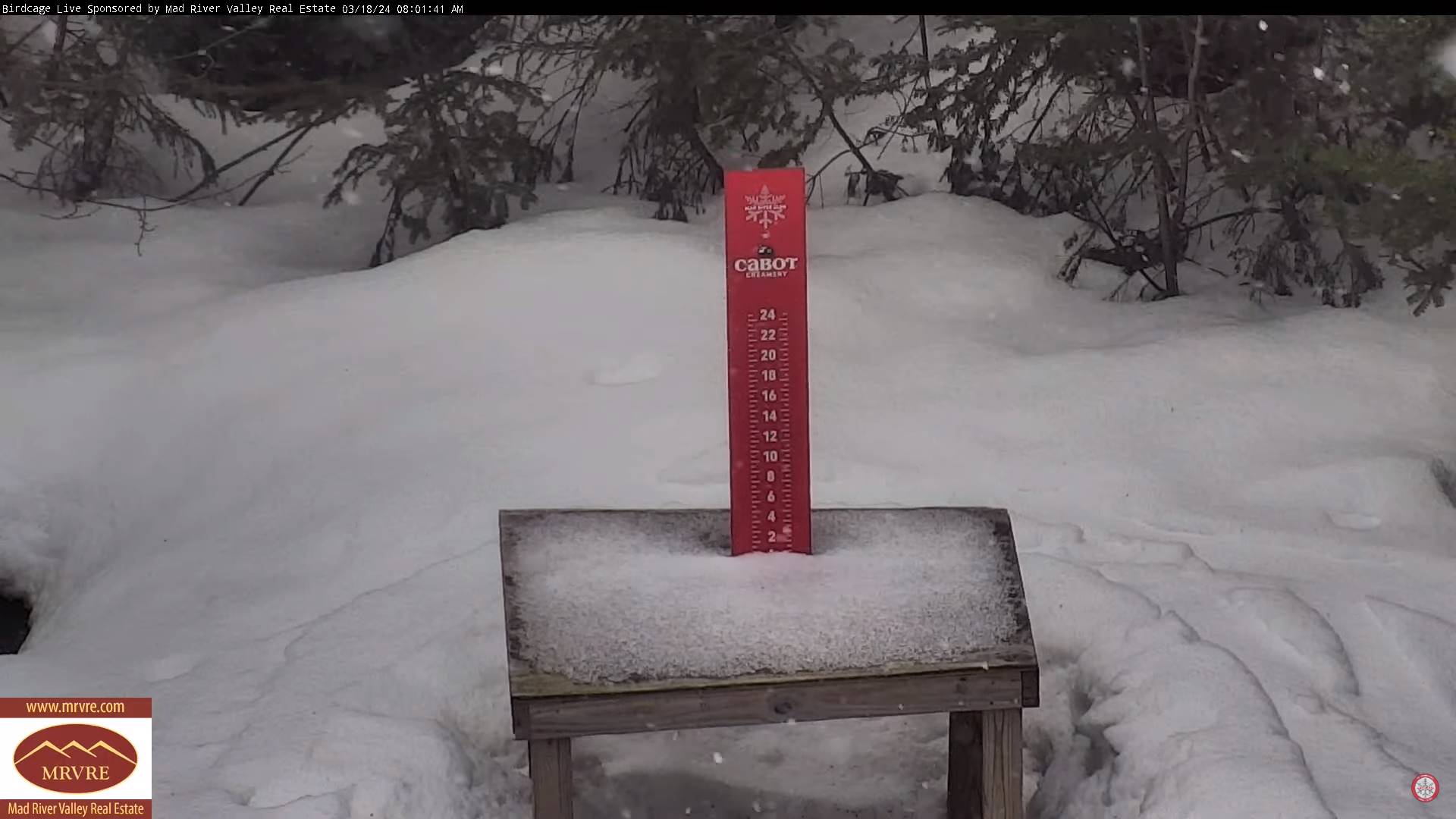
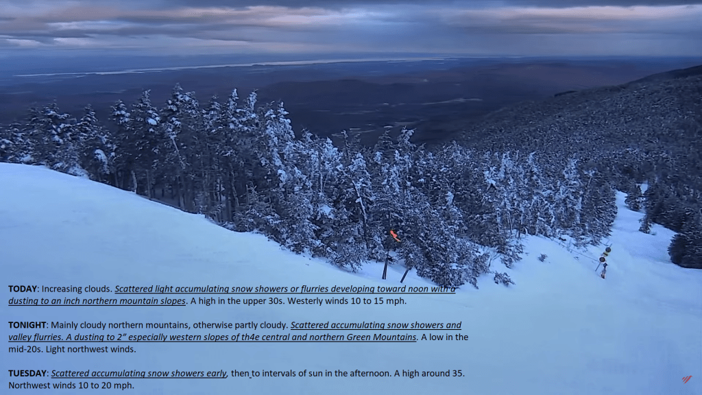
TODAY: Increasing clouds.Scattered light accumulating snow showers or flurries with a dusting to an inch northern mountain slopes. A high in the upper 30s. Westerly winds 10 to 15 mph.
TONIGHT: Mainly cloudy northern mountains, otherwise partly cloudy. Scattered accumulating snow showers and valley flurries. A dusting to 2” especially western slopes of the central and northern Green Mountains. A low in the mid-20s. Light northwest winds.
TUESDAY: Scattered accumulating snow showers early, then to intervals of sun in the afternoon. A high around 35. Northwest winds 10 to 20 mph.
Looking further ahead
TUESDAY NIGHT: Mostly cloudy.Chance for light accumulation snow showers or flurries. Additional minor accumulation. A low 25 to 30.
WEDNESDAY: Variable cloudiness. Good chance for light accumulating snow showers and valley flurries. A high upper 30s near 40.
THURSDAY: Partly to mostly cloudy & blustery. Maybe a stray flurry early. A low around 25. A high upper 20s near 30. Gusty northwest winds.
FRIDAY: Mixed sun and clouds then mostly cloudy later on. Slight chance for a flurry southern areas. A low 10 to 15 above. A high upper 20s near 30.
SATURDAY: Mainly cloudy. Slight chance for snow showers or flurries. A low 15 to 20. A high 35 to 40.
Average lows upper-teens to mid-20s. Average highs low to mid 40s
RH/3-18forecast][end]

TONIGHT: Variable clouds. A round of mixed precipitation developing after midnight with minor accumulation before daybreak.A low near 32. Light southwest winds.
TOMORROW: Mostly cloudy. Widely scattered rain showers mixed with wet snowflakes in the mountains. A high in the upper 40s. Light southwest winds.
SATURDAY NIGHT: A rising chance for rain showers, mixing with wet snow flakes.A low 32 to 35.
SUNDAY: Chance for rain or rain showers mixed with wet snow mountain summits.Otherwise clouds giving way to afternoon intervals of sunshine. Blustery A high around 45.
Looking further ahead
SUNDAY NIGHT: Partly cloudy to mostly clear. A low in the upper 20s.
MONDAY: Mostly cloudy. Scattered accumulating snow showers or flurries especially in the mountains. Minor accumulation. A high in the upper 30s.
TUESDAY: Scattered accumulating snow showers early, then to intervals of sun in the afternoon. A low in the mid-20s. A high in the lower 30s.
WEDNESDAY: Mainly gray. Chance for periods of light accumulating snow or snow showers. A low 20 to 25. A high near 32.

Average lows mid-teens to low 20s. Average highs mid-30s to low 40s
RH/3-14forecast][end]

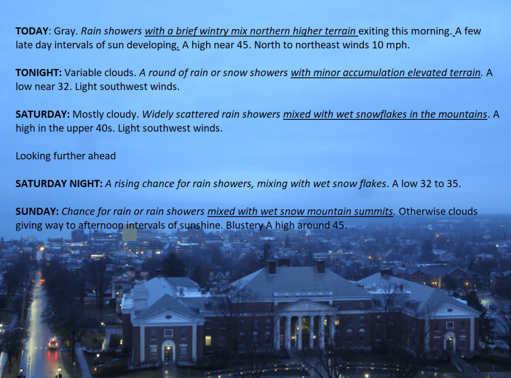
TODAY: Gray. Rain showers with a brief wintry mix northern higher terrain exiting this morning.A few late day intervals of sun developing. A high near 45. North to northeast winds 10 mph.
TONIGHT: Variable clouds. A round of rain or snow showers with minor accumulation elevated terrain.A low near 32. Light southwest winds.
SATURDAY: Mostly cloudy. Widely scattered rain showers mixed with wet snowflakes in the mountains. A high in the upper 40s. Light southwest winds.

Looking further ahead
SATURDAY NIGHT: A rising chance for rain showers, mixing with wet snow flakes.A low 32 to 35.
SUNDAY: Chance for rain or rain showers mixed with wet snow mountain summits.Otherwise clouds giving way to afternoon intervals of sunshine. Blustery A high around 45.
MONDAY: Mostly cloudy. Scattered accumulating snow showers or flurries especially in the mountains. Minor accumulation. A low in the upper 20s. A high in the upper 30s.
TUESDAY: Scattered accumulating snow showers early, then to intervals of sun in the afternoon. A low in the mid-20s. A high in the lower 30s.

WEDNESDAY: Mainly gray. Chance for periods of light accumulating snow or snow showers. A low 20 to 25. A high near 32.
Average lows mid-teens to low 20s. Average highs mid-30s to low 40s
RH/3-14forecast][end]
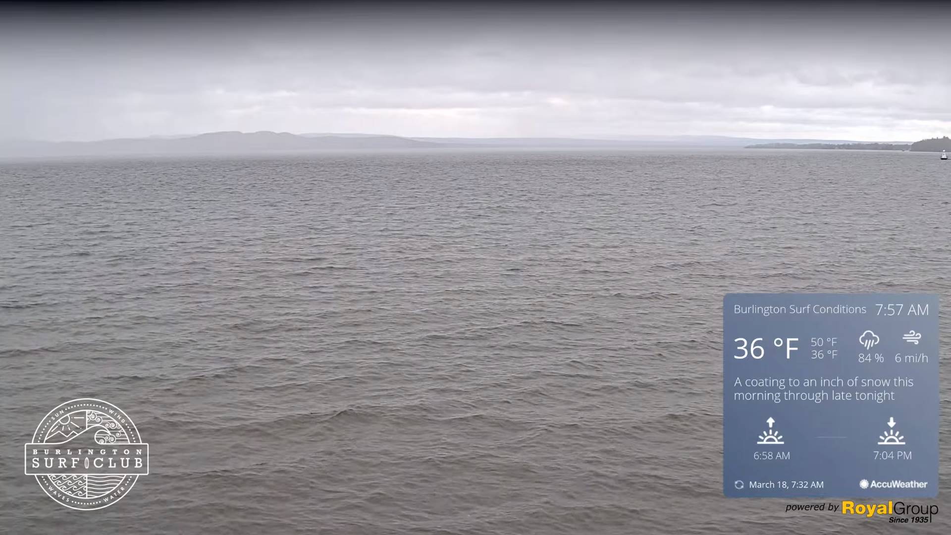
TONIGHT: Clouding up. Rain develops later this evening, some slushy snow accumulation grassy surfaces especially higher terrain central and northern Vermont.Areas of fog. A low around 35. Light easterly winds.
TOMORROW: Gray Periods of morning rain…mixed with slushy snow accumulation elevated terrain with less than an inch…exiting early afternoon to intervals of late day sun. A high in the low 40s. North to northeast winds 10 mph.
FRIDAY NIGHT: Becoming mostly cloudy. A round of rain or snow showers with minor accumulation elevated terrain.A low in the low 30s. Light southwest winds.
SATURDAY: Mostly cloudy. Widely scattered rain showers mixed with wet snowflakes in the mountains. A high 45 to 50. Light southwest winds.
Looking further ahead
SATURDAY NIGHT: A rising chance for rain showers.A low around 32.
SUNDAY: Lots of clouds.Chance for rain or rain showers mixed with wet snow mountain summits.A high around 45.
MONDAY: Clouds some intervals of sun. Scattered accumulating snow showers or flurries especially in the mountains. Minor accumulation. A low upper 20s near 30. A high mid to upper 30s.
TUESDAY: Scattered accumulating snow showers early, then exiting to intervals of sun in the afternoon. A low in the mid-20s. A high around 30
Average lows mid-teens to low 20s. Average highs mid-30s to low 40s
RH/3-14forecast][end]
TODAY: More sun than clouds & milder. A high near 55. Light southeast winds.
TONIGHT: Cloudy. Periods of rain developing around midnight.Areas of fog. A low around 35. Light easterly winds.
FRIDAY: Gray. Rain mixing with a wet snow high terrain with less than an inch accumulation early…tapering to sprinkles late. A high 40 to 45. Light north to northeast winds.

Looking further ahead
FRIDAY NIGHT: Variable cloudiness.Widely scattered rain or snow showers.A low 30 to 32.
SATURDAY: Mostly cloudy. Widely scattered rain showers mixed with wet snowflakes in the mountains. A high 45 to 50.
SUNDAY: Lots of clouds.Chance for rain or rain showers mixed with wet snow mountain summits.A low around 32. A high around 45.
MONDAY: Clouds some intervals of sun. Chance for accumulating snow showers or flurries. A dusting to 2 inches in the hills. A low upper 20s near 30. A high mid to upper 30s.
TUESDAY: Scattered accumulating snow showers or flurries. Intervals of sun in the afternoon. A low in the mid-20s. A high around 30
Average lows mid-teens to low 20s. Average highs mid-30s to low 40s
RH/3-13forecast][end]
