Updated Monday Morning Forecast — April 8th, 2024

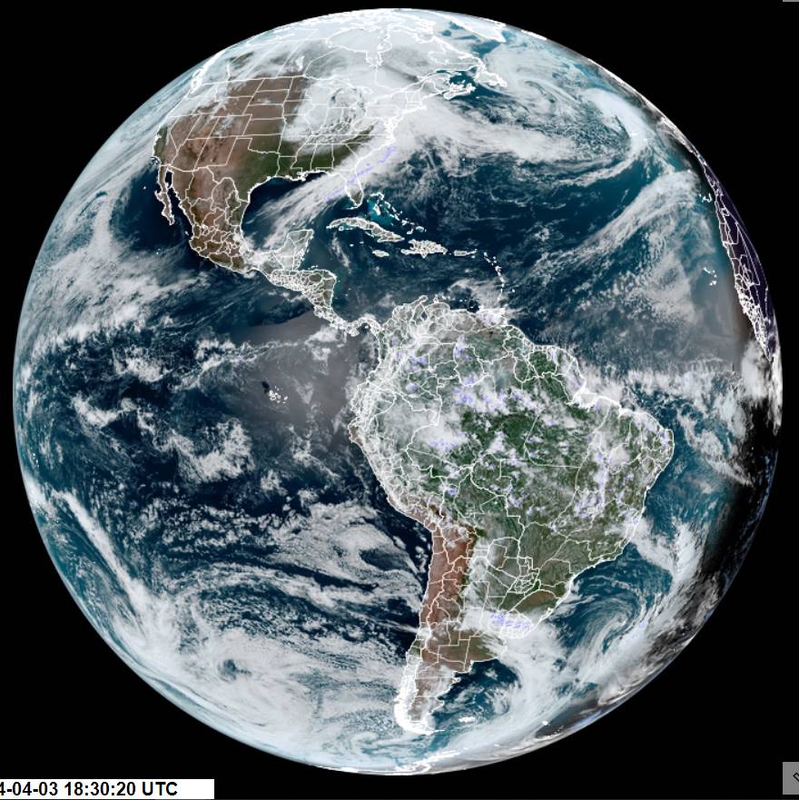
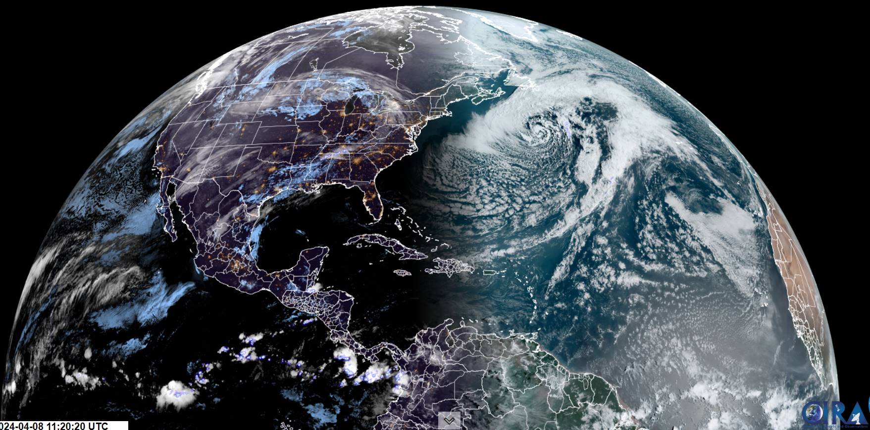
TODAY: Sunshine becoming filtered thru high clouds this afternoon. Arrival of this cirrus clouds…about 2:30 to 3:30 PM with the eclipse 3:26 PM. A high near 55. Light northwest winds.

TONIGHT: Partly to mostly cloudy. A low about 35. Light west winds.

TUESDAY: Sunshine filtered thru high clouds. A high around 60. Light northwest winds.

Looking further ahead

TUESDAY NIGHT: Variable cloudiness and unsettled.Slight chance for a shower.A low mid to upper 30s.

WEDNESDAY: Clouds with intervals of afternoon sunshine. Scattered light afternoon rain showers. A high around 50.

THURSDAY: Gray and damp. Good chance for periods of rain or rain showers. A low 40 to 45. A high upper 40s to around 50.

FRIDAY: Clouds with a break or two of sun. Good chance for periods of rain or showers. A low 45 to 50. A high 55 to 60.

SATURDAY: Morning sun then lots of clouds. Chance for rain showers mixed with wet snow higher terrain late. A low near 40. A high in the mid-40s.

Average lows mid-20s to low 30s. Average 50 to 55

Start of meteorological summer June 6th

RH/4-8forecast][end]

Updated Friday Evening Forecast — April 5th, 2024

TONIGHT: Overcast. Scattered snow showers or flurries. A dusting to a half inch or so. A low about 30. Light northwest winds.

TOMORROW: Cloudy with a few breaks of sun away from the mountains late. Scattered leftover rain or wet snow showers. Little to no accumulation. A high in the upper 30s to near 40. North to northwest winds 10 to 20 mph.

SATURDAY NIGHT: Considerable lingering cloudiness with a few northern mountain flurries winding down.A low mid to upper 20s. A light north wind.

SUNDAY: Mainly gray, eventually giving way to periods of late afternoon sunshine. A high near 45. North winds 10 mph.

Looking further ahead

SUNDAY NIGHT: Clear and colder.A low in the upper teens to around 20.

MONDAY: Mostly sunny with some thin high clouds. Total Solar Eclipse 3:26 PM EDT. A high around 50.

TUESDAY: Sunshine filtered thru high clouds. A low 25 to 30. A high around 55.

WEDNESDAY: Partly sunny with more in the afternoon. Rising chance for scattered afternoon rain showers. A low around 25. A high in the 50s.

Average lows 25 to 30. Average highs 45 to 50.

Start of meteorological summer June 6th

RH/4-5forecast][end]

Updated Friday morning Forecast — April 5th, 2024

TODAY: Cloudy. Scattered wet snow showers, mixed with rain valleys. A slushy dusting to an inch in spots. A high in the mid to upper 30s. Northwest winds 10 to 15 mph.

TONIGHT: Overcast. Scattered snow showers or flurries. A dusting to a half inch or so. A low upper 20s to about 30. Light northwest winds.

SATURDAY: Cloudy with a few breaks of sun away from the mountains late. Scattered leftover rain or wet snow showers. Little to no accumulation. A high in the upper 30s. Northwest winds 10 to 20 mph.

Looking further ahead

SATURDAY NIGHT: Considerable lingering cloudiness.A low mid-20s.

SUNDAY: Lots of morning clouds gradually giving way to periods of late aft4ernoon sunshine. A high in the lower 40s.

MONDAY: Mostly sunny with some late day high cloudiness. Total Solar Eclipse 3:26 PM EDT. A low 20 to 25. A high around 50.

TUESDAY: Sunshine filtered thru high clouds. A low in the mid-20s. A high around 55.

WEDNESDAY: Partly sunny more clouds late. Rising chance for a rain shower Wednesday evening. A low in the 20s. A high in the 50s.

Average lows 25 to 30. Average highs 45 to 50.

Start of meteorological summer June 6th

RH/4-5forecast][end]

Updated Thursday Morning Forecast — April 4th, 2024

High Wind Warnings & Advisories expire 10 AM…Winter Storm Warning and Advisories continue into tomorrow Friday morning…

TODAY: Gray. Periods of accumulating wet snow, about 2 to 4 inches. A high around 32. Northeast winds 10 mph.

TONIGHT: Overcast. Periods of light snow or snow showers. Around an inch of accumulation. A low near 30. Light north to northwest winds.

FRIDAY: Cloudy. Scattered wet snow showers, mixed with rain valleys. A slushy dusting to an inch in spots. Total storm snow accumulation 6 to locally 10 inches. A high mid to upper 30s. Northwest winds 10 mph.

Looking further ahead

FRIDAY NIGHT: Overcast. Scattered snow showers or flurries. A dusting in spots. A low near 30.

SATURDAY: Cloudy with a few breaks of sun away from the mountains late. Scattered leftover rain or wet snow showers early exiting late morning. A high in the upper 30s.

SUNDAY: Morning clouds, giving way partial afternoon sunshine. A low in the upper 20s. A high 40 to 45.

Total Solar Eclipse 3:26 PM EDT

MONDAY: Mostly sunny with a few high clouds. A low mid to upper 20s. A high 50 to 55.

TUESDAY: Sunny. A low around 30. A high around 55.

Average lows 25 to 30. Average highs 45 to 50.

Start of meteorological summer June 6th

RH/4-4forecast][end]

Updated Wednesday Evening Forecast — April 3rd, 2024

High Wind Warnings (western slopes) and Wind Advisories thru tomorrow morning…Winter Storm Warning and Advisories into early Friday…

TONIGHT: Cloudy. A wintry mix this evening, transitions wet snow. Variable accumulations of around 3 to 6 inches…most Green Mountains. A low 30 to 32. Blustery to windy. East winds 10 to 20 mph, stronger western Green Mountain slopes exceeding 45 mph.

TOMORROW: Gray. Periods of accumulating wet snow, accumulation 1 to 2 inches. A high around 32. Northeast winds 10 mph.

THURSDAY NIGHT: Cloudy. Chance for periods of light snow. A dusting to 2” accumulation. A low near 30. Light north to northwest winds.

FRIDAY: Cloudy. Chance for light accumulating wet snow showers, mixed with rain valleys. Around an inch in spots. Total storm snow accumulation 6 to locally 10 inches. A high 35 to 40. Northwest winds 10 mph.

Looking further ahead

FRIDAY NIGHT: Overcast. Scattered snow showers or flurries. A dusting in spots. A low in the lower 30s.

SATURDAY: Gray. Scattered leftover rain or wet snow showers early exiting late morning. A high in the upper 30s to near 40.

SUNDAY: Morning clouds, giving way to bright sunshine and blue skies. A low in the upper 20s. A high around 45.

Total Solar Eclipse 3:26 PM EDT

MONDAY: Mostly sunny with a few high clouds. A low mid to upper 20s. A high near 55.

TUESDAY: Mostly sunny. A low around 30. A high 50 to 55.

Average lows 25 to 30. Average highs 45 to 50.

Start of meteorological summer June 6th

RH/4-3forecast][end]

Updated Wednesday Morning Forecast — April 3rd, 2024

High Wind Warnings (western slopes) and Wind Advisories elsewhere 10 AM this morning thru 10 AM Thursday…Winter Storm Warning 11 AM thru early Friday morning…

TODAY: Gray. Rain and a messy mix spreads north from southern areas late morning into this afternoon mixed with accumulating wet snow elevated terrain. An inch or two of slushy wet snow and sleet with poor travel in the higher terrain. Blustery to windy southern Green Mountains & western slopes spreading north this afternoon. A high in the upper 30s. Easterly winds 10 to 20 mph stronger southern areas.

TONIGHT: Cloudy. A wintry mix likely moderate at times transitions to primarily wet snow. Accumulations of 3 to 7”. A low around 30. Blustery to windy with gusty easterly winds 10 to 20 mph stronger western Green Mountain slopes with gusts exceeding 45 mph.

THURSDAY: Gray. Periods of accumulating wet snow, accumulation 2 to 5 inches. A high 32 to 35. North to northeast winds 10 mph.

Looking further ahead

THURSDAY NIGHT: Cloudy. Chance for periods of light snow. Additional 1 to 2” accumulation. A low near 30.

FRIDAY: Cloudy. Chance for light accumulating wet snow showers, mixed with rain valleys. A high 35 to 40.

SATURDAY: Gray. Scattered leftover rain or wet snow showers early exiting late morning. A low in the lower 30s. A high in the upper 30s to near 40.

SUNDAY: Morning clouds, giving way to bright sunshine and blue skies. A low in the upper 20s. A high around 45.

Total Solar Eclipse April 8th 3:25 PM EDT

MONDAY: Mostly sunny with a few high clouds. A low mid to upper 20s. A high near 55.

TUESDAY: Mostly sunny. A low around 30. A high 50 to 55.

Average lows 25 to 30. Average highs 45 to 50.

Start of meteorological summer June 6th

RH/4-3forecast][end]

Updated Tuesday Evening Forecast — April 2nd, 2024

TONIGHT: Fair this evening, then thickening clouds. Scattered rain showers this evening far southern areas.A low 32 to 35. East to southeast winds 10 mph.

Winter Storm Watch Wednesday thru late Thursday night, High Wind Watch Wednesday afternoon thru Thursday morning…

TOMORROW: Overcast. Rain developing across the valleys, mixed with accumulating wet snow elevated terrain. An inch or two 1000 to 1500 ft and higher. Blustery to windy mountains & western slopes. A high in the upper 30s. Easterly winds 10 to 20 mph stronger southern areas.

WEDNESDAY NIGHT: Cloudy. A wintry mix likely moderate at times. Wet snow & sleet accumulations of 2 to 5”. A low in the upper 20s to around 30. Blustery to windy with gusty easterly winds 10 to 20 mph stronger western Green Mountain slopes.

THURSDAY: Gray. Periods of accumulating wet snow likely, accumulation 2 to 5 inches. A high 32 to 35. North to northeast winds 10 mph.

Looking further ahead

THURSDAY NIGHT: Cloudy. Chance for periods of light snow. Additional 1 to 2” accumulation. A low near 30.

FRIDAY: Cloudy. Chance for light accumulating wet snow showers, mixed with rain valleys. A dusting to locally 3” inches mainly in the mountains. A high mid to upper 30s.

SATURDAY: Gray. Scattered leftover rain or wet snow showers early exiting late morning. A low in the low 30s. A high near 40.

SUNDAY: Morning clouds, giving way to bright sunshine and blue skies. A low mid to upper 20s. A high around 45.

Total Solar Eclipse April 8th 3:25 PM EDT

MONDAY: Mostly sunny with a few high clouds. A low mid to upper 20s. A high near 55.

TUESDAY: Mostly sunny. A low around 30. A high 50 to 55.

Average lows 25 to 30. Average highs 45 to 50.

Start of meteorological summer June 6th

RH/4-1forecast][end]

Updated Tuesday Morning Forecast — April 2nd, 2024

Winter Storm Watch Wednesday morning thru late Thursday night, High Wind Watch Wednesday afternoon thru Thursday morning…

TODAY: Sunshine filtered thru high clouds central and northern areas, cloudy southern areas. A high in the low 50s. Light northeast winds.

TONIGHT: Fair this evening, then thickening clouds. Scattered rain showers developing this evening far southern areas.A low 30 to 35. Blustery at times far southern areas. East to southeast winds 10 to 15 mph.

WEDNESDAY: Overcast. Rain developing across the valleys, mixed with accumulating wet snow elevated terrain. Up to inch or two slushy accumulation above 1000 to 1500 ft. Blustery to windy mountains & western slopes. A high in the mid to upper 30s. Easterly winds 10 to 20 mph stronger southern areas.

Looking further ahead

WEDNESDAY NIGHT: Cloudy. A wintry mix likely. Wet snow & sleet accumulations of 3 to 6”. A low 30 to 32. Blustery to windy with gusty easterly winds.

THURSDAY: Gray. Periods of accumulating wet snow likely, accumulation 2 to 4 inches. A high 32 to 35.

FRIDAY: Cloudy. Light accumulating wet snow showers, mixed with rain valleys. A dusting to locally 3” inches mainly in the mountains. A low near 30. A high mid to upper 30s.

SATURDAY: Gray. Scattered leftover rain or wet snow showers early exiting late morning. A low in the low 30s. A high near 40.

SUNDAY: Morning clouds, giving way to bright sunshine and blue skies. A low mid to upper 20s. A high around 45.

Total Solar Eclipse April 8th 3:25 PM EDT

MONDAY: Mostly sunny with a few high clouds. A low mid to upper 20s. A high near 55.

TUESDAY: Mostly sunny. A low around 30. A high 50 to 55.

Average lows 25 to 30. Average highs 45 to 50.

Start of meteorological summer June 6th

RH/4-1forecast][end]