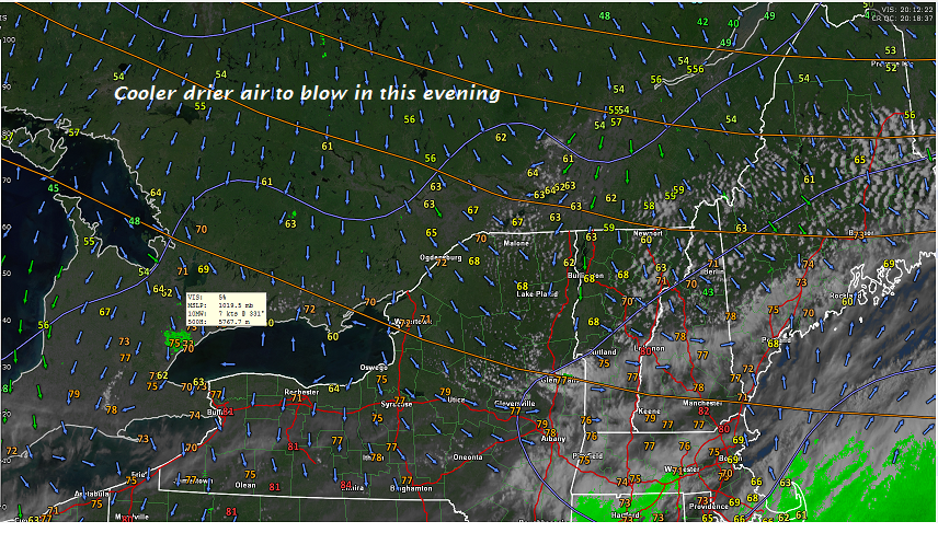
TONIGHT: Clear and starlit skies. Patchy dense valley fog overnight. Cooler. A low 40 to 45. Light northwest winds.
TOMORROW: Partly to mostly sunny, pleasant but cool. A high mid to upper 60s. West to northwest breeze 10 to 20 mph.
THURSDAY NIGHT: Clear & starlit skies giving way to few high clouds. Patchy valley fog. A low 50 to 55. Light winds.
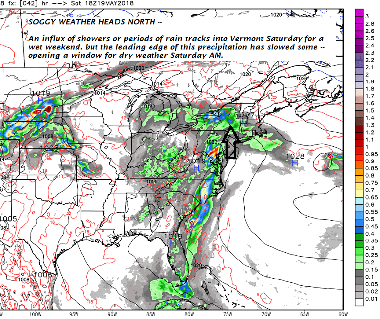
FRIDAY: Morning sunshine then increasing afternoon clouds. Rising chance for late day showers northern areas. A high of about 80. West winds 10 to 20 mph.
Looking further ahead…
FRIDAY NIGHT: Clouds, with a chance for showers northern areas. Otherwise, partly cloudy. Patchy valley fog. A low 55 to 60.
SATURDAY: Mixed sun and clouds. Sticky. Scattered showers and afternoon and evening thunderstorms mainly northern areas. A high 75 to 80.
SUNDAY: Lots of clouds. Muggy. Widely scattered showers & afternoon thunderstorms. A low around 60. A high mid to upper 70s.
MONDAY Memorial Day: Rather gray. A lingering chance for a showers and possible thunderstorms. A low 50 to 55. A high 65 to 70.
Average lows mid 40s to low 50s, normal highs mid 60s to low 70s
RH/5-23[end]
| Virus-free. www.avast.com |