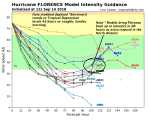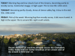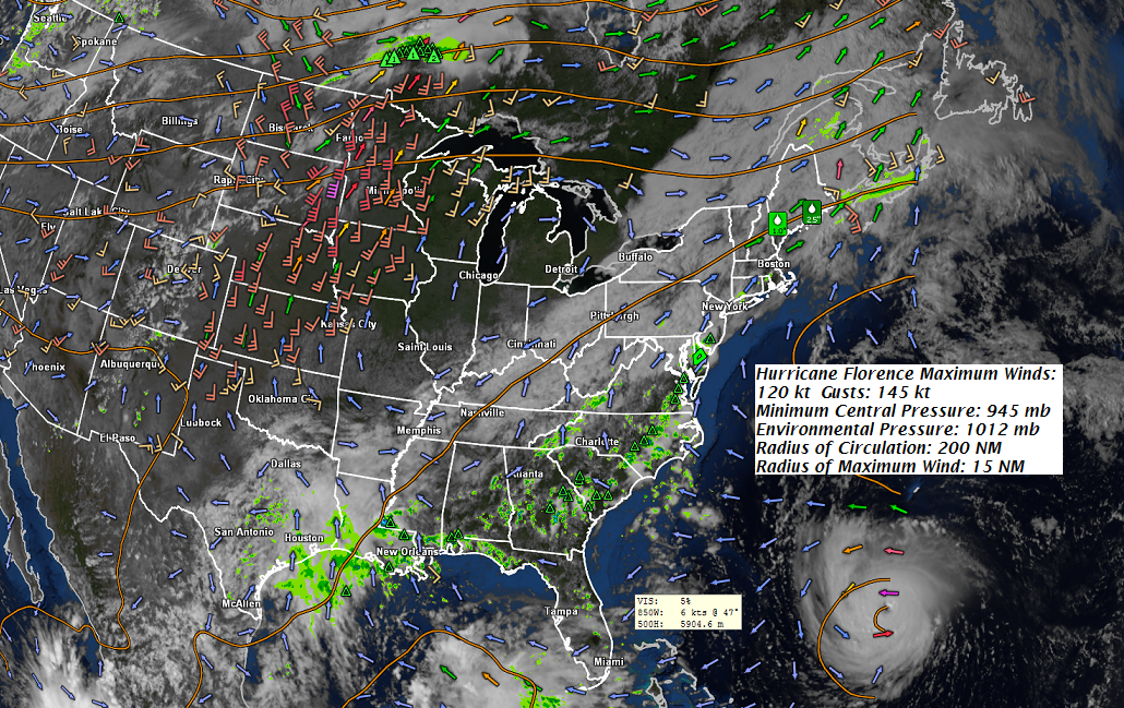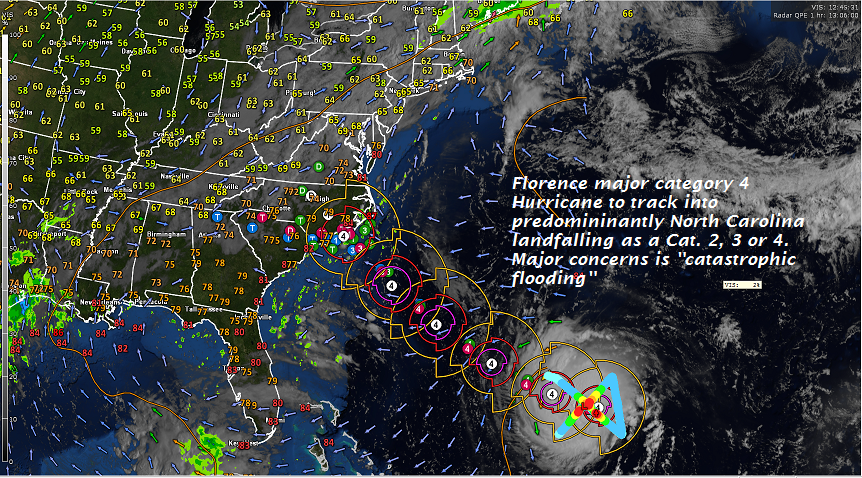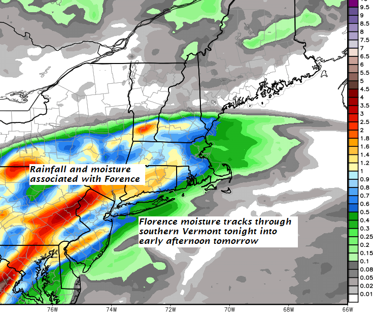
TONIGHT: Variable high cloudiness northern areas, mostly cloudy far southern areas with a chance for rain or showers far southern Vermont. Continued muggy with a low in the mid 60s. Light south to southwest winds.
TOMORROW: Considerable cloudiness. Showers likely toward Rutland, Widely scattered showers developing northern areas late in the afternoon. A high near 80. Winds become northwesterly 10 mph in the afternoon.
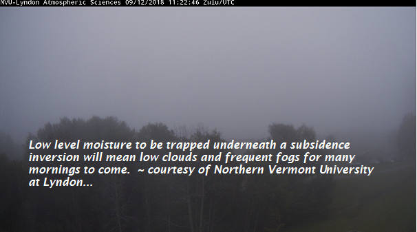
TUESDAY NIGHT: Partly cloudy with a slight chance for a shower early. Patchy valley fog. A low mid 50s. Light northwest winds.
WEDNESDAY: Mixed clouds and sun. A high in the mid to upper 60s. Northwest breeze 10 mph.
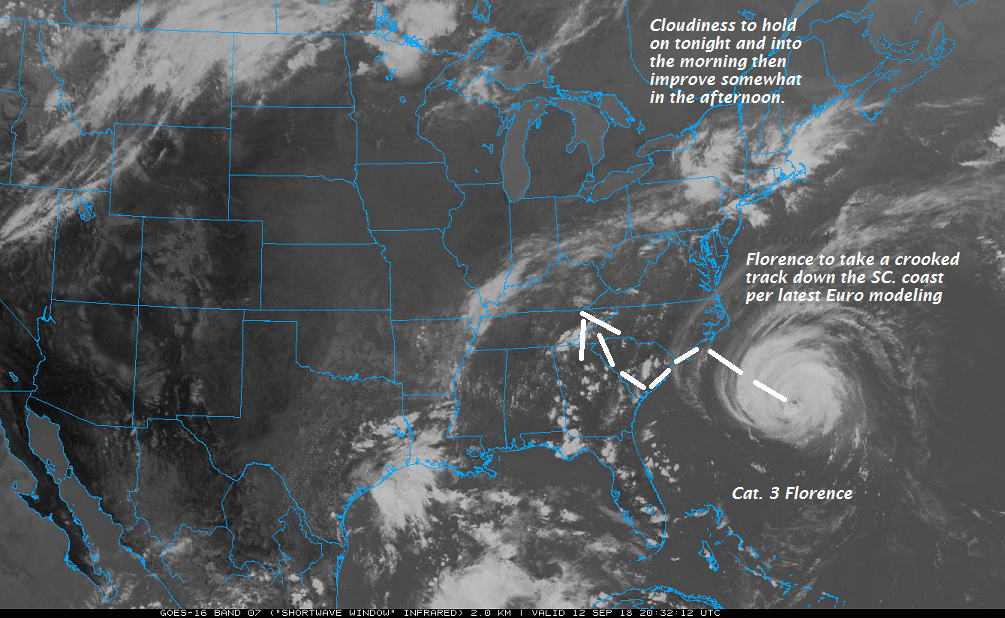
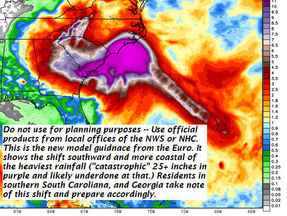
Looking further ahead…
WEDNESDAY NIGHT: Mostly clear with considerable valley fog overnight. A low upper 40s to low 50s.
THURSDAY: Partly to mostly cloudy. A rising chance for showers late. A high in the 60s.
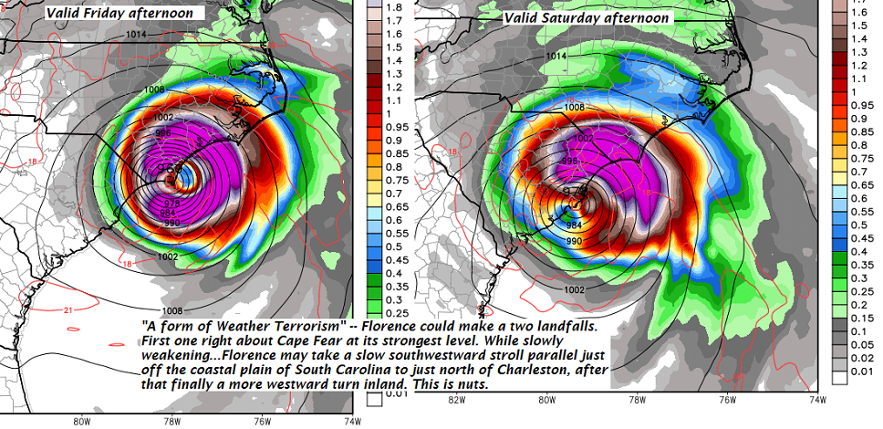
FRIDAY: Chance for a morning shower, then breezy at times…with mixed sun and clouds. A low in the 50s. A high in the mid 70s.
SATURDAY: Sunshine becoming filtered through high clouds. A low in the low 50s. A high 60 to 65.
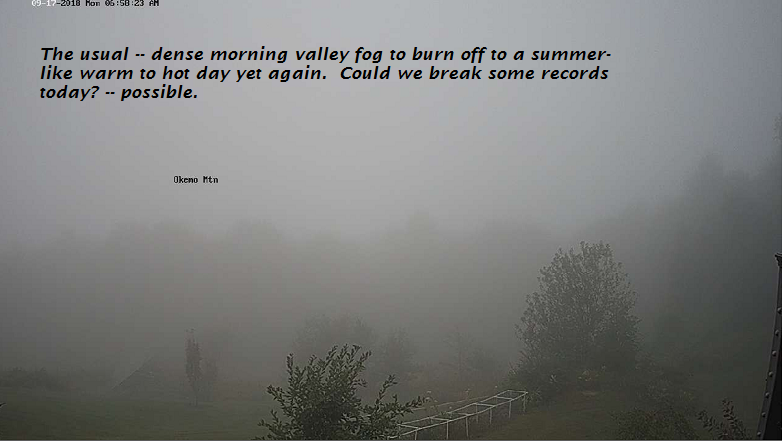
Average lows in the mid 40s to upper 40s. Normal highs in the mid 60s to near 70.
RH/9-17-18[end]
| Virus-free. www.avast.com |