Updated Monday Evening Forecast — June 24th, 2019

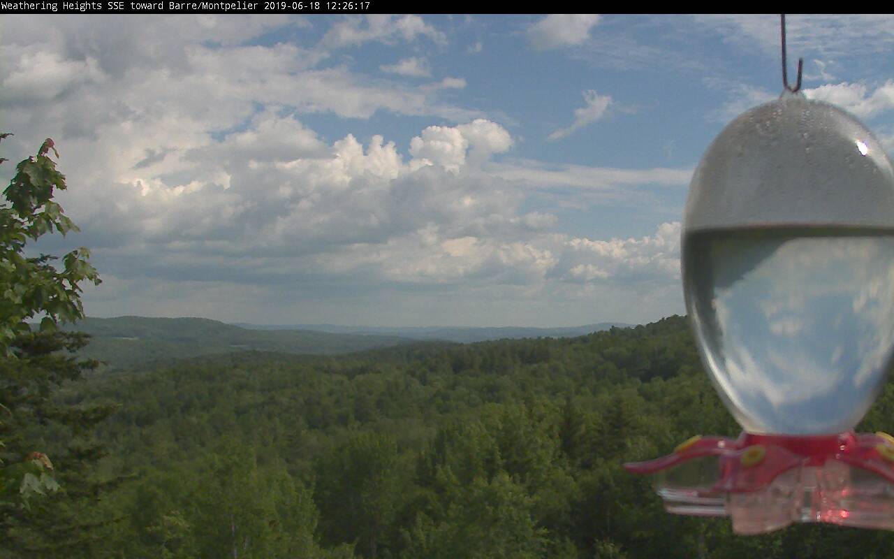
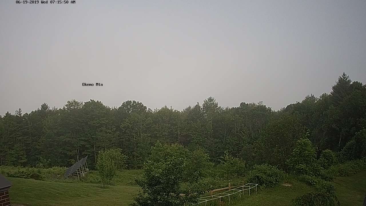
TONIGHT: Mostly clear with a few high clouds. A low 50 to 55. Light southeast winds.

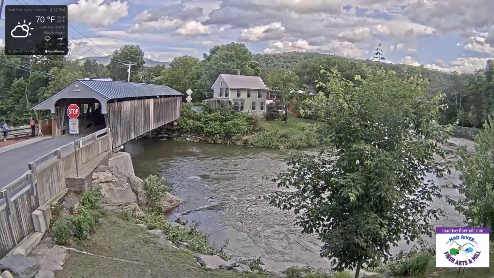
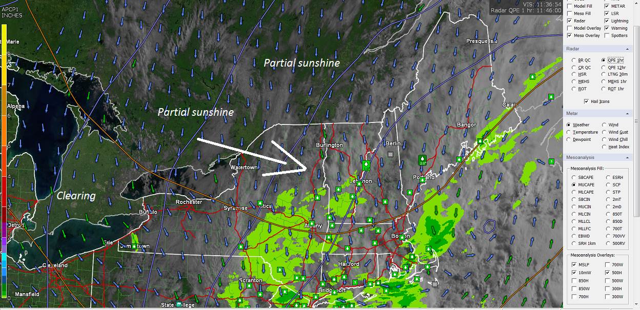
TOMORROW: Thickening clouds and a bit muggy. A good chance for showers…maybe a rumble of thunder late. A high near 70. Southeast breeze 10 to 15 mph.

TUESDAY NIGHT: Isolated leftover shower or storm winds down early. Otherwise…partly cloudy. A low around 60. Light south winds.

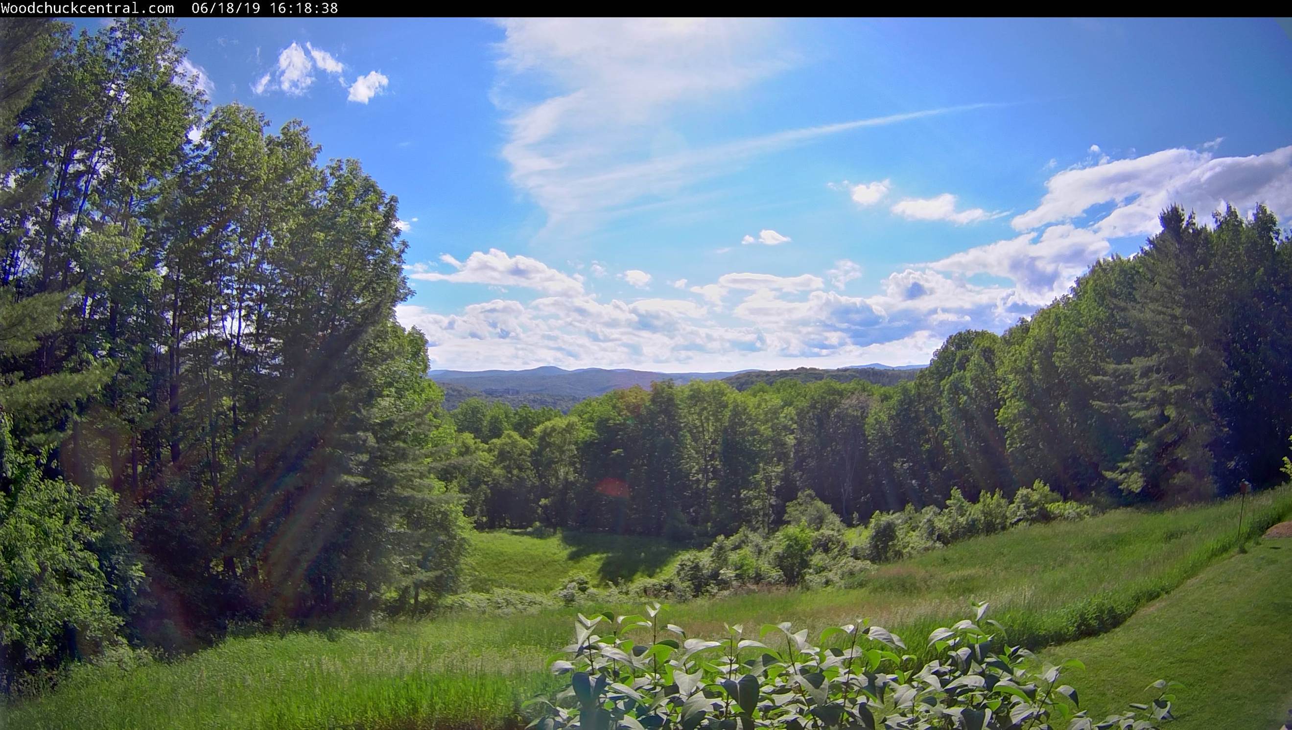
WEDNESDAY: More sunshine than clouds. Slight chance for a late day shower or thunderstorm. Warmer and a little muggy. A high 80 to 85. Light southwest winds.

Looking further ahead…

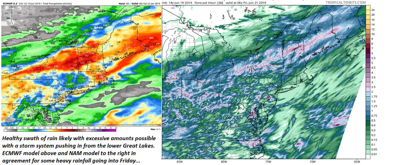
WEDNESDAY NIGHT: Partly cloudy & a bit muggy. A rising chance for showers and thunderstorms develops early to mid-evening. A low around 60.

THURSDAY: Partly sunny. Widely scattered afternoon showers and thunderstorms northern areas. A little muggy. A high around 80.

FRIDAY: Mixed sun and clouds. Slight chance for afternoon showers and thunderstorms northern areas. A low 55 to 60. A high upper 70s to near 80.

SATURDAY: Morning sun then mostly cloudy. Chance for a shower or thunderstorm. A low 55 to 60. A high 70 to 75.

Average lows 55 to 60. Average highs in the mid to upper 70s.

RH/6-24-19[end]

Updated Monday Morning Forecast — June 24th, 2019

TODAY: Mostly sunny with some occasional high cloudiness this afternoon. Comfortable with low humidity and a high 75 to 80. Light northwest winds.

TONIGHT: Fair skies with variable high cloudiness thickening up toward morning. A low 50 to 55. Light winds.

TUESDAY: Thickening clouds and a bit muggy. A good chance for showers & afternoon thunderstorms. A high around 70. Southeast breeze 10 to 15 mph.

Looking further ahead…

TUESDAY NIGHT: Isolated leftover shower or storm winds down early. Otherwise…partly cloudy. A low in the mid to upper 50s.

WEDNESDAY: More sunshine than clouds. Warmer and a little muggy. A rising chance for showers and thunderstorms develops early to mid-evening. A high in the low 80s.

THURSDAY: Partly sunny. Widely scattered afternoon showers and thunderstorms northern areas. A little muggy. A low around 60. A high around 80.

FRIDAY: Mixed sun and clouds. Slight chance for afternoon showers and thunderstorms northern areas. A low 55 to 60. A high upper 70s to low 80s.

Average lows 55 to 60. Average highs in the mid to upper 70s.

RH/6-24-19[end]

Updated Friday Evening Forecast — June 21st, 2019

TONIGHT: Scattered cloudiness then clearing overnight. Patchy valley fog. A low around 55. Light northwest winds.

TOMORROW: Morning sun then afternoon cloudiness. Widely scattered showers and thunderstorms especially Northeast Kingdom. Breezy at times. A high around 70. Northwest winds 10 to 25 mph with few higher gusts.

SATURDAY NIGHT: Clear with patchy valley fog. A low in the upper 40s to mid 50s. Light northwest winds.

SUNDAY: Gorgeous with lots of sunshine. A high mid 70s to near 80. West breeze 10 to 15 mph.

Looking further ahead…

SUNDAY NIGHT: Clear and partially moonlit. A low upper 40s to mid 50s.

MONDAY: Filtered sunshine through high clouds. A high 75 to 80.

TUESDAY: Filtered sunshine giving way to thickening clouds. A rising chance for showers & afternoon thunderstorms. A low 50 to 55. A high near 70.

WEDNESDAY: Partly sunny and a little muggy with an isolated thunderstorm. A low 55 to 60. A high in the low 80s.

Average lows in the mid to upper 50s. Average highs in the mid to upper 70s.

RH/6-21-19[end]

Updated Friday Morning Forecast — June 21st, 2019

Summer Solstice 11:54 AM Friday…

TODAY: Scattered sprinkles or light showers this morning. Partial afternoon sun with a couple showers toward the Northeast Kingdom. Blustery. A high 65 to 70. Northwest winds 10 to 20 mph.

TONIGHT: Mostly clear. Patchy valley fog. A low around 55. Light northwest winds.

SATURDAY: More sun than clouds. Blustery and cool. Widely scattered pop-up showers and thunderstorms. A high 65 to 70. Northwest winds 10 to 25 mph with few higher gusts.

Looking further ahead…

SATURDAY NIGHT: Clear with patchy valley fog. A low 50 to 55.

SUNDAY: Gorgeous with lots of sunshine. A high mid 70s to near 80.

MONDAY: Filtered sunshine through high clouds. A low 50 to 55. A high 75 to 80.

TUESDAY: Filtered sunshine giving way to thickening clouds. A rising chance for late afternoon showers & thunderstorms. A low in the mid 50s. A high around 75.

WEDNESDAY: Morning clouds and fog, then partly sunny. A low near 55. A high 75 to 80.

Average lows in the low to mid 50s. Average highs in the mid to upper 70s.

RH/6-21-19[end]

Updated Thursday Evening Forecast — June 20th, 2019

TONIGHT: Rain…tapers to scattered sprinkles this evening. Otherwise mainly cloudy. A low mid to upper 50s. North to northwest winds 10 to 15 mph.

Summer Solstice 11:54 AM Friday…

TOMORROW: A couple showers toward the Northeast Kingdom…otherwise more sunshine than clouds. Blustery. A high 65 to 70. Gusty north to northwest winds 10 to 25 mph.

FRIDAY NIGHT: Mostly clear. Patchy valley fog. A low around 55. Light northwest winds.

SATURDAY: More sun than clouds. Blustery to windy and cooler. Widely scattered pop-up showers and thunderstorms. A high upper 60s to near 70. Northwest winds 10 to 25 mph with higher gusts.

Looking further ahead…

SATURDAY NIGHT: Clear with patchy valley fog. A low 50 to 55.

SUNDAY: Lots of sunshine, blustery at times. A high around 75.

MONDAY: Filtered sunshine through high clouds. A low 50 to 55. A high near 80.

TUESDAY: Clouds mixed with periods of sunshine. A rising chance for showers possible thunderstorms toward evening. A low in the mid 50s. A high around 70.

Average lows in the low to mid 50s. Average highs in the mid to upper 70s.

RH/6-20-19[end]

Updated Thursday Morning Forecast — June 20th, 2019

TODAY: Gray and overcast. Scattered light morning showers blending into periods of rain…moderate to locally heavy at times. Risk of thunder later on. A high around 70. Light southeast winds.

TONIGHT: Cloudy. Periods of rain moderate to heavy at times mainly this evening…with few rumbles of thunder. A low around 55. North winds 10 mph picking up toward morning.

Summer Solstice 11:54 AM Friday…

FRIDAY: Showers…gradually ending west to east by mid day. Partial afternoon sunshine developing. Breezy. A high 65 to 70. Gusty northwest winds 10 to 25 mph.

Looking further ahead…

FRIDAY NIGHT: Mostly clear. Patchy valley fog. A low 50 to 55.

SATURDAY: Partly sunny, blustery to windy and cooler. Widely scattered pop-up showers and a risk for thunder. A high mid 60s to near 70.

SUNDAY: Lots of sunshine, blustery at times. A low 50 to 55. A high 75 to 80.

MONDAY: Filtered sunshine through high clouds. A low 50 to 55. A high near 80.

TUESDAY: Clouds mixed with periods of sunshine. A rising chance for showers possible thunderstorms. A low in the mid 50s. A high around 70.

Average lows in the low to mid 50s. Average highs in the mid to upper 70s.

RH/6-20-19[end]

Updated Wednesday Evening Forecast — June 19th, 2019

TONIGHT: Scattered showers and isolated thunderstorms mainly northern areas winding down overnight, otherwise variable cloudiness. Humid. A low around 60. Light southeast winds.

TOMORROW: Gray and overcast. Scattered light morning showers blending into periods of rain…moderate to locally heavy at times. Risk of thunder later. A high around 70. Light variable winds.

THURSDAY NIGHT: Cloudy. Periods of rain moderate to heavy at times with few rumbles of thunder. A low around 55. North winds 10 mph picking up toward morning.

Summer Solstice 11:54 AM Friday…

FRIDAY: Periods of rain early…tapering to scattered showers before departing in the afternoon Partial late day sun. Becoming breezy to windy. A high 65 to 70. Gusty northwest winds.

Looking further ahead…

FRIDAY NIGHT: Mostly clear. Considerable valley fog. A low 50 to 55.

SATURDAY: Partly sunny, blustery to windy and cooler. Widely scattered pop-up showers and risk for thunder. A high mid 60s to near 70.

SUNDAY: Lots of sunshine, blustery at times. A low 50 to 55. A high 70 to 75.

MONDAY: Partly to mostly sunny. A low 50 to 55. A high mid 70s.

Average lows in the low to mid 50s. Average highs in the mid to upper 70s.

RH/6-19-19[end]

Updated Wednesday Morning Weather — June 19th, 2019

TODAY: Mixed clouds and sun. Scattered afternoon pop-up showers and isolated thunderstorms, especially northern areas. A bit muggy. A high near 75. Light southwest winds.

TONIGHT: Partly cloudy early then clouding up. Chance for leftover shower or isolated thunderstorm mainly northern areas. Humid. A low around 60. Light southeast winds.

THURSDAY: Considerable cloudiness. Showers likely developing in the afternoon moderate to heavy at times with a few rumbles of thunder possible. A high 70 to 75. Light winds.

Looking further ahead…

THURSDAY NIGHT: Periods of rain with a chance for thunderstorms especially in the evening…moderate to heavy at times. A low in the mid to upper 50s.

Summer Solstice 11:54 AM Friday…

FRIDAY: Scattered morning showers exiting. Becoming breezy to windy. A high in the mid to upper 60s.

SATURDAY: Partly sunny, blustery to windy and cooler. Widely scattered pop-up showers and risk for thunder. A low in the low 50s. A high in the mid 60s.

SUNDAY: Mixed sun and clouds, blustery at times. A low in the 50s. A high 70 to 75.

Average lows in the low to mid 50s. Average highs in the mid to upper 70s.

RH/6-19-19[end]

Updated Tuesday Evening Forecast — June 18th, 2019

TONIGHT: Partly cloudy to mostly clear & fully moonlit skies. A low mid to upper 50s. Light southwest winds.

TOMORROW: Mixed clouds and sun. Scattered afternoon showers and thunderstorms especially northern areas. Sticky. A high near 75. Light southwest winds.

WEDNESDAY NIGHT: Partly cloudy early then clouding up. Chance for leftover shower mainly northern areas. Humid. A low around 60. Light southeast winds.

THURSDAY: Considerable cloudiness. Showers becoming likely in the afternoon with a risk for a thunderstorm…possibly moderate to heavy. A high in the low 70s. Light winds.

Looking further ahead…

THURSDAY NIGHT: Periods of rain with a chance for thunderstorms especially in the evening. A low in the mid to upper 50s.

Summer Solstice 11:54 AM Friday…

FRIDAY: Scattered morning showers exiting. Becoming breezy to windy. A high in the mid to upper 60s.

SATURDAY: Scattered mountain sprinkles, otherwise clouds mixing with more sun. A low in the low 50s. A high upper 60s to near 70.

SUNDAY: Mixed sun and clouds, blustery at times. A low in the 50s. A high 70 to 75.

Average lows in the low to mid 50s. Average highs in the mid to upper 70s.

RH/6-18-19[end]

Updated Tuesday morning Forecast — June 18th, 2019

TODAY: Clouds this morning, partly sunny this afternoon but more clouds southern areas. Moderately humid with a high near 75. Light southwest winds.

TONIGHT: Becoming mostly cloudy. Slight chance for a brief shower. A low around 55. Light southeast winds.

WEDNESDAY: Mixed clouds and sun. Scattered mainly afternoon showers and thunderstorms especially northern areas. Sticky. A high in the mid to upper 70s. Light south winds.

Looking further ahead…

WEDNESDAY NIGHT: Mostly cloudy. A leftover spotty shower. Kind of muggy. A low upper 50s to near 60.

THURSDAY: Considerable cloudiness. Chance for showers. A high 70 to 75.

Summer Solstice 11:54 AM Friday…

FRIDAY: Chance for rain…with a risk for thunder in the morning, moderate to locally heavy at times…tapering off in the later afternoon. Becoming breezy to windy. A low in the mid to upper 50s. A high 65 to 70.

SATURDAY: Scattered mountain sprinkles, otherwise clouds mixing with more sun. A low around 55. A high pushing to near 70.

SUNDAY: Mixed sun and clouds, blustery at times. A low 55 to 60. A high in the low to mid 70s.

Average lows in the low to mid 50s. Average highs in the mid to upper 70s.

RH/6-18-19[end]