Updated Friday Evening Forecast — May 1st, 2020

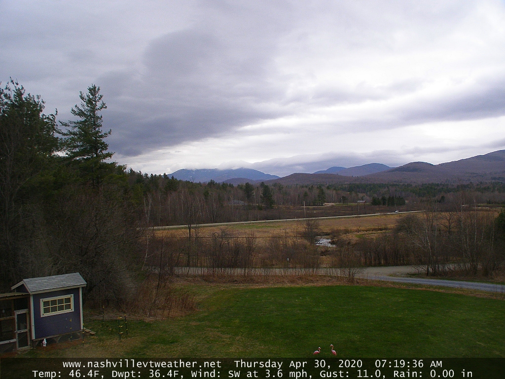
TONIGHT: A few leftover rain showers through mid-evening, otherwise becoming mostly clear. A low 35 to 40. Northwest winds picking up this evening 10 to 20 mph.

TOMORROW: Mostly sunny with some afternoon high clouds. A high around 60. Northwest winds 10 to 15 mph.

SATURDAY NIGHT: Thickening clouds. Scattered rain showers developing overnight. A low 40 to 45. Light south winds.

SUNDAY: Scattered rain showers in the morning, then partly to mostly sunny in the afternoon. Near to above normal in temperatures in the afternoon, with a high pushing near 65. West breeze 10 to 20 mph.

Looking further ahead…

SUNDAY NIGHT: Variable cloudiness. A low around 40.

MONDAY: Mostly cloudy & damp. Widely scattered rain showers, mainly in the afternoon. A high around 55.

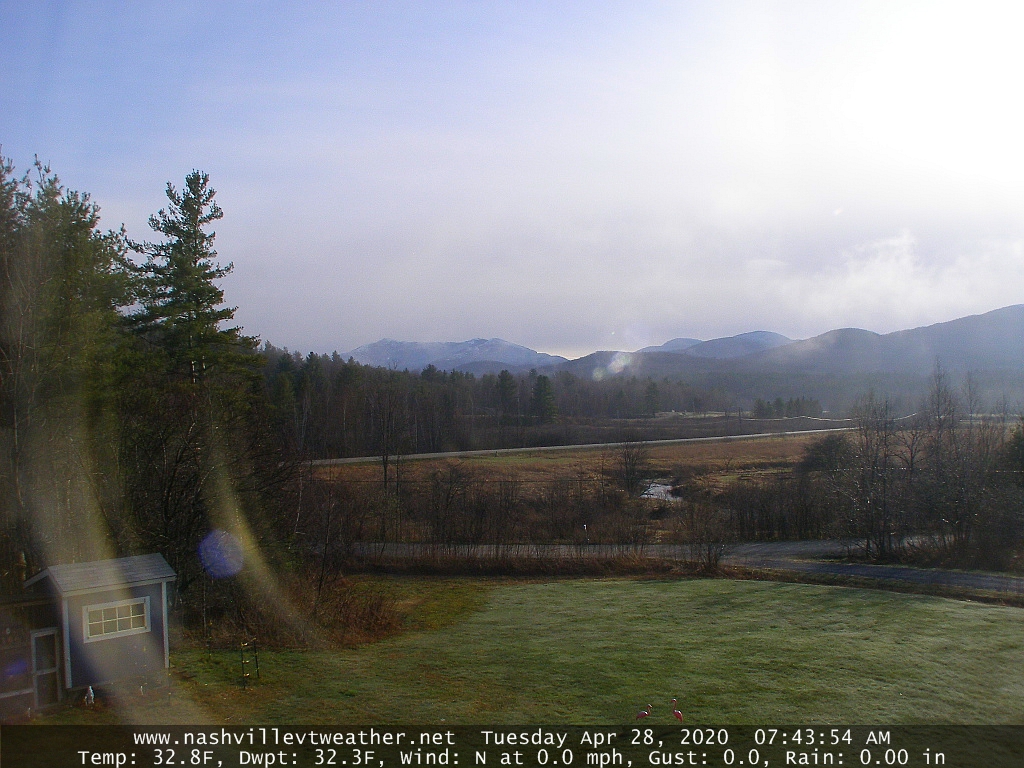
TUESDAY: Mostly sunny after a frosty start. A low around 32. A high upper 40s.

WEDNESDAY: Partly cloudy. A low 25 to 30. A high 50 to 55.

Average lows ranging mid-30s to around 40, average highs in the low to mid 60s.

RH/5-1[end]

Updated Friday Morning forecast — May 1st, 2020

TODAY: Gray. Rain…moderate at times eastern Vermont early, tapering to widely scattered showers. Areas of fog. Milder. A high around 55. Light east to southeast winds.

TONIGHT: A few leftover rain showers through mid-evening, then clearing overnight. A low upper 30s to low 40s. Northwest winds 10 to 15 mph.

SATURDAY: Sunny through early afternoon, then more clouds. A high upper 50s to around 60. Northwest winds 10 to 15 mph.

Looking further ahead…

SATURDAY NIGHT: Partly to mostly cloudy. A rising chance for few rain showers after midnight. A low 40 to 45.

SUNDAY: Partly to mostly cloudy. Widely scattered rain showers. Near to above normal temperatures in the afternoon, with a high in the low 60s.

MONDAY: A few breaks of morning sun, then cloudy & damp. Chance for rain showers, mainly in the afternoon. A low 32 to 35. A high around 55.

TUESDAY: Slight chance for an early morning flurry then partly sunny. A low around 32. A high upper 40s to around 50.

WEDNESDAY: Sunshine gives way to more clouds. A low 25 to 30. A high in the mid-50s.

Average lows ranging mid-30s to around 40, average highs in the upper-50s to mid-60s.

RH/5-1[end]

Updated Thursday Evening forecast — April 30th, 2020

TONIGHT: Overcast & damp. Widely scattered rain showers developing into moderate rain at times after midnight. Areas of fog. A low 40 to 45. Southeast winds 10 to 20 mph this evening diminishing overnight.

TOMORROW: Gray. Periods of rain…moderate at times, tapering to scattered showers in the afternoon. Areas of fog. Milder, with a high in the mid-50s. Light east to southeast winds.

FRIDAY NIGHT: Scattered rain showers exiting around midnight. Clearing overnight. A low in the low 40s. Northwest winds 10 to 15 mph.

SATURDAY: Partly to mostly sunny. A high 55 to 60. Northwest winds 10 to 15 mph.

Looking further ahead…

SATURDAY NIGHT: Fair early then clouding up. Chance for a few rain showers. A low 40 to 45.

SUNDAY: Partly to mostly cloudy. Chace for a few showers. Near to above normal temperatures in the afternoon, with a high in the mid-60s.

MONDAY: Mainly cloudy & damp. Chance for showers. A low 35 to 40. A high around 55.

TUESDAY: Partly cloudy after a few sprinkles or wet snow flurries early. A low around 32. A high in the mid-40s.

Average lows ranging mid-30s to around 40, average highs in the upper-50s to mid-60s.

RH/4-30[end]

Updated Thursday Morning Forecast — April 30th, 2020

TODAY: Cloudy. Widely scattered rain showers. Breezy to windy mainly western slopes of Green Mountains. Temperatures holding 45 to 50. Southeast breeze 10 to 20 mph.

TONIGHT: Overcast & damp. Widely scattered rain showers developing into moderate rain at times toward daybreak. Areas of fog. A low in the low 40s. Southeast winds 10 mph across the hills.

FRIDAY: Gray. Periods of rain…moderate at times, tapering to scattered showers in the afternoon. Areas of fog. Milder, with a high in the low to mid 50s. Light south to southeast winds.

Looking further ahead…

FRIDAY NIGHT: Scattered rain showers exiting late evening. Clearing overnight. A low in the low 40s.

SATURDAY: Partly to mostly sunny. A high mid to upper 50s.

SUNDAY: Partly to mostly cloudy. Scattered brief rain showers. A low around 40. Near seasonal temperatures in the afternoon, with a high in the mid to upper 60s.

MONDAY: Mainly cloudy & damp. Chance for showers becoming frequent in the afternoon. A low 40 to 45. A high near 50.

TUESDAY: Mostly cloudy and colder. Chance for rain showers mixed with wet snow across the higher terrain. A low 35 to 40. A high in the low 40s.

Average lows ranging mid-30s to around 40, average highs in the upper-50s to mid-60s.

RH/4-30[end]

Updated Wednesday Evening Forecast — April 29th, 2020

TONIGHT: Thickening clouds. Widely scattered sprinkles developing toward midnight. A low around 40. Southeast winds 10 to 15 mph.

TOMORROW: Lots of clouds. Widely scattered rain showers. Breezy especially western slopes of Green Mountains. A high upper 40s to near 50. Southeast winds 10 to 20 mph.

THURSDAY NIGHT: Overcast & damp. Widely scattered rain showers developing into moderate rain at times late. Patchy valley fog. A low in the low 40s. Southeast winds 10 mph across the hills.

FRIDAY: Gray. Rain likely…moderate at times tapering to scattered showers later in the afternoon. Areas of fog. A high in the low 50s. Light south to southeast winds.

Looking further ahead…

FRIDAY NIGHT: Scattered rain showers exiting late evening. Clearing overnight. A low in the low 40s.

SATURDAY: Morning sunshine gives way afternoon cloudiness. A high around 55.

SUNDAY: Sunshine mixing with more clouds in the afternoon. Slight threat for a shower. A low 35 to 40. Near seasonal temperatures in the afternoon, with a high near 65.

MONDAY: Mainly cloudy & damp. Chance for showers/periods of rain. A low 40 to 45. A high in the low 50s.

TUESDAY: Mostly cloudy and colder. Chance for rain showers possibly mixed with wet snowflakes late. A low in the 30s. A high only around 40.

Average lows ranging mid-30s to around 40, average highs in the upper-50s to mid-60s.

RH/4-29[end]

Updated Wednesday Morning Forecast — April 29th, 2020

TODAY: Pick of the week. Sunshine, filtered through high clouds at times. A bit warmer and pleasant. A high upper 50s to around 60. Southeast breeze 10 mph.

TONIGHT: Thickening clouds. Widely scattered sprinkles developing toward midnight. A around 40. Southeast winds 10 to 15 mph.

THURSDAY: Mainly cloudy. Widely scattered rain showers. Breezy especially western slopes of Green Mountains. A high in the low 50s. Southeast winds 10 to 20 mph.

Looking further ahead…

THURSDAY NIGHT: Overcast & damp. Widely scattered rain showers. Patchy valley fog. A low around 45.

FRIDAY: Gray. Good chance for rain…moderate at times, otherwise cloudy areas of fog. A high in the low to mid 50s

SATURDAY: Mostly cloudy and unsettled. Scattered rain showers. A low around 45. A high in the low 50s.

SUNDAY: Sunshine gives way to increasing high clouds. A low in the mid to upper 30s. Near seasonal temperatures in the afternoon, with a high near 65.

MONDAY: Gray skies. Chance for showers or a period of rain. A low around 45. A high 55 to 60.

Average lows ranging mid-30s to around 40, average highs in the upper-50s to mid-60s.

RH/4-29[end]

Updated Tuesday evening Forecast — April 28th, 2020

TONIGHT: A few evening clouds then mostly clear and chilly. A low in the low 30s. Light east winds.

TOMORROW: Pick of the week. Sunshine filtered through high clouds at times. A bit warmer. A high upper 50s to around 60. Southeast breeze 10 mph.

WEDNESDAY NIGHT: Thickening clouds. Widely scattered sprinkles developing toward midnight. A low in the low 40s. Southeast winds 10 to 15 mph.

THURSDAY: Mainly cloudy and damp. Chance for a few rain showers. Breezy especially western slopes of Green Mountains. A high in the low 50s. Southeast winds 10 to 20 mph.

Looking further ahead…

THURSDAY NIGHT: Cloudy & damp. Chance for a few light showers. A low around 45.

FRIDAY: Gray. Chance for rain…moderate at times, otherwise mainly cloudy. A high 55 to 60.

SATURDAY: Mostly cloudy and unsettled with scattered rain showers. A low in the upper 40s. A high around 55.

SUNDAY: Mostly sunny. A low 40 to 45. Near seasonal temperatures in the afternoon, with a high in the low to mid 60s.

Average lows ranging mid-30s to around 40, average highs in the upper-50s to mid-60s.

RH/4-27[end]

Updated Tuesday Morning Forecast — April 28th, 2020

TODAY: Clouds, with intervals of sun developing. Partly sunny later this afternoon. A high 50 to 55. Light north to northwest winds.

TONIGHT: A few evening clouds then mostly clear and colder. A low upper 20s to around 32. Light east winds.

WEDNESDAY: Pick of the week. Sunshine filtered through high clouds at times. A bit warmer. A high 55 to 60. Southeast breeze 10 mph.

Looking further ahead…

WEDNESDAY NIGHT: Thickening clouds. A rising chance for light rain showers developing. A low in the upper 30s.

THURSDAY: Gray. Chance for spotty light rain. Breezy especially western slopes of Green Mountains. A high in the upper 40s to low 50s.

FRIDAY: Chance for rain…moderate at times in the morning, otherwise mainly cloudy. A low 45 to 50. A high 55 to 60.

SATURDAY: Leftover showers gives way to intervals of afternoon sun. A low 40 to 45. A high around 55.

SUNDAY: Partly to mostly sunny. A low in the 30s. Near seasonal temperatures in the afternoon, with a high upper 50s to low 60s.

Average lows ranging mid-30s to around 40, average highs in the upper-50s to mid-60s.

RH/4-27[end]

Updated Monday Evening Forecast — April 27th, 2020

TONIGHT: Overcast. Lingering light rain showers mixing with wet snow for a time this evening…before exiting to the south. A low about 32 to 35. Light northwest winds.

TOMORROW: Clouds, with a few breaks of sun in the morning becoming partly sunny late. A high upper 40s to around 50. Light north to northwest winds.

TUESDAY NIGHT: A few evening clouds then mostly clear. A low upper 20s to low 30s. Light east winds.

WEDNESDAY: Pick of the week. Sunshine filtered through high clouds at times. A high mid-50s to around 60. Southeast breeze 10 mph.

Looking further ahead…

WEDNESDAY NIGHT: Thickening clouds. Chance for a few light rain showers overnight. A low 35 to 40.

THURSDAY: Gray. Chance for spotty light rain. Breezy especially western slopes of Green Mountains. A high 45 to 50.

FRIDAY: Chance for morning rain…moderate at times, then partial afternoon sunshine and near seasonal temperatures. A low 40 to 45. A high 55 to 60.

SATURDAY: Morning clouds then increasing sunshine and pleasant. A low around 45. A high upper 50s to around 60.

Average lows ranging mid-30s to around 40, average highs in the upper-50s to mid-60s.

RH/4-27[end]

Updated Monday Morning forecast — April 27th, 2020

TODAY: Gray, Occasional light rain mixed with wet snow across heights this morning, changing to occasional light rain this afternoon. Some minor additional coating above 1500 ft elevation central and southern areas. Temperatures in the mid-30s to low 40s. North to northeast winds 10 to 15 mph.

TONIGHT: Overcast. Lingering scattered light rain or snow showers. Minor accumulation across the hills. A low 32 to 35. Light northwest winds.

TUESDAY: Considerable cloudiness lingering. Isolated mountain flurries early. A high 45 to around 50. Light north winds.

Looking further ahead…

TUESDAY NIGHT: Evening clouds break up with clearing skies. A low 30 to 35.

WEDNESDAY: Sunshine filtered through high cloudiness in the afternoon. A high in the low to mid 50s.

THURSDAY: Overcast. Chance for spotty light rain. Breezy to windy western slopes of Green Mountains. A low 35 to 40. A high mid to upper 40s.

FRIDAY: Chance for morning rain…moderate at times, then partial afternoon sunshine and near seasonal temperatures. A low 40 to 45. A high 55 to 60.

SATURDAY: Morning clouds then increasing sunshine and pleasant. A low around 45. A high in the mid-50s.

Average lows ranging mid-30s to around 40, average highs in the upper-50s to mid 60s.

RH/4-27[end]