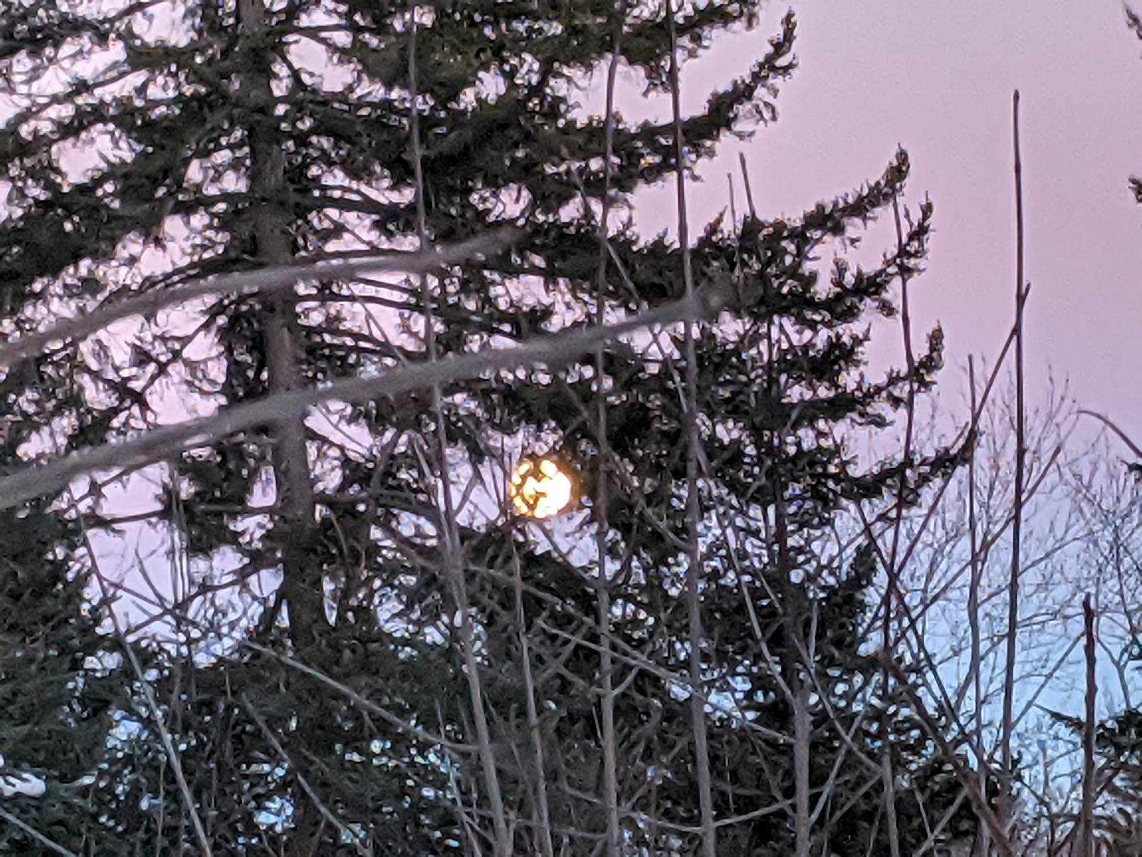
Full Cold Moon…10:30 PM Tuesday Evening…
TONIGHT: Clear and moonlit this evening. Increasing clouds overnight. A low upper single digits to mid-teens. Light west winds.
TOMORROW: Mainly cloudy. A round of flurries developing later in the afternoon. A high in the low 30s. Light south breeze.
WEDNESDAY NIGHT: Lots of clouds. Wet snow showers & possible wintry mix, changing to rain showers toward dawn. Variable accumulation less than an inch. Temperatures holding in the low to mid 30s. South winds 10 to 15 mph.
THURSDAY: Spotty mixed precipitation or sprinkles in the morning exits to partial afternoon sunshine. A little milder. A high 35 to 40. Southwest winds becoming northwesterly 10 to 20 mph.
Looking further ahead…
NEW YEARS EVE THURSDAY NIGHT: Mostly clear. A low upper teens to around 20.
FRIDAY New Year’s Day: Sunshine gives way to thickening high cloudiness late. A high mid-30s.
SATURDAY: Overcast. Periods of wet snow with accumulation 1 to locally 3” possible…transitions to sleet and freezing rain with icy travel in the morning. Precipitation eventually trends toward rain showers along with milder temperatures in the afternoon. A low 25 to 30. A high around 45.
SUNDAY: Morning sunshine then thickening clouds with a chance for late day snow showers or flurries. A low in the 20s. A high in the low to mid 30s.
Average low mid-single digits to low-teens, Average highs mid-20s to low-30s.
Peak of Winter (coldest averages) January 23rd. End of Winter March 9th… based off local climatology.
RH/12-28category forecast][end]