TONIGHT: Considerable cloudiness. A couple periods of scattered flurries northern areas, a strong dusting in spots. A low around 20. Light south winds.
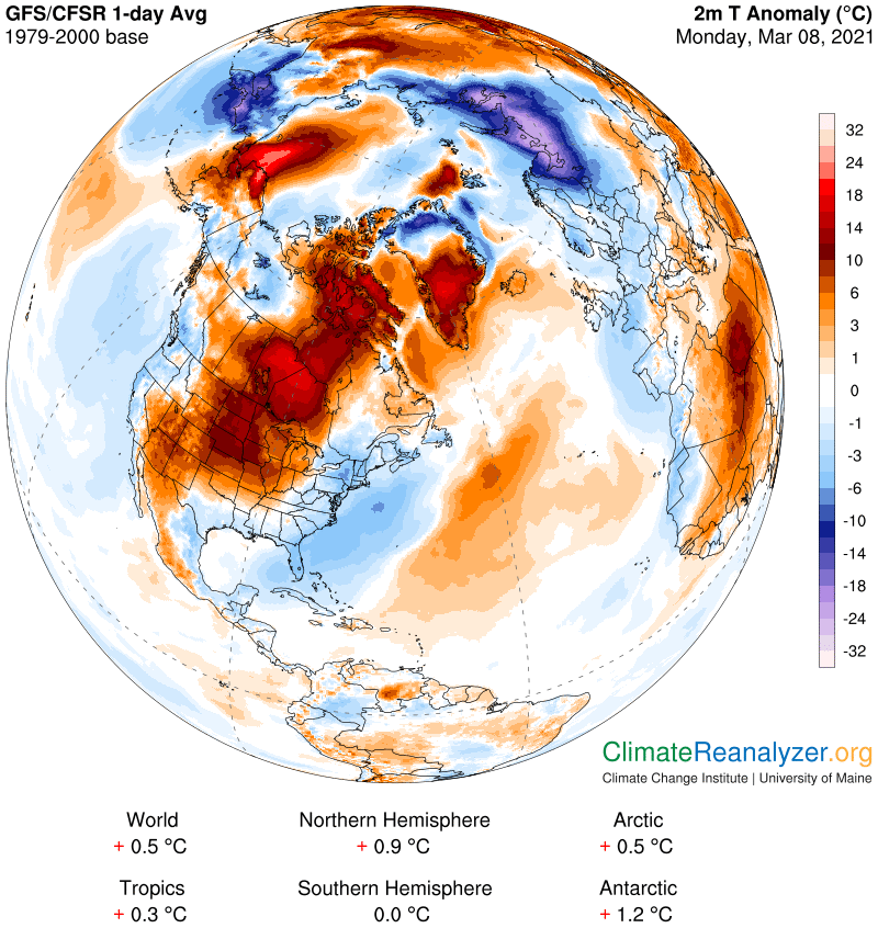
End of Meteorological Winter
TOMORROW: Clouds, with intervals of sun away from the mountains, eventually mostly sunny late. Milder. A high 35 to 40. (Possible sap run Maple sugaring) Wind becoming northwesterly 10 mph.
TUESDAY NIGHT: Clear skies. A low upper teens to around 20. Little wind.
WEDNESDAY: Morning sunshine gives to considerable cloudiness in the afternoon. Well above normal in temperature, lots of snow melt. A high near 50. (Sap run likely maple sugaring). Light south winds.
Looking further ahead…
WEDNESDAY NIGHT: Mostly cloudy. A low ranging thru the 30s.
THURSDAY: Mostly cloudy. Scattered sprinkles or light rain showers northern areas. Mild with lots of snow melt, sap runs. A high reaching to around 55.
FRIDAY: Morning cloudiness, then lots of afternoon sunshine. A low upper 30s to around 40. A high near 50.
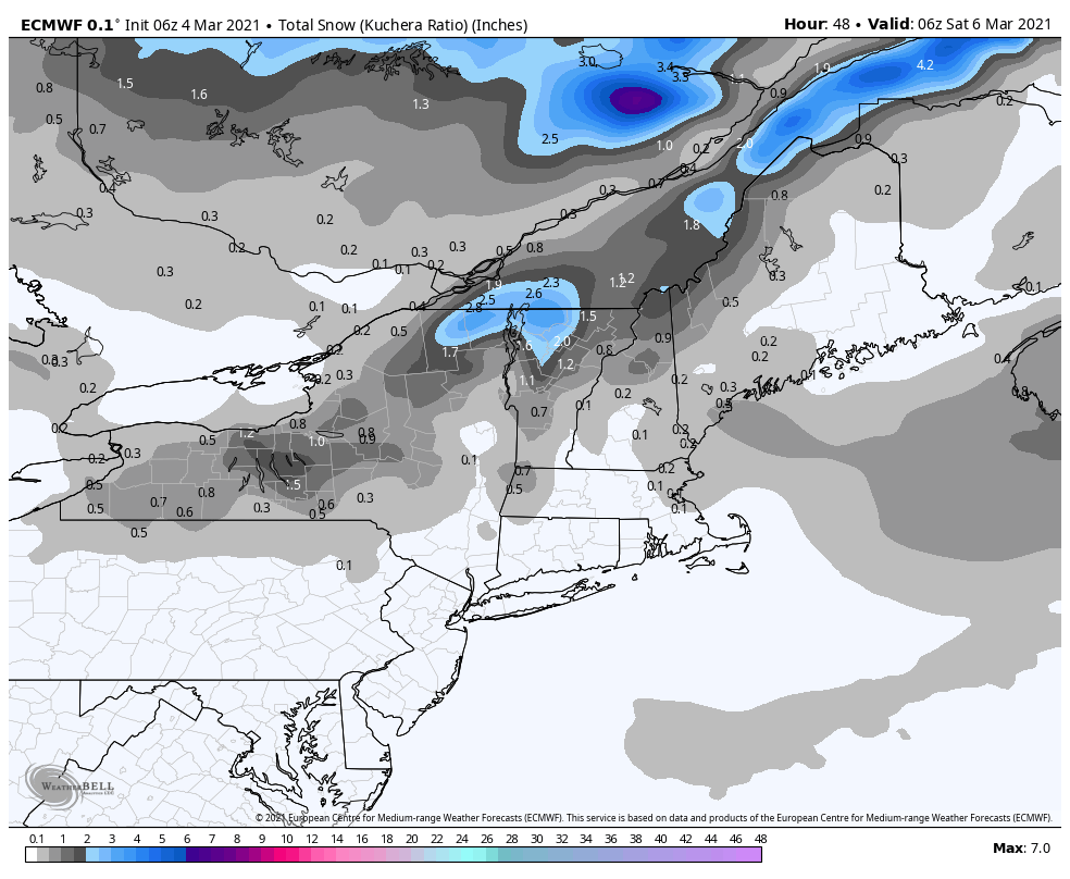
SATURDAY: Chance for morning snow showers or flurries. A dusting to 2” possible. A low 20 to 25. Temperatures in the mid to upper 30s.
Average low mid-teens to low 20s Average highs ranging mid-30s to near 40.
End of Meteorological Winter March 9th… based off local climatology.
RH/3-8category forecast][end]