Updated Monday Evening Forecast — April 26th, 2021

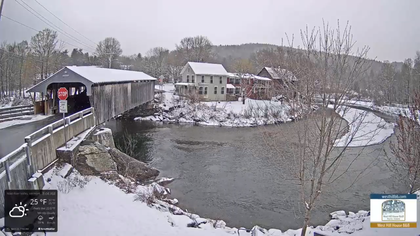
Full Pink Moon 11:32 PM.

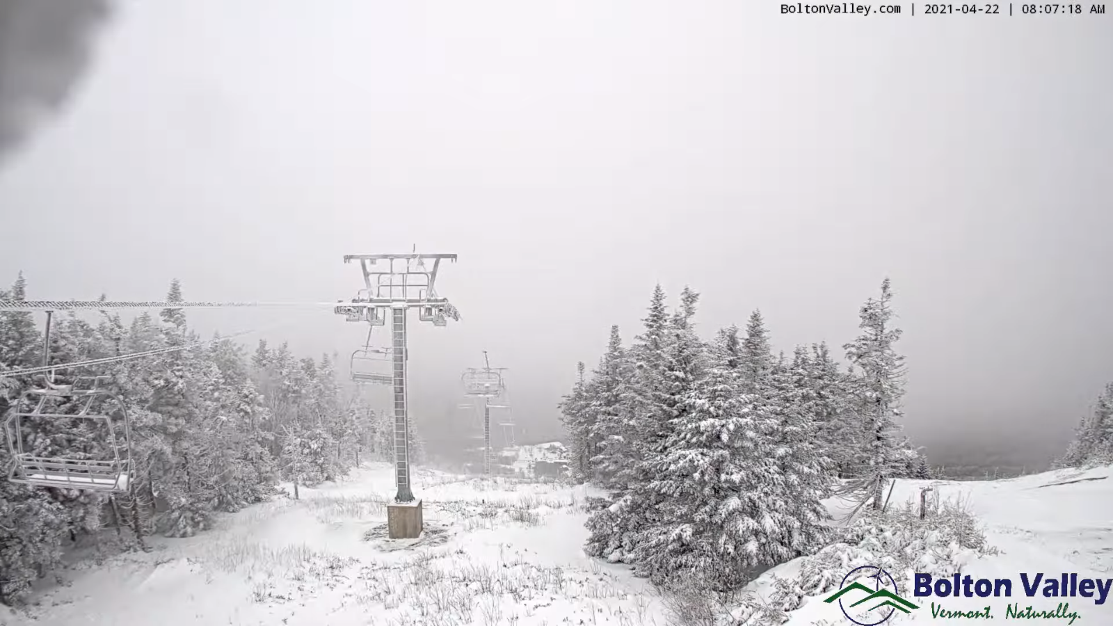
TONIGHT: Clear & fully moonlit. A low upper 20s to low 30s. Light northwest winds.

TUESDAY: Filtered sunshine through high cloudiness. A high mid to upper 50s. Northwest winds 10 mph.

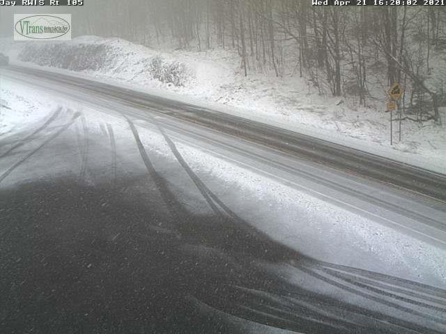
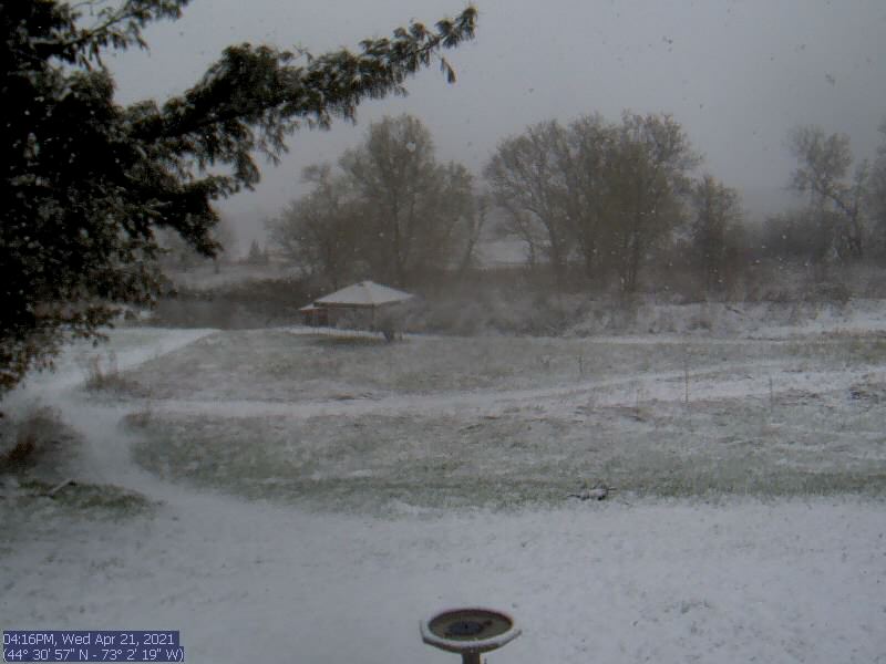
TUESDAY NIGHT: Thickening clouds leading to occasional showers, mainly southern areas. A low around 40. Little wind.

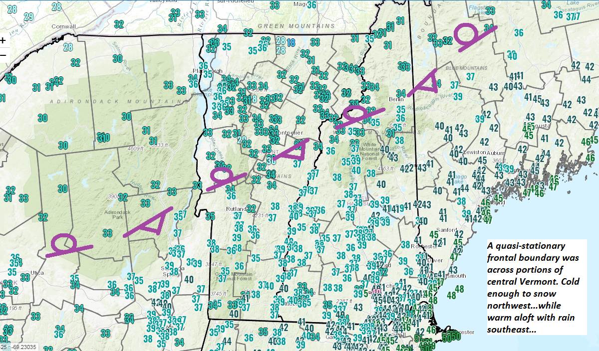
WEDNESDAY: Considerable cloudiness with a few breaks of sun. Rain showers becoming likely toward mid-day possibly moderate at times. Slight risk for thunder southern Vermont. A high mid-50s to around 60. Light winds.

Looking further ahead…

WEDNESDAY NIGHT: Cloudy. Rain showers likely except dry northern areas. A low 40 to 45.

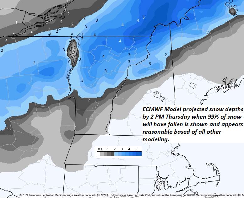
THURSDAY: Considerable cloudiness. A rising chance for rain or rain showers later on…possibly moderate at times. A high ranging from mid-50s to mid-60s…warmest across the far northern areas.

FRIDAY: Morning clouds then partly sunny in the afternoon. Scattered rain showers…possibly mixed with wet snowflakes elevated terrain late. A low in the mid-40s. A high around 55.

SATURDAY: Cloudy, blustery and chilly. Chance for lingering rain showers…possibly mixed with wet snowflakes. A low mid to upper 30s. A high 45 to 50.

SUNDAY: Mixed sun and clouds. A low around 35. A high 50 to 55.

Average low 35 to 40. Average highs upper 30s to low 40s.

Start of Meteorological Summer June 6th… Summer peaks approx.. July 22nd based off local climatology.

RH/4-26category forecast][end]

Updated Monday Morning forecast — April 26th, 2021

TODAY: Considerable morning cloudiness gradually gives way to partly to mostly sunny skies this afternoon…clouds lingering near the Canadian border. Chilly and blustery at times. A high 45 to 50. Northwesterly wind 10 to 25 mph especially this afternoon.

Full Pink Moon Tonight 11:32 PM.

TONIGHT: Clear & fully moonlit. A low around 30. Light northwest winds.

TUESDAY: Filtered sunshine through high cloudiness. A high upper 50s to near 60. Northwest winds 10 to 15 mph.

Looking further ahead…

TUESDAY NIGHT: Thickening clouds leading to a scattered showers mainly southern and western areas. A low around 40.

WEDNESDAY: Considerable cloudiness with a few breaks of sun. Chance for rain showers in the afternoon. Maybe a thunderstorm southern areas. A high near 60.

THURSDAY: Considerable cloudiness. A rising chance for rain showers later on. A low near 40. A high around 65.

FRIDAY: Lots of clouds & blustery at times. Chance for rain showers…possibly mixed with wet snowflakes elevated terrain late. A low in the mid-40s. A high 55 to 60.

Average low 35 to 40. Average highs upper 30s to low 40s.

Start of Meteorological Summer June 6th… Summer peaks approx.. July 22nd based off local climatology.

RH/4-26category forecast][end]

Updated Friday Evening Forecast — April 23rd, 2021

TONIGHT: Mostly clear & partially moonlit. A low mid to upper 30s. Southwest winds 10 mph.

TOMORROW: Mixed sun & clouds with more clouds late. A high around 60. West breeze 10 mph.

SATURDAY NIGHT: Fair with high clouds in the evening…thickening clouds overnight. A low 35 to 40. Light south winds.

SUNDAY: Cloudy. Scattered rain showers with a rumble of thunder possible Quebec border. A high near 55. South breeze 10 to 20 mph.

Looking further ahead…

SUNDAY NIGHT: Partly to mostly cloudy. Scattered evening rain showers exiting before midnight. A low upper 20s.

MONDAY: Partly to mostly sunny. A high 45 to 50.

Full Pink Moon late Monday night 11:32 PM.

TUESDAY: Partly sunny. A low upper 20s to low 30s. A high upper 50s to low 60s.

WEDNESDAY: Morning sun then afternoon clouds. Scattered afternoon showers & thunderstorms. A low around 45. A high 70 to 75.

Average low in the 30s. Average highs mid-50s to around 60.

Start of Meteorological Summer June 6th… Summer peaks approx.. July 22nd based off local climatology.

RH/4-23category forecast][end]

Updated Friday Morning Forecast — April 23rd, 2021

TODAY: Clouds mixing with sunshine. Blustery at times. A high upper 40s to near 50. Northwest winds flare up 10 to 20 mph late morning into the afternoon.

TONIGHT: Mostly clear & partially moonlit. A low around 32. Light southwest winds.

SATURDAY: Mixed sun & clouds with more clouds late. A high near 60. Northwest winds 10 mph.

Looking further ahead…

SATURDAY NIGHT: Cloudy. A rising chance for rain later overnight. A low around 40.

SUNDAY: Cloudy. Good chance for rain showers. A high around 50.

MONDAY: Maybe a morning sprinkle early, otherwise partly to mostly sunny. A low around 30. A high near 50.

Full Pink Moon late Monday night 11:32 PM.

TUESDAY: Partly sunny. A low around 32. A high 60 to 65.

WEDNESDAY: Morning sun then afternoon clouds. Scattered afternoon showers…maybe a thunderstorm. A low in the low to mid 40s. A high around 75.

Average low in the 30s. Average highs mid-50s to around 60.

Start of Meteorological Summer June 6th… Summer peaks approx.. July 22nd based off local climatology.

RH/4-23category forecast][end]

Updated Thursday Evening Forecast — April 22nd, 2021

TONIGHT: Scattered mountain snow showers and valley flurries for a time early this evening. Gradual clearing overnight. A low 25 to 30. West winds 10 to 15 mph.

TOMORROW: Morning sunshine, then more clouds than sun for the afternoon. A high upper 40s to near 50. Northwest winds flare up 10 to 20 mph late morning into the afternoon.

FRIDAY NIGHT: Mostly clear & partially moonlit. A low around 32. Light southwest winds.

SATURDAY: Mixed sun & clouds becoming cloudy late. A high near 60. Northwest winds 10 mph.

Looking further ahead…

SATURDAY NIGHT: Cloudy. A rising chance for rain later overnight. A low around 40.

SUNDAY: Cloudy. Chance for rain…moderate at times. A high around 50.

MONDAY: Chance for rain showers…mixed with wet snow higher terrain exiting in the morning. Some intervals of sun developing in the afternoon. A low around 30. A high 45 to 50.

Full Pink Moon late Monday night 11:32 PM.

TUESDAY: Partly sunny. A low around 32. A high near 60.

Average low in the 30s. Average highs mid-50s to around 60.

Start of Meteorological Summer June 6th… Summer peaks approx.. July 22nd based off local climatology.

RH/4-22category forecast][end]

Updated Thursday morning Forecast — April 22nd, 2021

TODAY: Clouds with breaks of sun developing away from the mountains especially this afternoon. Colder & blustery with frequent mountain snow showers and valley flurries. Dusting to around an inch possibly more northern Greens. A high around 35. Gusty northwest winds picking up 10 to 25 mph with higher gusts producing blowing and drifting and brief white-outs.

TONIGHT: Partial clearing this evening becoming mostly clear overnight. A low 25 to 30. West winds 10 to 15 mph.

FRIDAY: Morning sunshine then partly to mostly cloudy in the afternoon. A high upper 40s to near 50. Northwest winds flare up 10 to 20 mph.

Looking further ahead…

FRIDAY NIGHT: Mostly clear & partially moonlit. A low around 30.

SATURDAY: Some morning cloudiness, then mostly sunny before more clouds push in again. A high around 60

SUNDAY: Cloudy. Chance for rain…moderate at times. A low around 40. A high around 50.

MONDAY: Chance for rain showers…mixed with wet snow higher terrain exiting in the morning. Some intervals of sun developing in the afternoon. A low around 30. A high in the upper 40s.

TUESDAY: Partly sunny. A low around 32. A high near 60.

Average low in the 30s. Average highs mid-50s to around 60.

Start of Meteorological Summer June 6th… Summer peaks approx.. July 22nd based off local climatology.

RH/4-21category forecast][end]

Updated Wednesday Evening Forecast — April 21, 2021

Winter Weather Advisory Northern Green Mountains into the Northeast Kingdom through 8 AM Tomorrow

TONIGHT: Periods of snow tapering to scattered mountain snow showers and valley flurries overnight. Accumulation dusting lower valleys to locally 3” northern Greens and Northeast Kingdom. Otherwise overcast. A low in the mid-20s. Northwest 10 mph.

TOMORROW: Mostly cloudy, colder & blustery. Occasional mountain snow showers and valley flurries. Minor additional accumulation… up 2”northern Greens. A high around 35. Gusty northwest winds picking up 10 to 25 mph with higher gusts.

THURSDAY NIGHT: Evening clouds then clearing. A low in the mid to upper 20s. West winds 10 to 15 mph.

FRIDAY: Morning sunshine then mostly cloudy northern areas in the afternoon. A high around 45. Northwest winds flare up 10 to 20 mph.

Looking further ahead…

FRIDAY NIGHT: Mostly clear partially moonlit. A low near 30.

SATURDAY: Partly to mostly sunny. A high upper 50s to near 60.

SUNDAY: Cloudy. Chance for rain…moderate at times. A low around 40. A high in the upper 40s.

MONDAY: Gray. Chance for periods of accumulating snow…moderate at times tapering to scattered rain or snow showers. A low 30 to 32. A high in the 40s.

Average low in the 30s. Average highs mid-50s to around 60.

Start of Meteorological Summer June 6th… Summer peaks approx.. July 22nd based off local climatology.

RH/4-21category forecast][end]

Updated Wednesday morning Forecast — April 21st, 2021

Winter Weather Advisory Northern Green Mountains and into the Northeast Kingdom through 8 AM Thursday…

TODAY: Gray. Periods of rain central and southern Vermont…with periods of wet snow northern areas eventually transitioning to all wet snow, accumulation ranging from inch southern valleys to 4”in the northern Green Mountains portions of the far northern Champlain Valley. A high 35 to 40 northern areas and in the 40s to low 50s southern areas. Light northeast winds becoming northwesterly 10 to 20 mph late.

TONIGHT: Periods of snow tapering to scattered mountain snow showers and valley flurries overnight. Accumulation dusting to 2” especially Northeast Kingdom. Otherwise cloudy. A low in the mid to upper 20s. Northwest 10 mph.

THURSDAY: Overcast colder & blustery. Occasional mountain snow showers and valley flurries. Minor additional accumulation up 2”northern Greens. A high 30 to 35. Gusty northwest winds picking up 10 to 25 mph with higher gusts.

Looking further ahead…

THURSDAY NIGHT: Partly cloudy. A low in the upper 20s.

FRIDAY: Clouds holding in northern areas with scattered snow or rain showers Northeast Kingdom. Otherwise increasing amounts of sunshine Barre-Montpelier area south. A high around 45.

SATURDAY: Partly to mostly sunny. A low near 30. A high 55 to 60.

SUNDAY: Cloudy. Chance for rain…moderate at times. A low 40 to 45. A high in the mid to upper 40s.

MONDAY: Gray. Chance for periods of accumulating snow…moderate at times tapering to scattered rain or snow showers. A low 25 to 30. A high mid to upper 30s.

Average low in the 30s. Average highs mid-50s to around 60.

Start of Meteorological Summer June 6th… Summer peaks approx.. July 22nd based off local climatology.

RH/4-21category forecast][end]

Updated Tuesday Evening Forecast — April 20th, 2021

TONIGHT: Variable clouds this evening then overcast. A period of wet snow possibly mixed with rain overnight. Accumulation a dusting to 2” with the most across the north-central Vermont. A low 32 to 35. Light winds.

TOMORROW: Gray. Periods of rain central and southern Vermont…with periods of wet snow northern areas eventually transitioning to all wet snow, accumulation ranging from inch southern valleys to 4”in the northern Green Mountains. A high mid to upper 30s northern areas and in the mid to upper 40s southern areas. Light northeast winds becoming northwesterly 10 to 20 mph late.

WEDNESDAY NIGHT: Periods of snow tapering to scattered mountain snow showers and valley flurries overnight. Accumulation dusting to 2” especially Northeast Kingdom. Otherwise cloudy. A low 25 to 30. Northwest 10 mph.

THURSDAY: Overcast colder & blustery. Occasional mountain snow showers and valley flurries. Minor additional accumulation up 2”northern Greens. A high 30 to 35. Gusty northwest winds picking up 10 to 25 mph with higher gusts.

Looking further ahead…

THURSDAY NIGHT: Partly cloudy. A low around 30.

FRIDAY: Clouds holding in northern areas with scattered snow or rain showers Northeast Kingdom. Otherwise increasing amounts of sunshine Barre-Montpelier area south. A high 45 to 50.

SATURDAY: Partly to mostly sunny. A low near 30. A high 50 to 55 Northeast Kingdom, otherwise near 60 elsewhere.

SUNDAY: Cloudy. Chance for rain…possibly moderate at times. A low upper 30s to mid-40s. A high 40 to 45.

Average low in the 30s. Average highs mid-50s to around 60.

Start of Meteorological Summer June 6th… Summer peaks approx.. July 22nd based off local climatology.

RH/4-20category forecast][end]

Updated Tuesday Morning Forecast — April 20th, 2021

TODAY: Clouds with breaks of sunshine at times. Occasional rain showers, exiting later this afternoon. A high 50 to 55. Southwest winds 10 to 15 mph.

TONIGHT: Considerable cloudiness. A period of wet snow developing after midnight. Accumulation a dusting to 2” with the most across the north-central Vermont. A low 32 to 35. Light winds.

WEDNESDAY: Gray. Periods of rain central and southern Vermont with periods of wet snow northern areas eventually transitioning to all wet snow, accumulation 1 to locally 5” with the most northern Champlain Valley adjacent Green Mountains. A high mid to upper 30s. Light northeast winds.

Looking further ahead…

WEDNESDAY NIGHT: Periods of snow. Accumulation 1 to locally 3” northern Greens. Otherwise cloudy. A low 25 to 30.

THURSDAY: Overcast colder & blustery. Snow showers tapering to flurries. Additional accumulation dusting to an inch. A high 32 to 35.

FRIDAY: Clouds holding in northern areas with scattered snow or rain showers Northeast Kingdom. Otherwise increasing amounts of sunshine Barre-Montpelier area south. A low around 30. A high 45 to 50.

SATURDAY: Partly to mostly sunny. A low near 30. A high 50 to 55 Northeast Kingdom, otherwise near 60 elsewhere.

Average low in the 30s. Average highs mid-50s to around 60.

Start of Meteorological Summer June 6th… Summer peaks approx.. July 22nd based off local climatology.

RH/4-20category forecast][end]