TONIGHT: Mountain flurries wind down, otherwise scattered mountain clouds to clear skies. A low upper teens to mid-20s. Light west winds.
TOMORROW: Considerable high cloudiness, thickening in the afternoon. A high near 40. Light winds increasing southeasterly 10 to 15 mph.
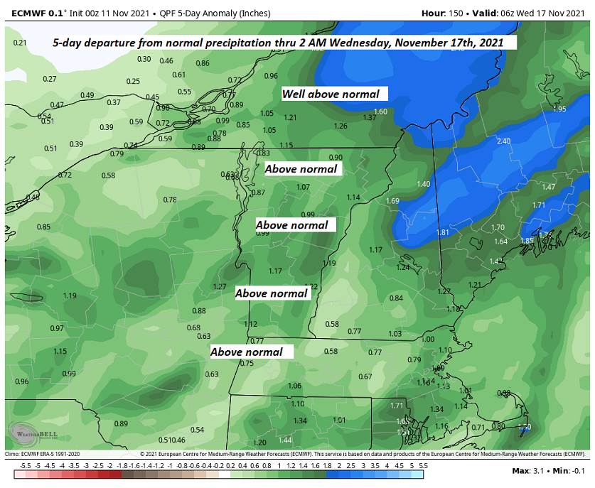
WEDNESDAY NIGHT: Overcast. Scattered light rain showers, north of the Barre-Montpelier area with brief spotty mixed precipitation at onset. A low 35 to 40. South winds 10 to 15 mph.
THURSDAY: Pick of the week. More clouds than sun, but rather mild. Isolated sprinkles far northern areas blending to a period of frequent rain showers late. Milder. A high pushing toward 60. South breeze 10 to 15 mph.
Looking further ahead…
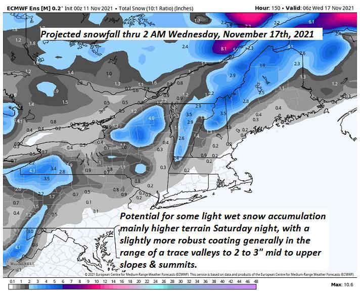
THURSDAY NIGHT: Overcast. Chance for rain mixing with higher elevation wet snow. A low in the mid-30s.
FRIDAY: Partly to mostly sunny, blustery and colder, with isolated wet snow showers and sprinkles. A high near 40.
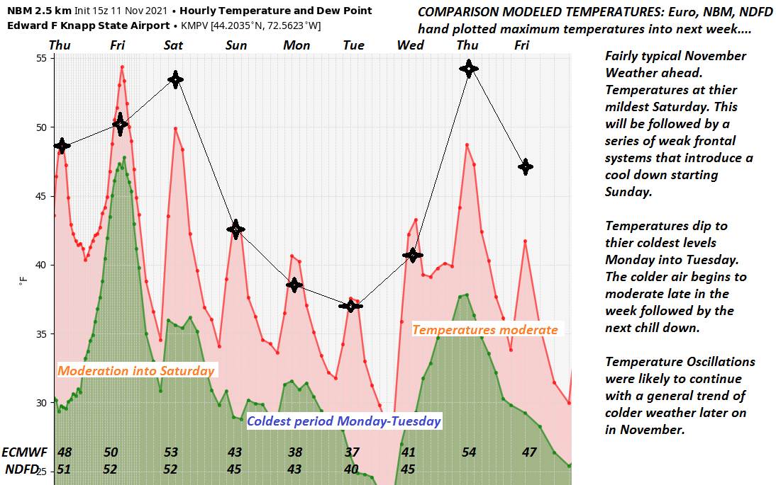
SATURDAY: Mostly sunny with a few high clouds late. A low in the mid-20s. A high mid to upper 30s.
SUNDAY: Filtered sunshine through high cloudiness. A low around 30. A high near 45.
Average lows 25 to 30. Average highs 40 to 45.
RH/11-16forecast][end]