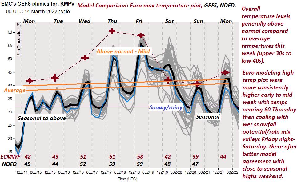
TODAY: A fair amount of sunshine northern and central areas, with lots clouds southern areas where scattered light showers were possible. Very mild. A high 60 to 65…and lots of snow melt, muddy back roads. South to southwest breeze 10 to 15 mph stronger toward Lake Champlain.
TONIGHT: Fair with high cloudiness. A low mid-30s northern areas to low 40s otherwise. Light southwest winds.
FRIDAY: Partly to mostly sunny. Continued rather pleasant and mild. A high mid-50s to near 60. Northwest winds around 10 mph.
Looking further ahead…
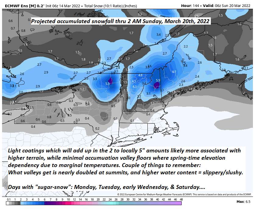
FRIDAY NIGHT: Thickening clouds. A rising chance for rain showers & spotty brief mixed precipitation east of the Green Mountains. A low in the mid-30s to lower 40s.
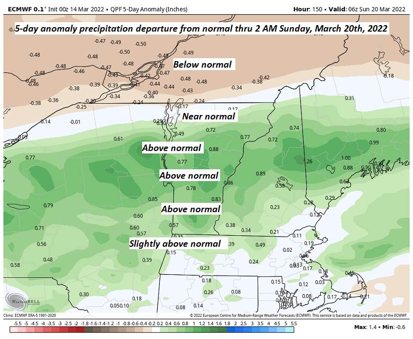
SATURDAY: Gray & rather wet. Chance for rain or rain showers…moderate at times. Areas of fog. A high in the lower 40s.
SUNDAY: Overcast. Periods of rain early giving way to scattered light rain showers. A low upper 30s to mid-40s. A high 50 to 55.
MONDAY: Morning sunshine then more afternoon clouds & blustery. Scattered rain or wet snow showers. A low upper 20s to low 30s. A high upper 30s to low 40s.
TUESDAY: More clouds than sun & blustery. Scattered flurries. A low in the 20s. A high mid to upper 30s.
Average lows ranging mid-teens thru low 20s. Average highs upper 30s to low 40s.
RH/3-17 forecast][end]