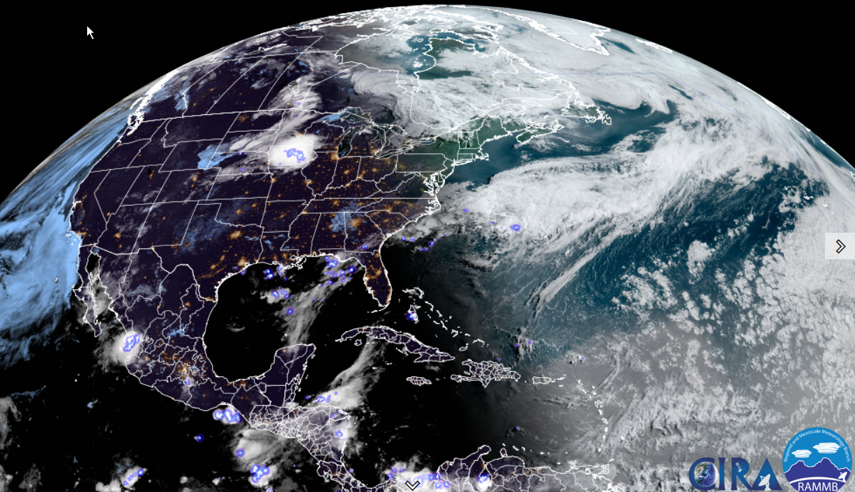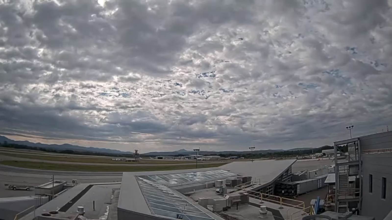
TONIGHT: Fair this evening. Cloudy periods overnight with a rising chance for a shower around daybreak. A low near 65. Light south winds…stronger near Lake Champlain.
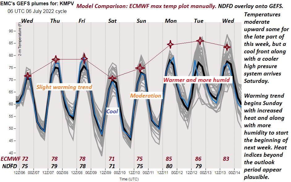
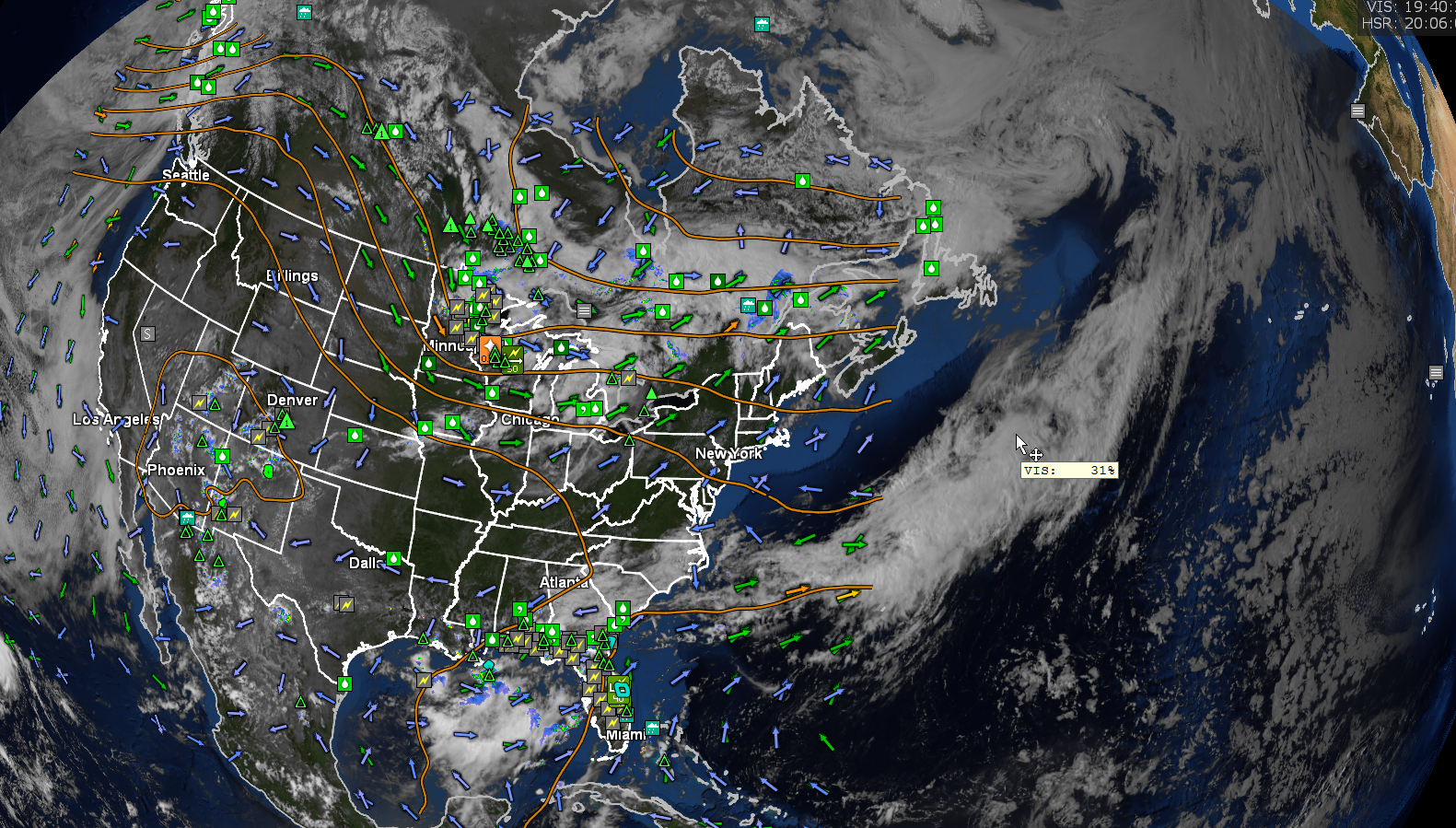
TOMORROW: Clouds with periods of hazy sunshine. Scattered showers and afternoon thunderstorms. Some, possibly strong to locally severe heavy downpours. Muggy. A high 80 to 85. Southwest breeze 10 to 20 mph.
TUESDAY NIGHT: A leftover evening shower or thunderstorm, otherwise partially moonlit. Patchy valley fog. A low in the lower 60s. Light west winds.
Full Buck Moon 2:37 PM Wednesday
WEDNESDAY: Partly to mostly sunny & less humid. A high around 80. Light northwest winds.
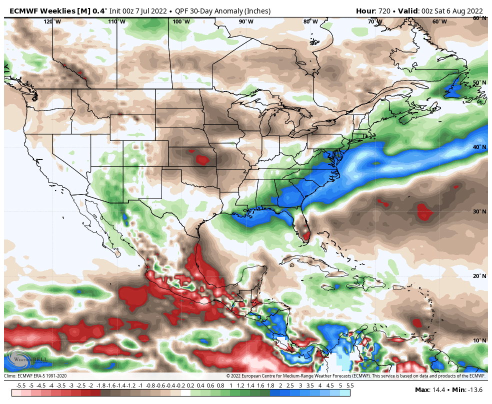
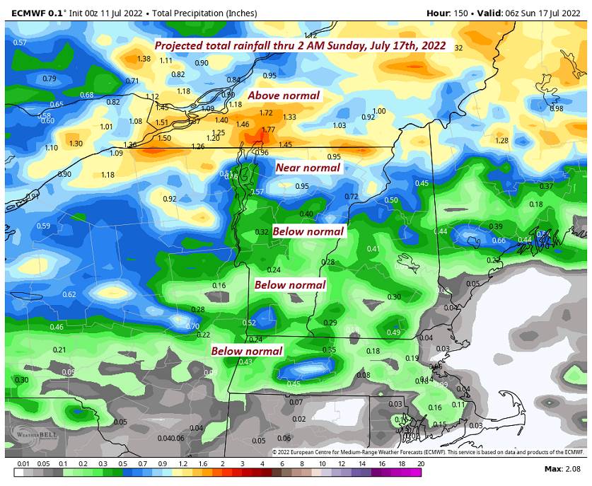
Looking further ahead…
WEDNESDAY NIGHT: Mostly clear and moonlit. Isolated valley fog. A low around 55.
THURSDAY: More sun than clouds. Moderately humid. Widely scattered showers and thunderstorms. A high mid to upper 70s.
FRIDAY: Partly to mostly sunny. Moderately humid. A low in the mid-50s. A high in the mid-70s.
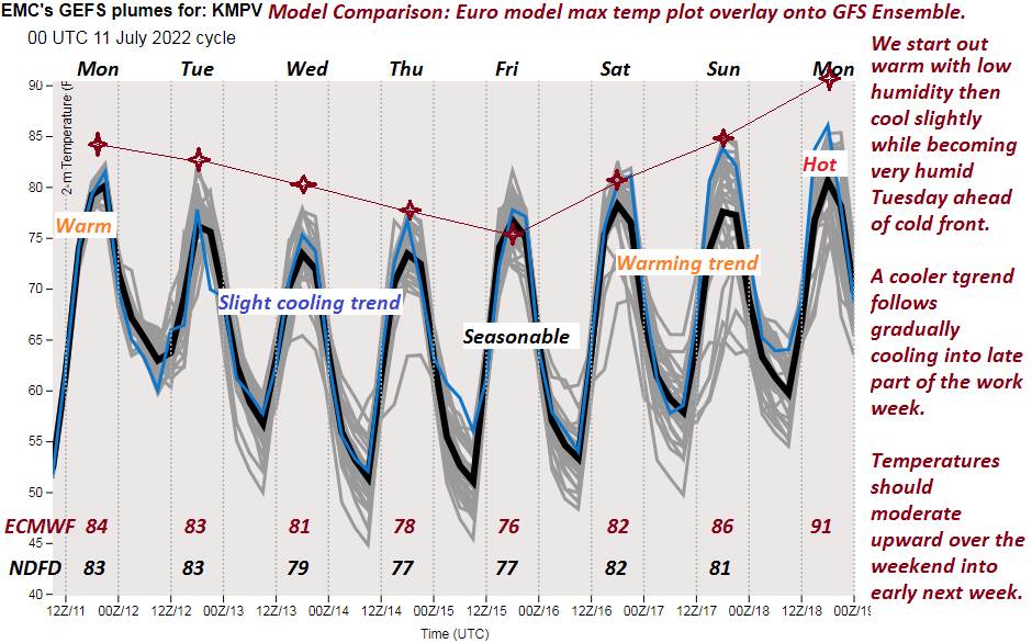
SATURDAY: Mostly sunny and gorgeous. A low near 55. A high 80 to 85.
Average lows mid-50s to low 60s. Average highs upper-70s to low 80s
RH/7-11[forecast][end]