Updated Wednesday Evening Forecast — November 9th, 2022

TONIGHT: Clear and moonlit. A low in the low to mid 30s. Light south winds, stronger near Lake Champlain.

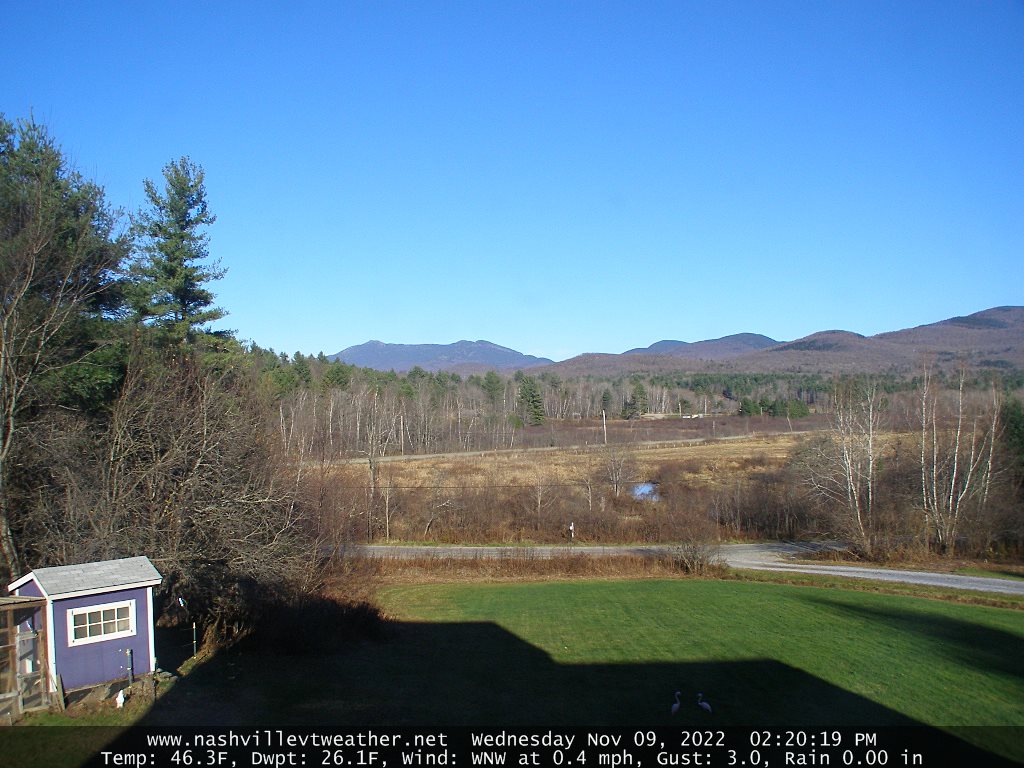
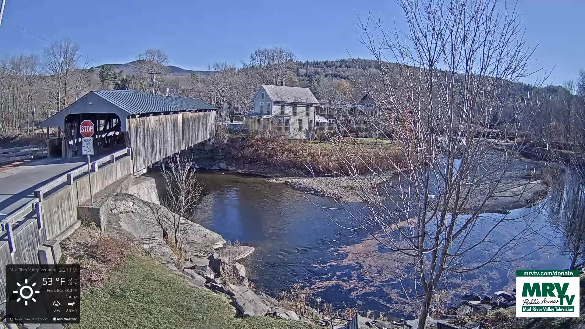
TOMORROW: Sunshine with few more clouds across northern areas. A high in the low 60s. Light southwest winds. stronger Lake Champlain.

THURSDAY NIGHT: Mostly clear, then increasing high cloudiness. A low mid-40s. Light southwest winds.

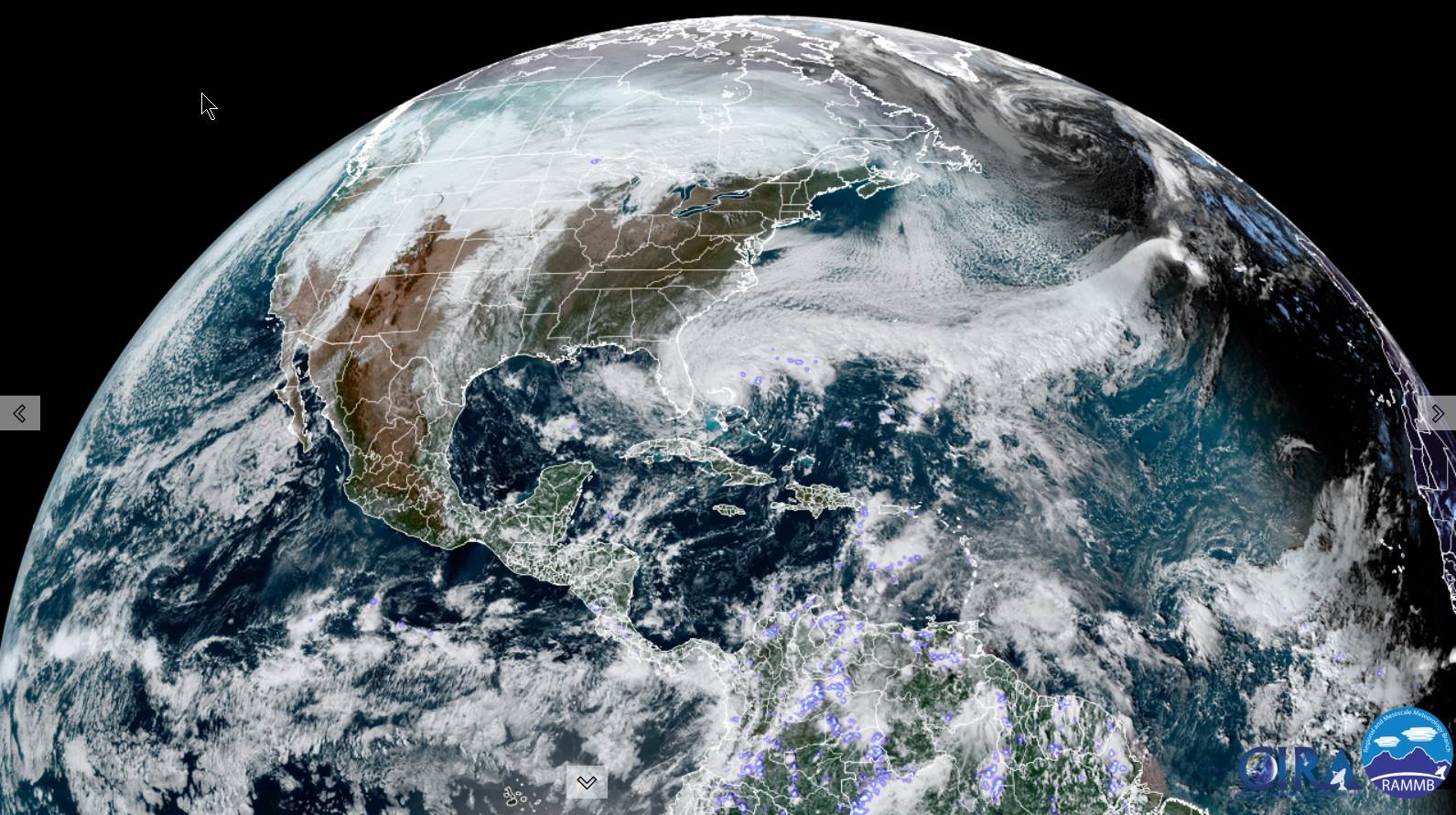
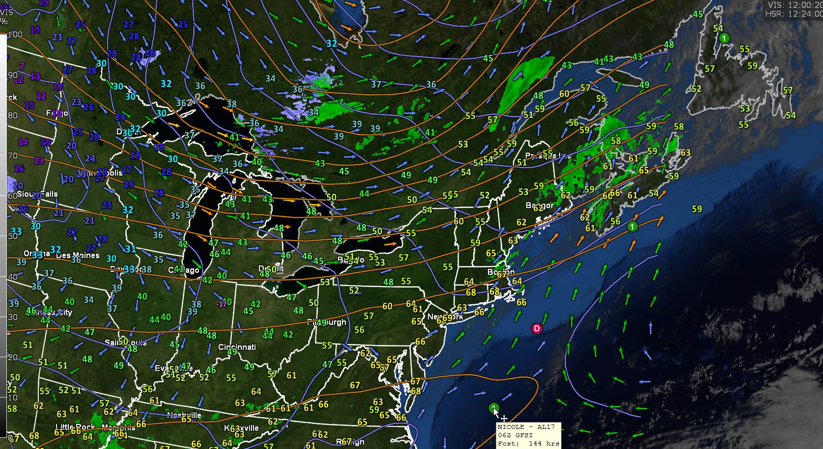
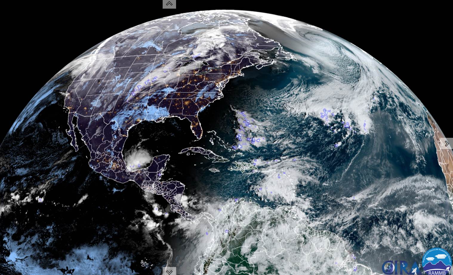
FRIDAY: Increasing clouds. Rising chance for rain arriving late from the south. A high 60 to 65. South breeze 10 mph.

Looking Further Ahead…

FRIDAY NIGHT: Overcast and breezy to windy. Chance for rain, moderate to heavy at times in the evening tapering to isolated sprinkles overnight, before another round of moderate to locally heavy showers before daybreak. An early low upper 40s…milder overnight.

SATURDAY: An early round of showers exits to intervals of sun, chance for a leftover brief shower. An early high around 60, cooler in the afternoon.

SUNDAY: Partly to mostly cloudy & blustery. Scattered rain and wet snow showers with trace accumulations higher terrain. A low around 35. A high 40 to 45.

MONDAY: Mixed clouds and sun. A low around 25. A high mid to upper 30s.

Average lows mid-20s to low 30s. Average highs 45 to 50.

RH/11-9forecast][end]

Updated Wednesday Morning Forecast — November 9th, 2022

TODAY: Sunny. A high about 50. Little wind.

TONIGHT: Clear and moonlit. A low 32 to 35. Light south winds, stronger near Lake Champlain.

THURSDAY: Sunshine with few more clouds across northern areas. A high 60 to 65. Light south to southwest winds stronger Lake Champlain.

Looking Further Ahead…

THURSDAY NIGHT: Mostly clear, then increasing high cloudiness. A low 40 to 45.

FRIDAY: Increasing clouds. Rising chance for rain arriving late from the south. A high near 65.

SATURDAY: Variable clouds. An early round of showers, moderate at times. Scattered light showers/sprinkles in the afternoon. A low upper 40s near 50. An early high around 60, cooler in the afternoon.

SUNDAY: Partly to mostly cloudy & blustery. Scattered rain and wet snow showers with trace accumulations higher terrain. A low around 35. A high 40 to 45.

MONDAY: Mixed clouds and sun. A low around 25. A high mid to upper 30s.

Average lows mid-20s to low 30s. Average highs 45 to 50.

RH/11-9forecast][end]

Updated Tuesday Night Forecast — November 8th, 2022

TONIGHT: Clear and fully moonlit. A low in the low to mid 20s. Light north winds.

TOMORROW: Sunny. A high near 50. Little wind.

WEDNESDAY NIGHT: Clear and moonlit. A low near 32. Light south winds, stronger near Lake Champlain.

THURSDAY: Sunny, a few high clouds late. A high in the lower 60s. South to southwest winds 10 to 15 mph.

Looking Further Ahead…

THURSDAY NIGHT: Mostly clear, then increasing high cloudiness. A low around 40.

FRIDAY: Thickening clouds. Rising chance for rain arriving late from the south. A high in the mid-60s.

SATURDAY: Gray. Chance for rain early, then widely scattered sprinkles. A low mid to upper 40s.

A high 55 to 60.

SUNDAY: Mostly cloudy. Scattered rain and wet snow showers in the hills with trace accumulations Sunday night. A low around 35. A high around 55.

Average lows mid-20s to low 30s. Average highs 45 to 50.

RH/11-8forecast][end] T

Updated Tuesday Morning Election Day Forecast — November 8th, 2022

TODAY: Some northern mountain clouds this morning, otherwise sunny, rather chilly and blustery A high 40 to 45. Northwest winds 10 to 20 mph.

TONIGHT: Clear and fully moonlit. A low in the low to mid 20s. Light north winds.

WEDNESDAY: Sunny. A high around 50. Little wind.

Looking Further Ahead…

WEDNESDAY NIGHT: Clear and moonlit. A low near 32.

THURSDAY: Mostly sunny. A high in the lower 60s.

FRIDAY: Thickening clouds. Rising chance for periods of rain arriving in the afternoon…moderate at times. A low around 40. A high in the mid-60s.

SATURDAY: Gray. Periods of rain or showers early tapering to widely scattered sprinkles. A low mid to upper 40s. A high 55 to 60.

SUNDAY: Sunshine mixed with clouds. Widely scattered rain and wet snow showers. A low around 35. A high around 55.

Average lows mid-20s to low 30s. Average highs 45 to 50.

RH/11-8forecast][end]

Updated Monday Evening Forecast — November 7th, 2022

TONIGHT: Mostly clear fully moonlit with few clouds northern mountains. A low about 32 to 35. Northwest breeze 10 to 15 mph.

Full Beaver Moon 6:02 AM EST

TOMORROW: Mostly sunny. Blustery at times. Near seasonal temperatures. A high upper 40s to about 50. Northwest winds 10 to 20 mph.

TUESDAY NIGHT: Clear and fully moonlit. A low about 25. Light north winds.

WEDNESDAY: Mostly sunny. A high in the low 50s. Little wind.

Looking Further Ahead…

WEDNESDAY NIGHT: Clear and moonlit. A low around 35.

THURSDAY: A few clouds far north, otherwise bright sunshine. A high around 60.

FRIDAY: Partly sunny. A low in the lower to mid-40s. A high 60 to 65.

SATURDAY: Gray. Periods of rain or showers, moderate at times in the morning tapering to widely scattered sprinkles. A low in the mid to upper 40s. A high around 55.

SUNDAY: Sunshine mixed with clouds. Widely scattered sprinkles mixed with wet snowflakes. A low in the 30s. A high in the 40s.

Average lows mid-20s to low 30s. Average highs 45 to 50.

RH/11-7forecast][end]

Updated Monday Morning Forecast — November 7th, 2022

TODAY: Sunshine this morning with a few more clouds late northern areas. Blustery at times. A high around 65. Gusty west to northwest winds 10 to 25 mph picking up this afternoon.

TONIGHT: Partially moonlit skies. A low in the mid-30s. Northwest breeze 10 to 15 mph.

Full Beaver Moon 6:02 AM EST

TUESDAY: Mostly sunny. Blustery at times. Near seasonal temperatures. A high mid-40s to near 50. Northwest winds 10 to 15 mph.

Looking Further Ahead…

TUESDAY NIGHT: Clear and moonlit. A low ranging mid to upper 20s.

WEDNESDAY: Mostly sunny. A high 50 to 55.

THURSDAY: A few clouds far north, otherwise bright sunshine. A low in the mid to upper 30s. A high 60 to 65.

FRIDAY: Partly sunny. A low in the lower to mid-40s. A high in the mid-60s.

Average lows mid-20s to low 30s. Average highs 45 to 50.

RH/11-7forecast][end]

Updated Friday Evening Forecast — November 4th, 2022

TONIGHT: Mostly clear & partially moonlit clouding up late. A low 50 to 55. Light south to southwest winds stronger near Lake Champlain.

TOMORROW: Clouds with breaks of sun. An isolated sprinkle or two toward Rutland. Rather mild & a little more humid. A near record high in the low 70s. Southwest breeze 10 to 15 mph, stronger Lake Champlain.

Time change – fall back 1 hour to standard time

SATURDAY NIGHT: Mostly cloudy and a balmy early November night. A low upper 50s to around 60. Southerly breeze 10 to 15 mph, stronger at the lake.

SUNDAY: Mainly gray. Scattered light rain showers or sprinkles Barre-Montpelier north and west. A near record high again in the low 70s. Southwest winds 10 to 15 mph.

Looking Further Ahead…

SUNDAY NIGHT: Mostly cloudy. A few leftover showers giving way to partial clearing. A low in the low to mid 50s.

MONDAY: Morning clouds then partly to mostly sunny. A bit blustery. A high 65 to 70.

Full Beaver Moon 6:02 AM EST

TUESDAY: Lots of sunshine with a few mountain clouds. Blustery. A low around 35. A high 50 to 55.

WEDNESDAY: Mostly sunny. A low 25 to 30. A high in the upper 40s.

Average lows upper 20s to low 30s. Average highs mid-40s to low 50s.

RH/11-4forecast][end]

Updated Friday Morning Forecast — November 4th, 2022

TODAY: Sunshine becoming filtered by high clouds. A high 65 to 70. South to southwest breeze 10 mph, stronger Lake Champlain.

TONIGHT: Mostly fair, then clouding up overnight. A low 50 to 55. South to southwest winds 10 mph.

SATURDAY: Clouds with breaks of sun. Rather mild & a little more humid. A near record high in the low 70s. Light southwest breeze, stronger Lake Champlain.

Looking Further Ahead…

Time change – fall back 1 hour to standard time

SATURDAY NIGHT: Mostly cloudy. A low mid to upper 50s.

SUNDAY: Gray. A rising chance for light rain showers or sprinkles especially northwestern areas. A near record high 70 to 75.

MONDAY: Morning clouds then partly to mostly sunny. A bit blustery. A low 50 to 55. A high 65 to 70.

TUESDAY: Lots of sunshine with a few mountain clouds. Blustery. A low around 35. A high 50 to 55.

WEDNESDAY: Mostly sunny. A low 25 to 30. A high in the upper 40s.

Average lows upper 20s to low 30s. Average highs mid-40s to low 50s.

RH/11-4forecast][end]

Updated Thursday Evening Forecast — November 3rd, 2022

TONIGHT: Mostly clear with high clouds. Isolated valley fog. A low in the mid 40s. Light southwest breeze, stronger Lake Champlain.

TOMORROW: Sunshine filtered by high clouds. A high around 65. South to southwest breeze 10 mph, stronger Lake Champlain.

FRIDAY NIGHT: Fair early with increasing clouds overnight. A low around 50. South to southwest winds 10 mph.

SATURDAY: Clouds with breaks of sun. Rather mild & a little more humid. A high around 70. Light southwest breeze, stronger Lake Champlain.

Looking Further Ahead…

Time change – fall back 1 hour to standard time

SATURDAY NIGHT: Mostly cloudy. A low mid to upper 50s.

SUNDAY: Gray. A rising chance for rain showers especially northern western areas. A high in the lower 70s.

MONDAY: Morning clouds then partly to mostly sunny. A bit blustery. A low 50 to 55. A high 65 to 70.

TUESDAY: Lots of sunshine with a few mountain clouds. Blustery. A low in the mid-30s. A high 50 to 55.

WEDNESDAY: Mostly sunny. A low upper 20s to low 30s. A high low to mid 50s.

Average lows upper 20s to low 30s. Average highs mid-40s to low 50s.

RH/11-3forecast][end]

Updated Thursday Morning Weather — November 3rd, 2022

TODAY: Pick of the week. Sunny. A few high clouds late. A high 60 to 65. Light southwest breeze.

TONIGHT: Mostly clear with high clouds. Isolated valley fog. A low 40 to 45. Light southwest breeze, stronger Lake Champlain.

FRIDAY: Sunshine filtered by high clouds. A high around 65. South to southwest breeze 10 mph, stronger Lake Champlain.

Looking Further Ahead…

FRIDAY NIGHT: Fair early with increasing clouds overnight. A low around 50.

SATURDAY: Partly to mostly cloudy. Rather mild & as little more humid. A high around 70.

SUNDAY: Gray. A rising chance for rain showers especially northern western areas. A low mid to upper 50s. A high in the lower 70s.

MONDAY: Morning clouds then partly to mostly sunny. A bit blustery. A low 50 to 55. A high 65 to 70.

TUESDAY: Lots of sunshine with a few mountain clouds. Blustery. A low in the mid-30s. A high 50 to 55.

WEDNESDAY: Mostly sunny. A low upper 20s to low 30s. A high low to mid 50s.

Average lows upper 20s to low 30s. Average highs mid-40s to low 50s.

RH/11-3forecast][end]