Updated Tuesday Evening Forecast — December 13th, 2022

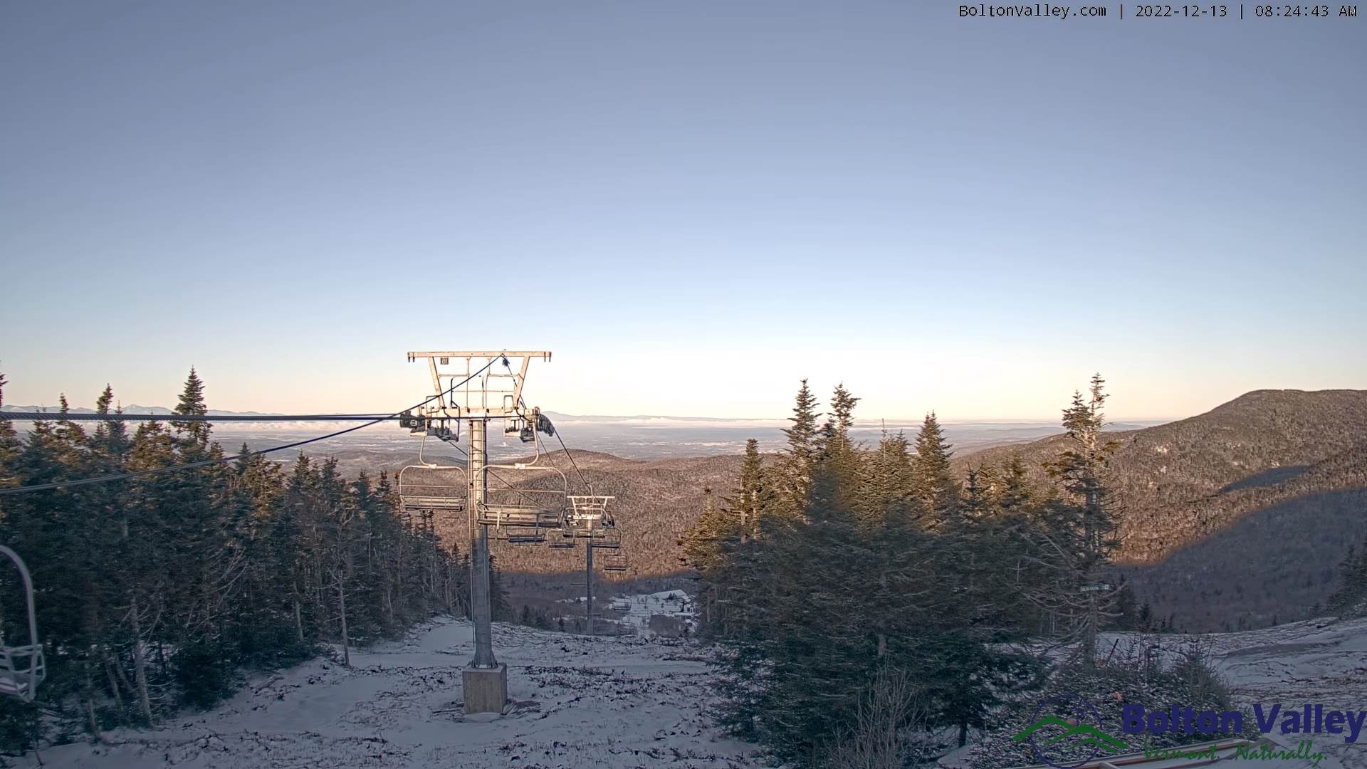
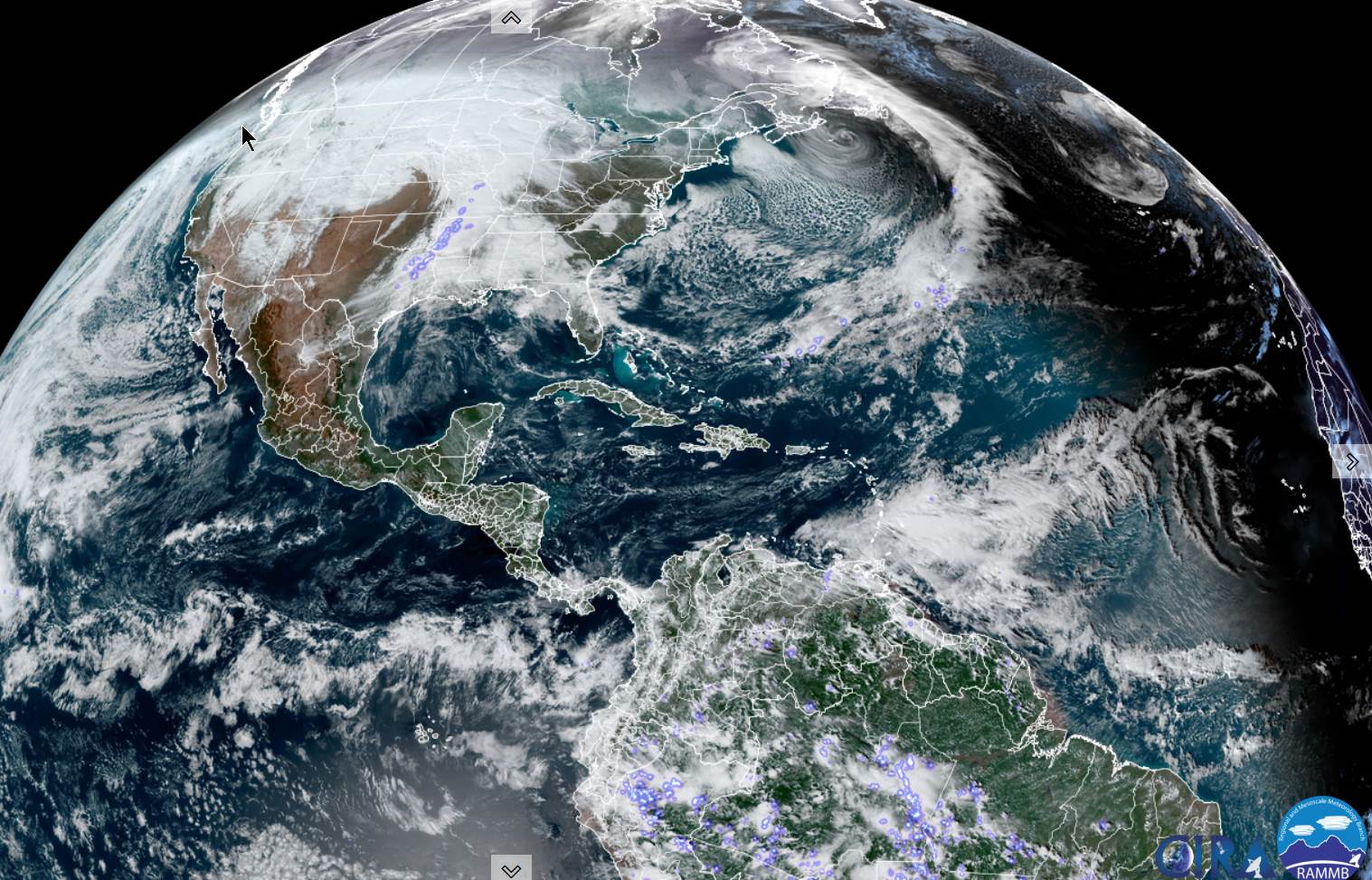
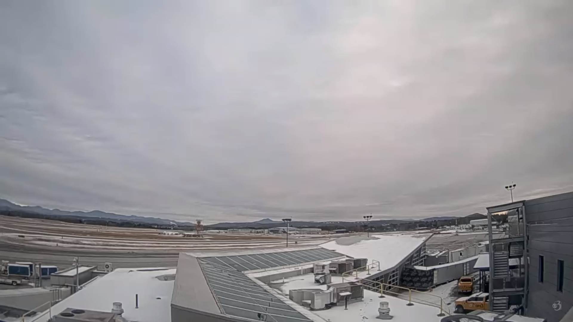
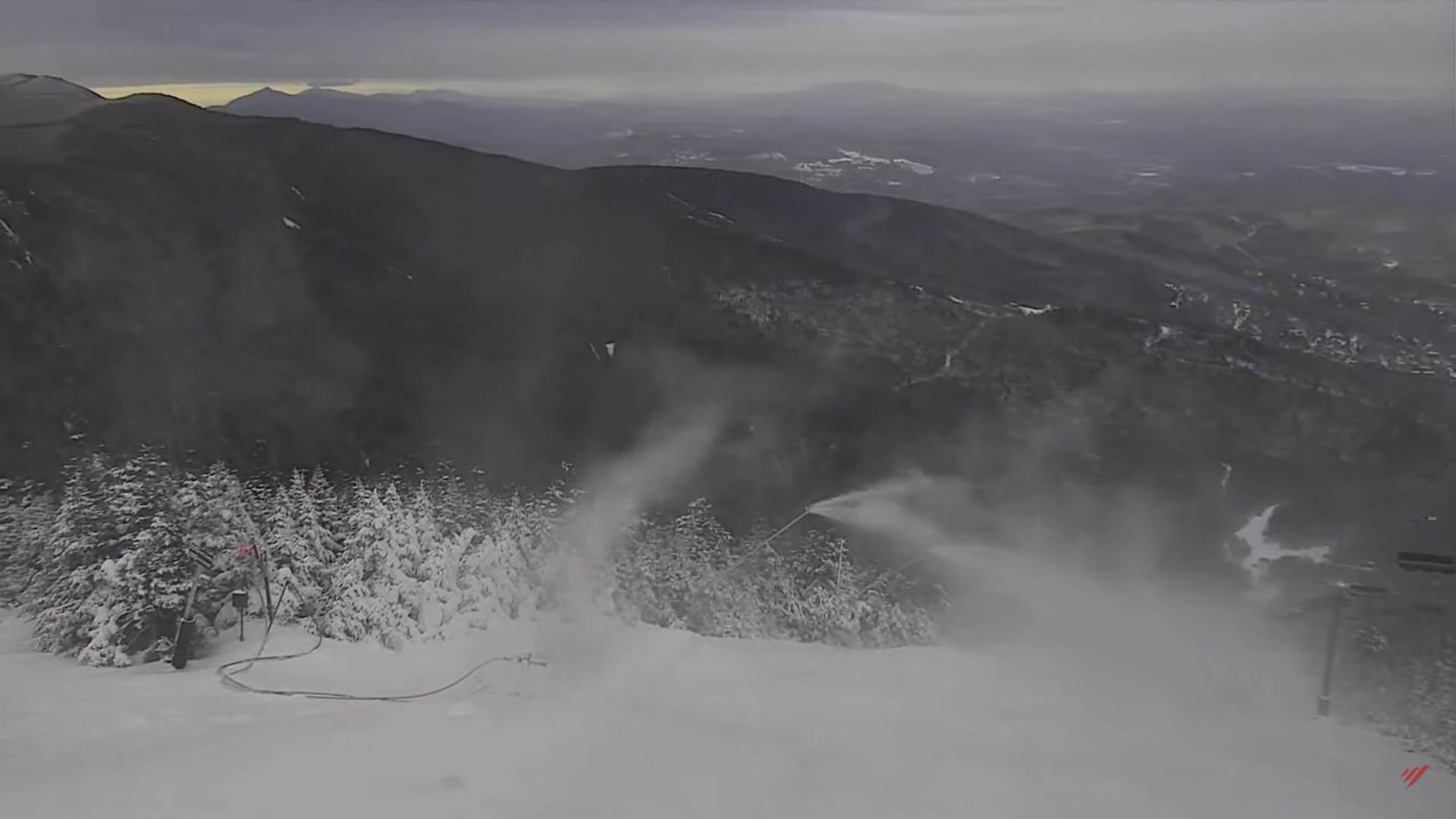
TONIGHT: Lots of clouds and a bit blustery. Occasional light accumulating snow showers or flurries. Less than an inch. A low in the mid-teens. Northwest winds 10 to 20 mph and gusty.

TOMORROW: More clouds than sun with stray flurry. A bit blustery. A high in the upper 20s. Northwest 10 to 15 mph.

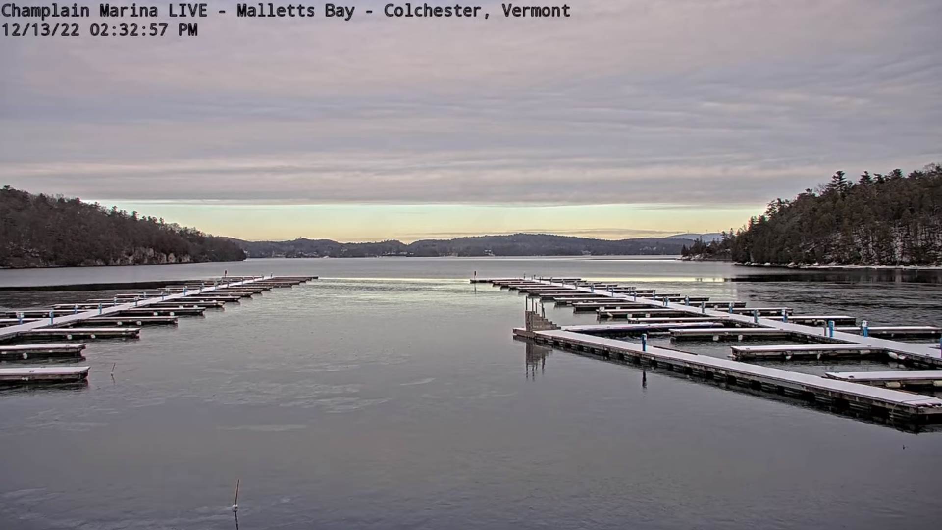
WEDNESDAY NIGHT: Scattered clouds. A low 20 to 25. Light north winds.

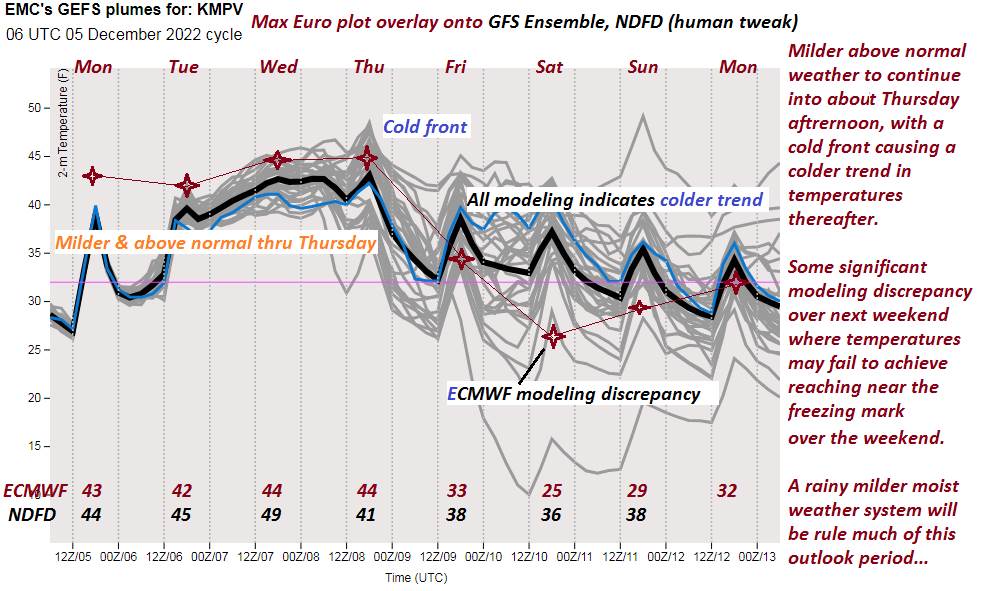
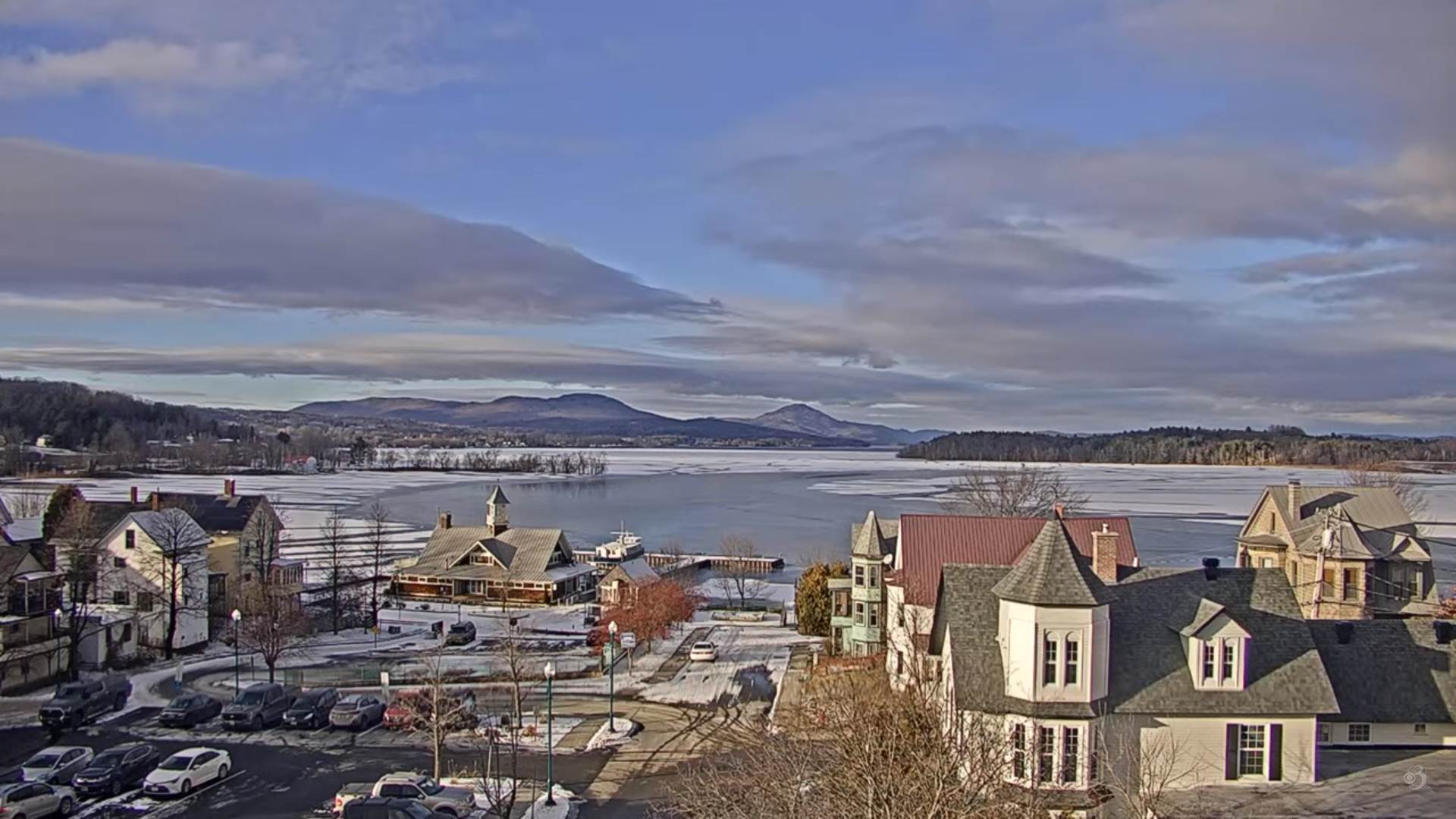
THURSDAY: Clouds with a few breaks of sun. Milder. A high in the lower 40s. Winds easterly 10 to 15 mph.

Looking Further Ahead…

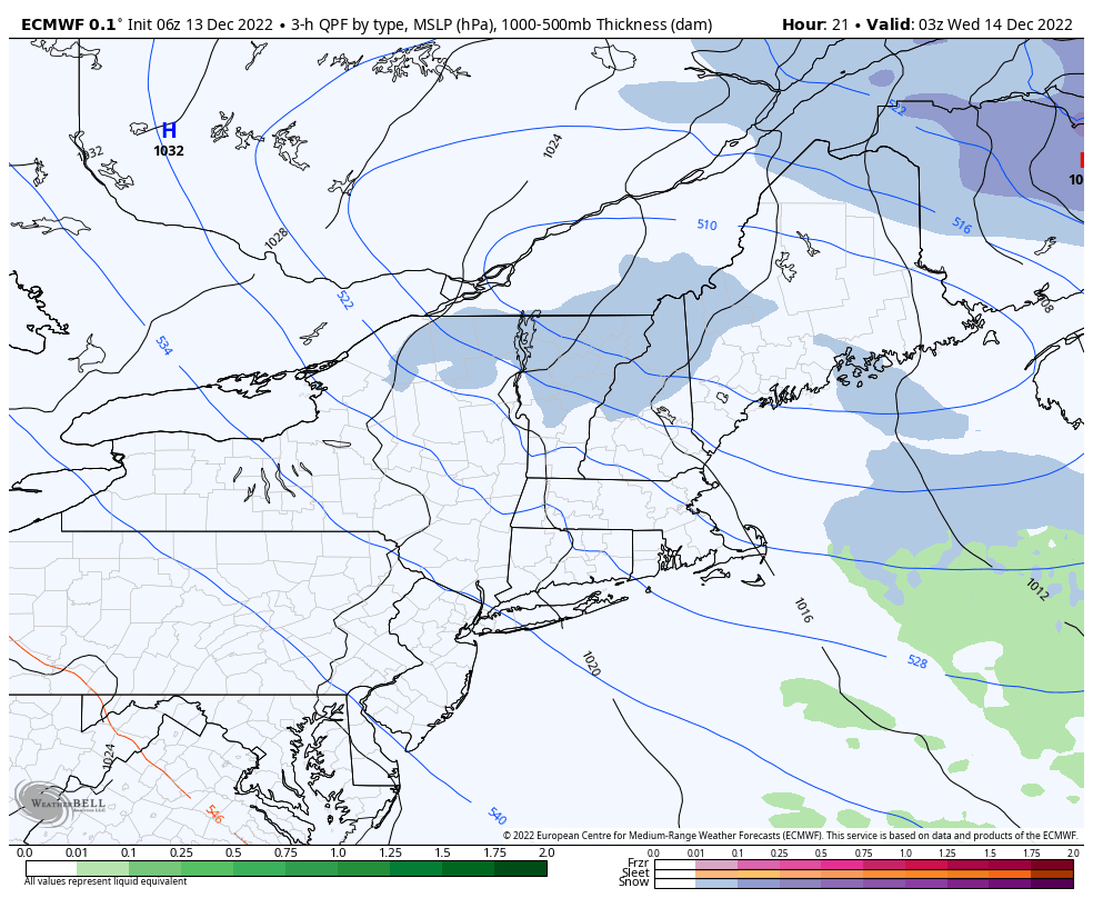
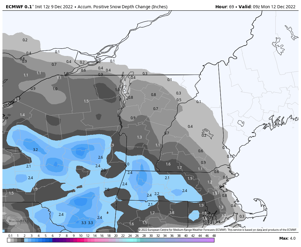
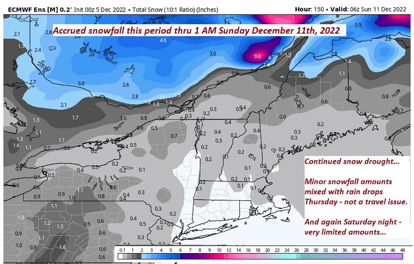
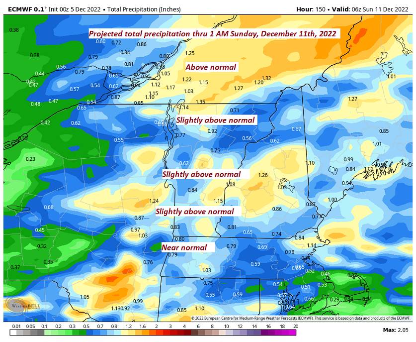
THURSDAY NIGHT: Overcast. A good chance for accumulating snow southern and western areas overnight with light coating in spots. A low in the upper 20s.

FRIDAY: Overcast. Good chance for accumulating wet snow, possibly mixed with rain valley floors. A few inches northern areas greater than 6 inches southern Green Mountains. Blustery to windy. A high in the mid-30s

SATURDAY: Mainly cloudy. Chance for leftover accumulating snow showers with some additional accumulation. A low near 30. A high 32 to 35.

SUNDAY: Clouds mixed with intervals of sunshine. Occasional light snow showers or flurries with minor additional accumulation. A low around 25. A high in the low 30s.

Average lows low to mid-teens. Average highs upper 20s to mid-30s

Climatological winter in progress…peaks coldest approx. January 22nd ends March 9th…

RH/12-12forecast][end]

Updated Tuesday Morning Forecast — December 13th, 2022

TODAY: Periods morning sunshine gives way to clouds northern areas with a few flurries developing later on. A bit blustery. A high in the mid-20s. Northwest winds 10 to 15 mph.

TONIGHT: Mostly cloudy. Blustery. Occasional light accumulating snow showers or flurries. A light coating of a dusting to an inch. A low in the mid-teens. Northwest 10 to 20 mph.

WEDNESDAY: Mostly cloudy & continued blustery. A high in the upper 20s. Northwest winds 10 to 20 mph.

Looking Further Ahead…

WEDNESDAY NIGHT: Clearing skies. A low 20 to 25.

THURSDAY: Clouds mixed with intervals of sun. Milder. A high in the lower 40s.

FRIDAY: Overcast. Chance for accumulating wet snow, possibly mixed with rain valley floors. A few to several inches accumulation especially with the most southern Greens. Blustery to windy. A low in the upper 20s. A high in the mid-30s

SATURDAY: Mainly cloudy. Chance for leftover accumulating snow showers with some additional accumulation. A low near 30. A high 32 to 35.

SUNDAY: Clouds mixed with intervals of sunshine. Occasional light snow showers or flurries with minor additional accumulation. A low around 25. A high in the low 30s.

Average lows low to mid-teens. Average highs upper 20s to mid-30s

Climatological winter in progress…peaks (coldest approx. January 22nd ends March 9th…

RH/12-12forecast][end]

Updated Monday Evening Forecast — December 12th, 2022

TONIGHT: Clear with partially moonlit skies, becoming mostly cloudy later overnight. A low 10 to 15. Light northwest winds.

TOMORROW: Mostly cloudy northern areas, partly sunny southern areas. A bit blustery at times. A high around 25. Northwest winds 10 to 15 mph.

TUESDAY NIGHT: Mostly cloudy. Blustery. Occasional snow showers or flurries developing, with a dusting to less than an inch. A low in the mid-teens. Northwest 10 to 20 mph.

WEDNESDAY: Mostly cloudy & continued blustery. A high 25 to 30. Northwest 10 to 20 mph.

Looking Further Ahead…

WEDNESDAY NIGHT: Clearing skies. A low around 20.

THURSDAY: Variable mainly high cloudiness. A high in the low 40s.

FRIDAY: Overcast. Chance for accumulating wet snow, possibly mixed with rain valley floors. A few to several inches accumulation especially in the mountains. Blustery or windy. A low mid-20s to near 30. A high near 35.

SATURDAY: Mainly cloudy. Chance for accumulating snow or snow showers with additional accumulation. A low near 30. A high about 32.

Average lows low to mid-teens. Average highs upper 20s to mid-30s

Start of Climatological Winter December 12th (today)…peaks (coldest January 22nd) ends March 9th…

RH/12-12forecast][end]

Updated Monday Morning Forecast — December 12th, 2022

TODAY: Some morning clouds, then clearing to bright sunshine. Seasonable in temperature. A high upper 20s to around 30. North winds 10 mph.

TONIGHT: Clear partially moonlit, with more clouds overnight. A low mid to upper teens. Light northwest winds.

TUESDAY: Mostly cloudy northern areas partly sunny southern areas. A bit blustery at times. A high mid to upper 20s. Northwest winds 10 to 15 mph.

Looking Further Ahead…

TUESDAY NIGHT: Partly to mostly cloudy. Scattered snow showers or flurries with minor accumulation. Blustery northwest winds. A low in the mid to upper teens.

WEDNESDAY: Mostly cloudy. Blustery northwest winds. A high in the upper 20s.

THURSDAY: Variable mainly high cloudiness. A low in the low 20s. A high pushing to near 40.

FRIDAY: Overcast. Chance for accumulating wet snow, possibly mixed with rain valley floors. A few to several inches accumulation especially in the mountains. Blustery or windy. A low mid-20s. A high 32 to 35.

SATURDAY: Mainly cloudy. Chance for accumulating snow or snow showers. A low near 30. A high about 32.

Average lows low to mid-teens. Average highs upper 20s to mid-30s

Start of Climatological Winter December 12th (today)…peaks (coldest January 22nd) ends March 9th…

RH/12-12forecast][end]

Updated Friday Evening Forecast — December 9th, 2022

TONIGHT: Clear & moonlit. A low mid to upper teens. Light north to northeast winds, stronger toward Lake Champlain.

TOMORROW: Mostly sunny. More clouds eastern and southern Vermont late. A high 32 to 35. Light northeast winds.

SATURDAY NIGHT: Mostly clear skies giving way to Increasing clouds later on. A low in the upper teens to low 20s. Light east to southeast winds.

SUNDAY: Considerable cloudiness. A high 32 to 35. Southeast winds 10 mph.

Looking Further Ahead…

SUNDAY NIGHT: Overcast. A rising chance for light accumulating snow. A dusting Northeast kingdom with up to 2” southern Green Mountains. A low upper teens to mid-20s.

MONDAY: Some early cloudiness, then becoming mostly sunny. High around 32.

TUESDAY: Partly to mostly sunny. A low mid to upper teens. A high in the upper 20s

WEDNESDAY: Mostly sunny. A low mid to upper teens. A high 32 to 35.

Average lows mid-teens to low-20s. Average highs low to mid 30s

Start of Climatological Winter December 12th…peaks (coldest January 22nd) ends March 9th…

RH/12-9forecast][end]

Updated Friday Morning Weather — December 9th, 2022

TODAY: Sunny and gorgeous, with near seasonal temperatures. A high about 35. Light north winds a little stronger toward Lake Champlain.

TONIGHT: Clear & moonlit. A low 15 to 20. Light north to northeast winds, stronger toward Lake Champlain.

SATURDAY: Mostly sunny. More clouds eastern and southern Vermont late. A high 30 to 35. Light northeast winds.

Looking Further Ahead…

SATURDAY NIGHT: Mostly clear skies giving way to Increasing clouds later on. A low in the upper teens.

SUNDAY: Considerable cloudiness. A high 32 to 35.

SUNDAY NIGHT: Overcast. A rising chance for light accumulating snow. A dusting Northeast kingdom with up to 2” southern Green Mountains.

MONDAY: Some early cloudiness, then becoming mostly sunny. A low near 25. High 32 to 35.

TUESDAY: Partly to mostly sunny. A low mid to upper teens. A high around 30.

WEDNESDAY: Mostly sunny. A low mid to upper teens. A high upper 20s to low 30s.

Average lows mid-teens to low-20s. Average highs low to mid 30s

Start of Climatological Winter December 12th…peaks (coldest January 22nd) ends March 9th…

RH/12-9forecast][end]

Updated Wednesday Evening Forecast — December 7th, 2022

TONIGHT: Cloudy with areas of fog. A leftover valley sprinkle/wet snowflake northern Green Mountains.A low about 35. Winds northwest 10 mph.

TOMORROW: Mostly cloudy with a northern mountain flurry, valley sprinkle. Afternoon sunshine predominates but cooler. A high 35 to near 40. Northwest winds pick up 10 to 15 mph.

THURSDAY NIGHT: Clear and partially moonlit. A low upper teens to low 20s. Light north to northwest winds.

FRIDAY: Sunny and gorgeous, with near seasonal temperatures. A high around 35. Light north winds.

Looking Further Ahead…

FRIDAY NIGHT: Clear early, then clouding up. A low 20 to 25.

SATURDAY: Clouds with an interval of sun now and then. A high upper 30s.

SUNDAY: Considerable cloudiness. A low around 25. A high upper 30s to around 40. Chance for flurries/spotty light snow with skiff of accumulation Sunday night.

MONDAY: Morning clouds with a flurry…gives way to partial Afternoon sun. A low around 20. Near seasonal temperatures return. A high in the low to mid 30s.

Average lows mid-teens to low-20s. Average highs low to mid 30s

Start of Climatological Winter December 12th…peaks (coldest January 22nd,) ends March 9th…

RH/12-7forecast][end]

Updated Wednesday Morning Forecast — December 7th, 2022

Full “Cold Moon” 11:08 AM

TODAY: Continued gray skies with periods of light rain or showers. Areas of fog. A high in the upper 40s to around 50. Southeast breeze 10 mph this morning becoming light and southerly.

TONIGHT: Mainly cloudy with areas of fog. A few leftover sprinkles mixed with wet snowflakes exiting.A low about 35. Winds northwest 10 mph.

THURSDAY: Early morning clouds with a brief mountain flurry valley sprinkle, gives way lots of sunshine but cooler. A high mid-30s to near 40. Northwest winds pick up 10 to 15 mph.

Looking Further Ahead…

THURSDAY NIGHT: Clear and partially moonlit. A low upper teens to low 20s.

FRIDAY: Sunny and gorgeous, with near seasonal temperatures. A high around 35.

SATURDAY: Clouds maybe an intervals of sun. A low 20 to 25. A high upper 30s.

SUNDAY: Considerable cloudiness. A low around 25. A high upper 30s to around 40.

MONDAY: Morning clouds give way to partial clearing. A low around 20. Near seasonal temperatures return. A high in the low to mid 30s.

Average lows mid-teens to low-20s. Average highs low to mid 30s

Start of Climatological Winter December 12th…peaks (coldest January 22nd,) ends March 9th…

RH/12-7forecast][end]

Updated Tuesday Evening Forecast — December 6th, 2022

TONIGHT: Overcast. Periods of rain or showers. Areas of fog. Rather mild but damp. Temperatures holding in the mid-40s. Southeast winds 10 to 15 mph.

Full “Cold Moon” 11:08 AM (hah)

TOMORROW: Continued gray skies with periods of rain or showers. Areas of fog. A high in the upper 40s to around 50. Southeast breeze 10 to 15 mph mainly in the morning.

WEDNESDAY NIGHT: Mainly cloudy with areas of fog. A few leftover sprinkles mixed with wet snowflakes exiting.A low in the mid-30s. Winds becoming northwest 10 to 15 mph.

THURSDAY: Any early sprinkles/mountain flurries dry up. Otherwise increasing afternoon sunshine. Temperatures in the mid to upper 30s. Northwest winds 10 to 15 mph.

Looking Further Ahead…

THURSDAY NIGHT: Clear and partially moonlit. A low upper teens to low 20s.

FRIDAY: Sunny. A high around 35.

SATURDAY: Clouds with a few intervals of sun possible. A low 20 to 25. A high in the mid to upper 30s.

SUNDAY: Becoming mostly cloudy. A low mid to upper 20s. A high back to the mid-40s.

Average lows mid-teens to low-20s. Average highs low to mid 30s

Start of Climatological Winter December 12th…peaks (coldest January 22nd,) ends March 9th…

RH/12-6forecast][end]

Updated Tuesday Morning Forecast — December 6th, 2022

TODAY: Gray. A Rising likelihood of showers or periods of rain developing this afternoon. Areas of fog late. A high near 45. Southeast breeze 10 to 15 mph, stronger near Lake Champlain.

TONIGHT: Overcast. Period of rain or showers. Areas of fog. Temperatures holding in the low to mid 40s. Southeast winds 10 to 15 mph.

Full Cold Moon 11:08 Wednesday morning

WEDNESDAY: Continued gray skies with periods of rain or showers likely. Areas of fog. A high in the upper 40s. Southeast breeze 10 to 15 mph mainly in the morning.

Looking Further Ahead…

WEDNESDAY NIGHT: Mainly cloudy with areas of fog. A few leftover sprinkles mixed with wet snowflakes overnight.A low mid to upper 30s.

THURSDAY: An isolated sprinkle or flurry. Otherwise clouds giving way to breaks of sun in the afternoon. A high 40 to 45.

FRIDAY: Sunny. A low upper teens to low 20s. A high around 35.

SATURDAY: Brief morning sun, then clouding up. A low 20 to 25. A high in the mid-30s.

Average lows mid-teens to low-20s. Average highs low to mid 30s

Start of Climatological Winter December 12th…peaks (coldest January 22nd,) ends March 9th…

RH/12-6forecast][end]