
A bit of lull has moved across portions of Vermont, but mixed precipitation resumes, with poor travel conditions especially east of the Green Mountains.

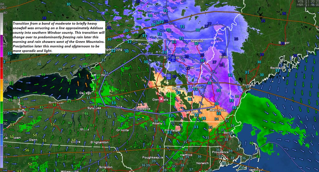
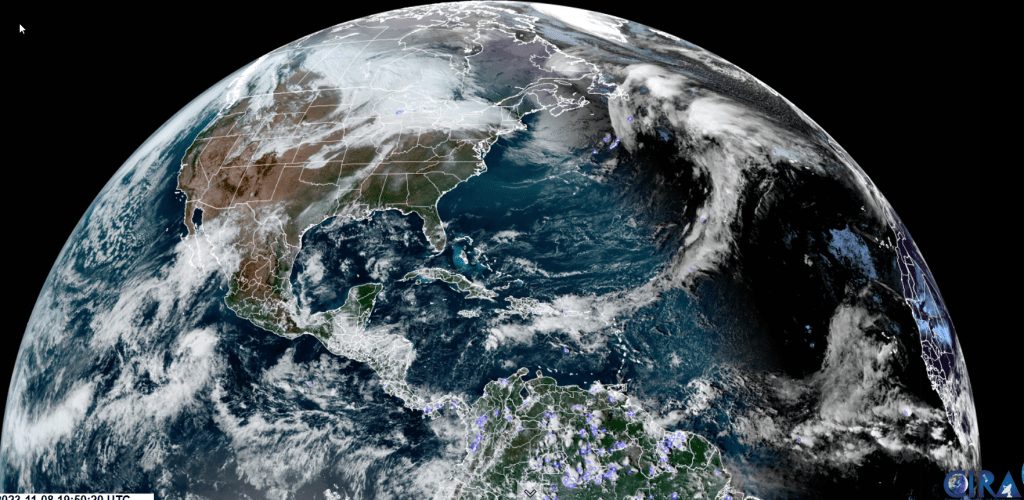
Winter Weather Advisory 11 PM thru 1 PM Thursday Afternoon…
TONIGHT: Thickening high clouds this evening leading to wet snow developing overnight with 1 to 2”transitioning to sleet and freezing rain with poor travel. A low around 25. Light north winds.
TOMORROW: Overcast. A wintry mix with slippery travel for the morning transitioning to scattered light rain showers in the afternoon. A high in the upper-30s. Southeast winds 10 to 15 mph.
THURSDAY NIGHT: Variable cloudiness with lingering light showers of mixed precipitation. A low around 32 degrees. Winds becoming southwest 10 mph.
FRIDAY: Clouds and occasional period of sun. Widely scattered sprinkles mixed with wet snowflakes higher terrain. A high in the low 40s. West winds 10 to 20 mph.
Looking further ahead
FRIDAY NIGHT: Mostly cloudy. Possible mountain flurries.A low in the upper 20s
SATURDAY: A few morning flurries little to no accumulation. Otherwise periods of afternoon sun. A high around 35.
SUNDAY: Mostly sunny. Chilly. A low near 25. A high around 35.
MONDAY: Variable mainly high cloudiness. A low 20 to 25. A high in the mid-30s.
Average lows mid-20s to low 30s. Average highs mid-40s to 50.
RH/11-7 forecast][end]
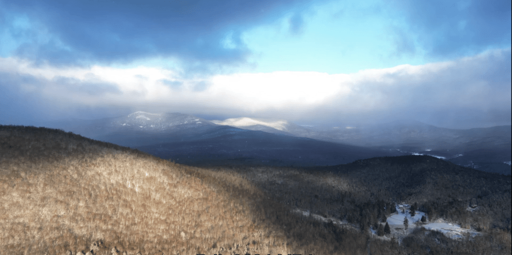
TODAY: Clouds with leftover mountain flurries mixing with some afternoon sunshine filtered through high clouds, & continued blustery. A high in the upper 30s. Northwest winds 10 to 15 mph.
Winter Weather Advisory 11 PM tonight thru 1 PM Thursday Afternoon…
TONIGHT: Thickening clouds. Wet snow develops after midnight with up to an inch of accumulation, changing and mixing with sleet and freezing rain. A low around 25. Light north winds.
THURSDAY: Overcast. A wintry mix with slippery travel is likely for the morning commute improving in the afternoon and transitioning to scattered light rain showers. A high in the upper 30s. Southeast breeze 10 mph.
Looking further ahead
THURSDAY NIGHT: Variable cloudiness.Isolated sprinkles.A low is around 32 degrees.
FRIDAY: Clouds and occasional period of sun. Widely scattered sprinkles mixed with wet snowflakes on higher terrain. A high in the low 40s.
SATURDAY: A few morning flurries little to no accumulation. Otherwise periods of afternoon sun. A low in the upper 20s. A high around 35.
SUNDAY: Lots of sunshine with a few high clouds. Chilly. A low near 25. A high around 35.
Average lows are mid-20s to low 30s. Average highs are mid-40s to 50.
RH/11-7 forecast][end]
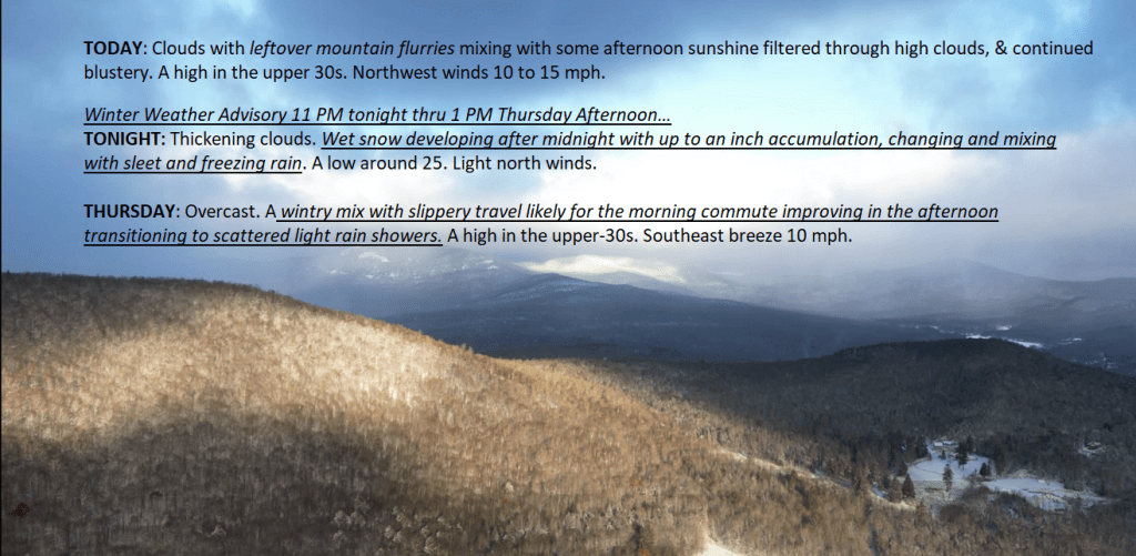

TONIGHT: Considerable clouds & blustery. A few leftover rain showers, changing to snow flurries in northern areas, before exiting. Watch for slick spots. Blustery. A low 25 to 30. Northwest winds 10 to 20 mph.
TOMORROW: Clouds mixing with some afternoon sunshine filtered through high clouds, & continued blustery. A high in the upper 30s. Northwest winds 10 to 15 mph.
WEDNESDAY NIGHT: High cloudiness thickening up. A wintry mix develops central and southern areas toward daybreak. A low around 25. Light north winds.
THURSDAY: Overcast. A wintry mix with minor accumulation & slick travel is likely for the morning commute. A high around 35. Southeast breeze 10 mph.
Looking further ahead
THURSDAY NIGHT: Variable cloudiness.Isolated sprinkles.A low in the mid-30s.
FRIDAY: Clouds and occasional period of sun. Widely scattered sprinkles mixed with wet snowflakes on higher terrain. A high 40 to 45.
SATURDAY: A few morning flurries little to no accumulation. Otherwise periods of afternoon sun. A low in the upper 20s. A high 35 to 40.
SUNDAY: Lots of sunshine with a few high clouds. Chilly. A low 20 to 25. A high mid to upper 30s.
Average lows are mid-20s to low 30s. Average highs are mid-40s to 50.
RH/11-7 forecast][end]

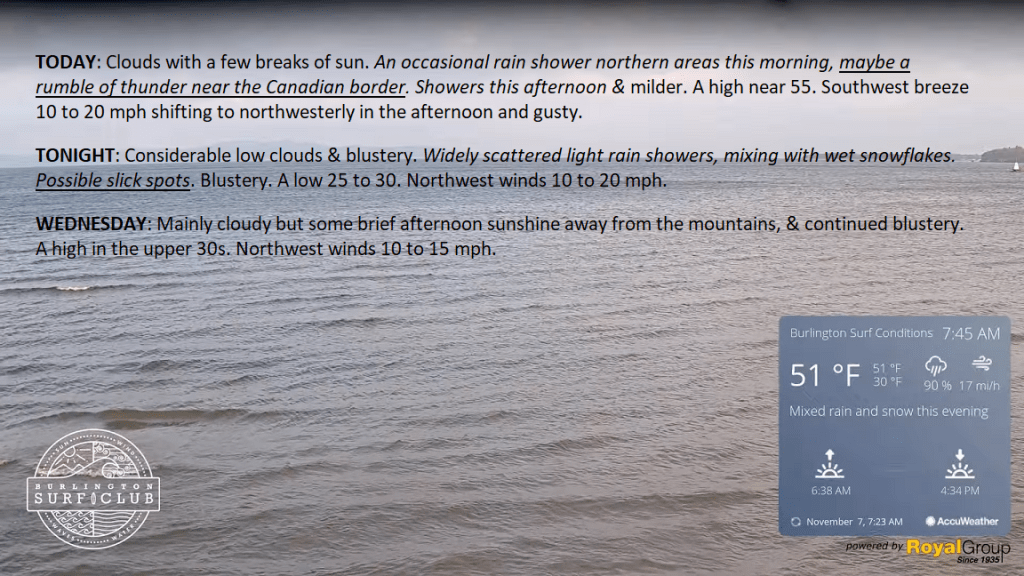
TODAY: Clouds with a few breaks of sun. An occasional rain shower in northern areas this morning, maybe a rumble of thunder near the Canadian border. Showers this afternoon & milder. A high near 55. Southwest breeze 10 to 20 mph shifting to northwesterly in the afternoon and gusty.
TONIGHT: Considerable low clouds & blustery. Widely scattered light rain showers, mixing with wet snowflakes. Possible slick spots. Blustery. A low 25 to 30. Northwest winds 10 to 20 mph.
WEDNESDAY: Mainly cloudy but some brief afternoon sunshine away from the mountains, & continued blustery. A high in the upper 30s. Northwest winds 10 to 15 mph.
Looking further ahead
WEDNESDAY NIGHT: High cloudiness thickening up overnight.A wintry mix developing central and southern areas toward daybreak. A low around 25.
THURSDAY: Overcast. A wintry mix with minor accumulation & slick travel is likely for the morning commute. A high around 35.
FRIDAY: Considerable clouds. Widely scattered light snow showers or flurries mix with rain in the afternoon. A low in the mid-30s. A high 40 to 45.
SATURDAY: Chance for morning flurries with some spotty minor accumulation. Otherwise, clouds give way to periods of afternoon sun. A low in the upper 20s. A high 35 to 40.
SUNDAY: Lots of sunshine with a few high clouds. Chilly. A low 20 to 25. A high mid to upper 30s.
Average lows are mid-20s to low 30s. Average highs are mid-40s to 50.
RH/11-7 forecast][end]
 Weathering Heights, Roger Hill's weather forecasting service