Updated Friday morning Forecast — May 3rd, 2024

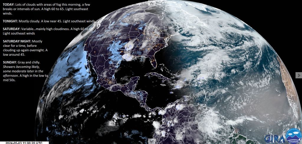
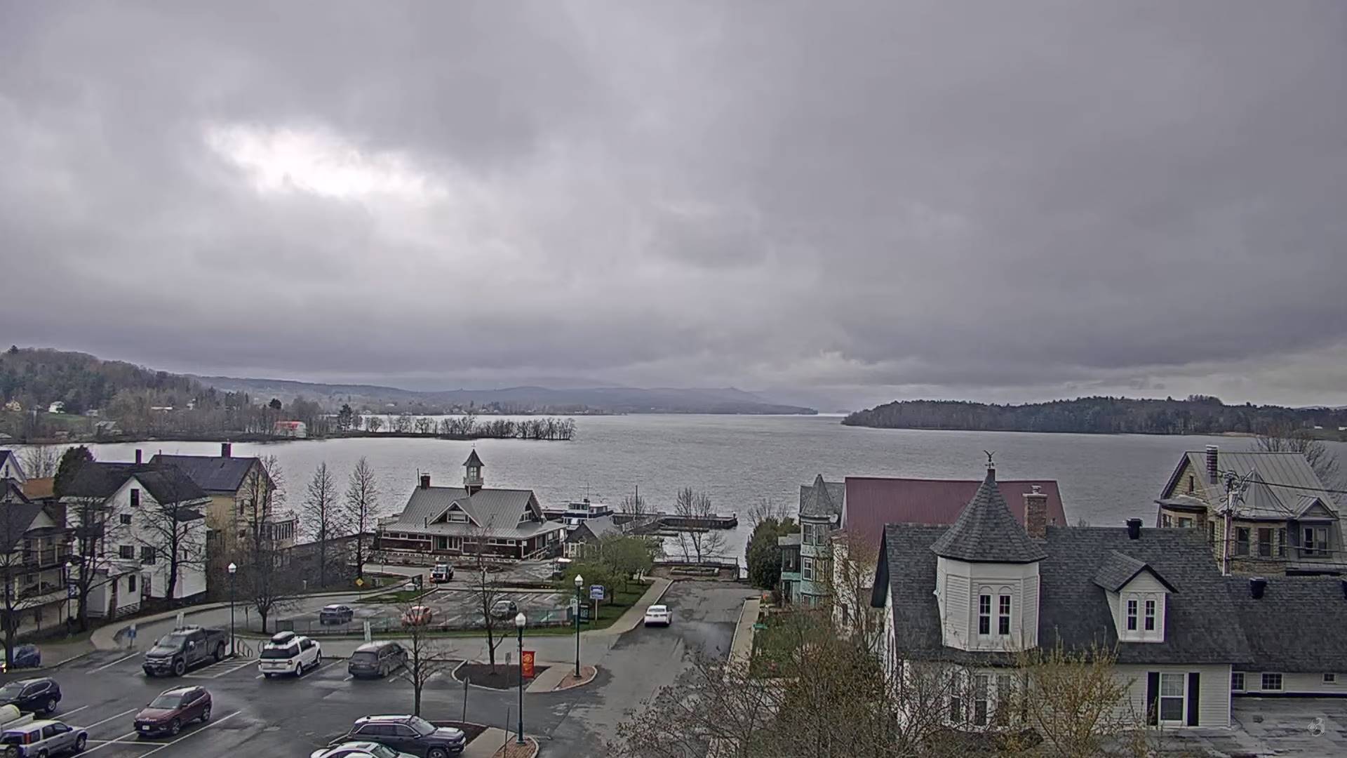
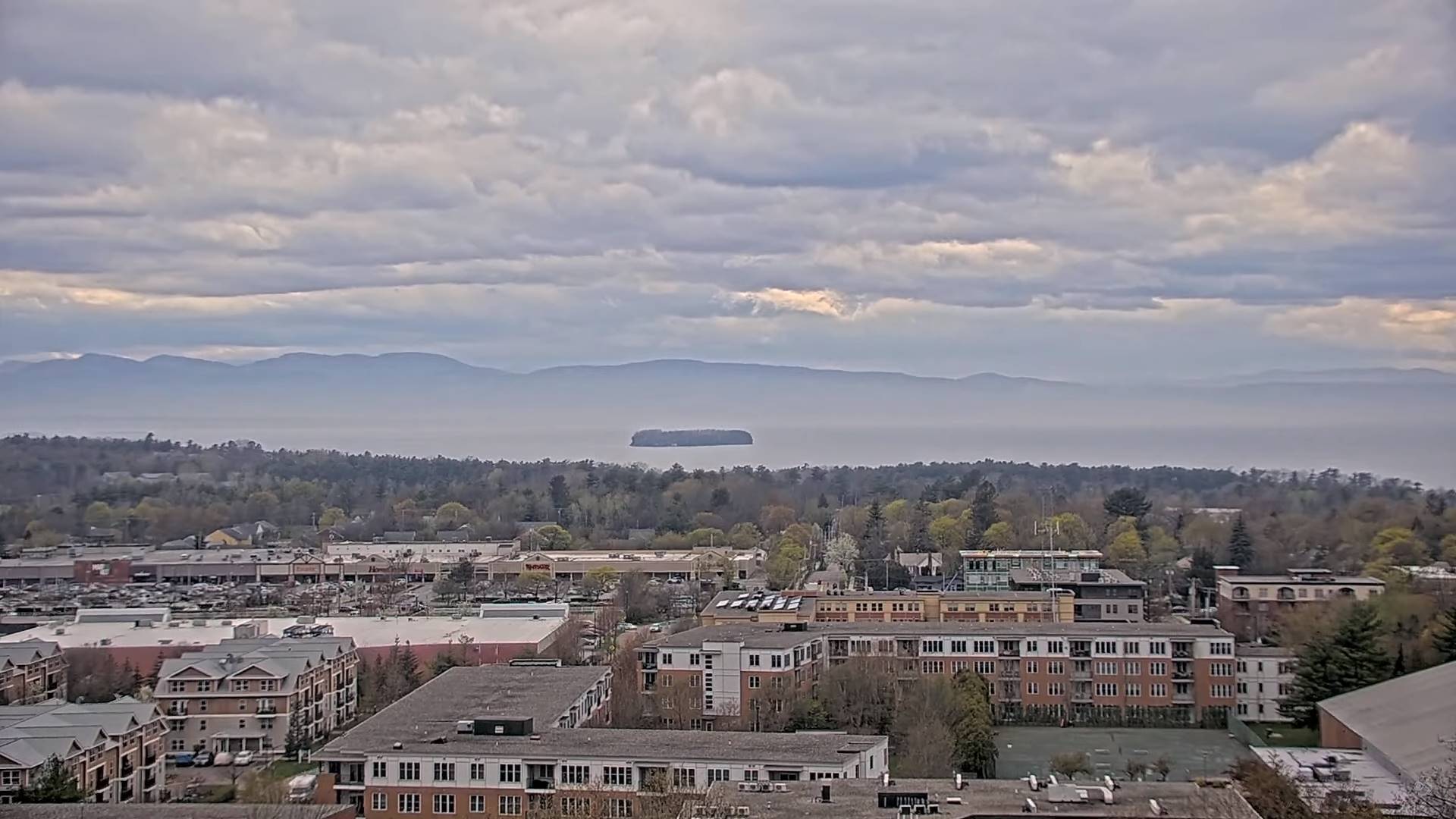
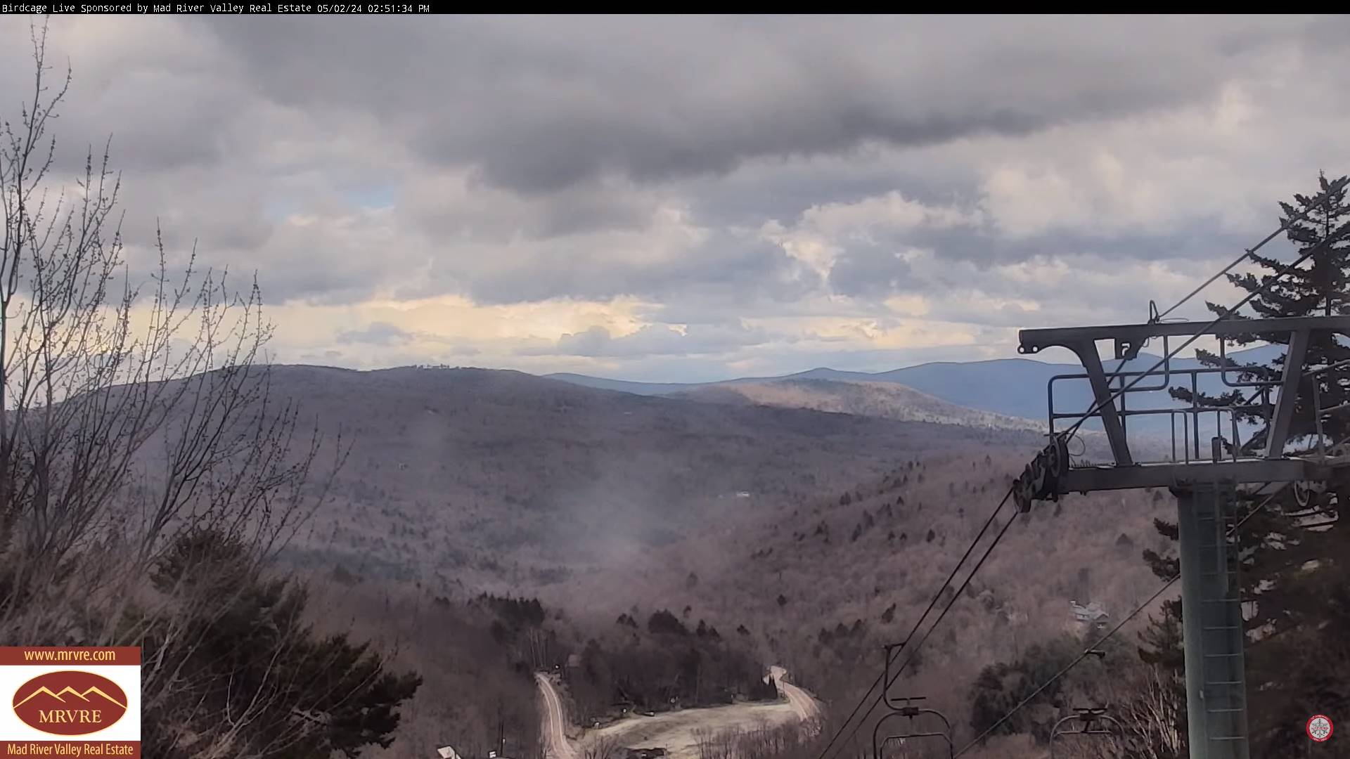
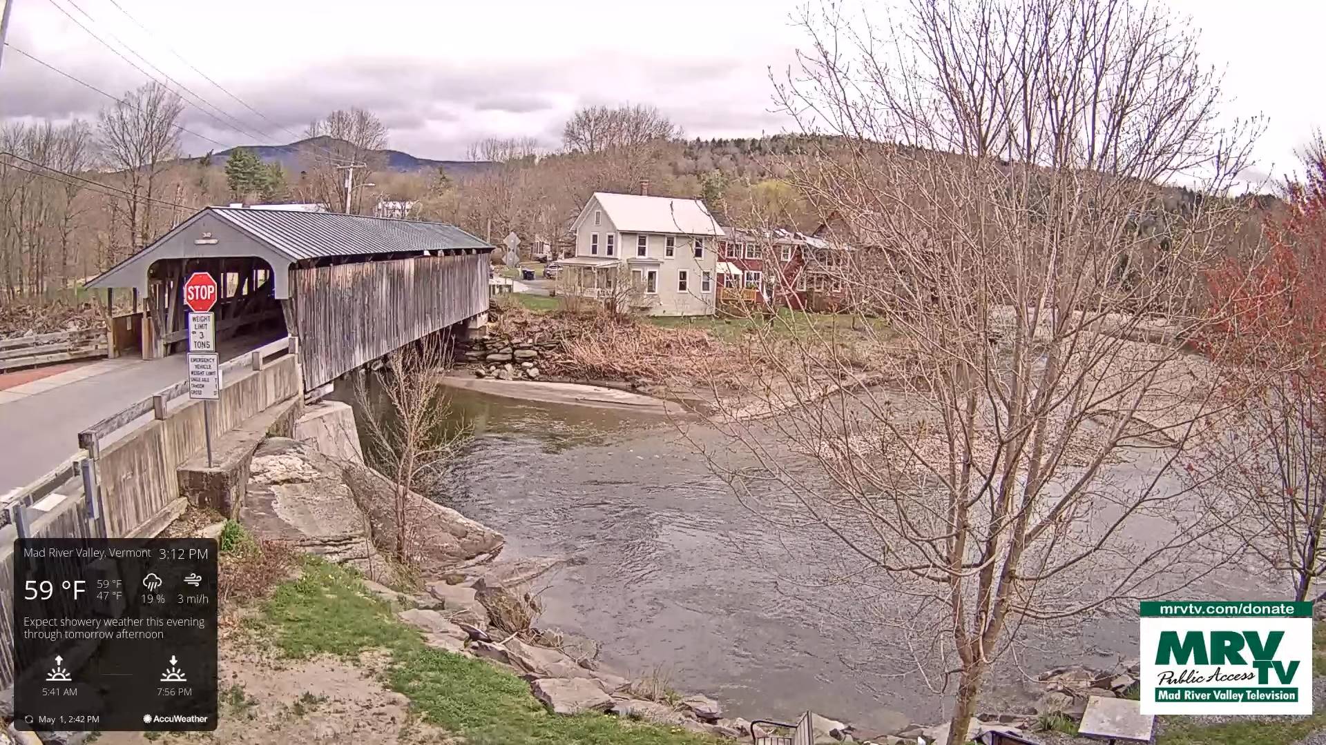
TODAY: Lots of clouds with areas of fog this morning, a few breaks or intervals of sun. A high 60 to 65. Light southeast winds.

TONIGHT: Mostly cloudy.A low near 45. Light southeast winds.

SATURDAY: Variable…mainly high cloudiness. A high 60 to 65. Light southeast winds

Looking further ahead

SATURDAY NIGHT: Mostly clear for a time, before clouding up again overnight.A low around 45.

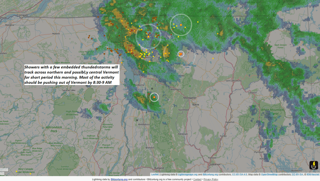
SUNDAY: Gray and chilly. Showers becoming likely, some moderate later in the afternoon. A high in the low to mid 50s.

MONDAY: Morning clouds with widely scattered showers.Periods of sun developing in the afternoon. A low mid to upper 40s. A high mid-60s.

TUESDAY: Mostly sunny with some high clouds late. A low mid-40s. A high in the low to mid 60s.

WEDNESDAY: Increasing clouds. A rising chance for showers, maybe a rumble of thunder. A low around 45. A high in the mid-60s

Average lows low 30s to near 40. Average highs upper 50s to mid-60s.

Start of meteorological summer June 6th

RH/5-3forecast][end]

Updated Thursday Evening Forecast — May 2nd, 2024

TONIGHT: Mostly cloudy.A few leftover showers Northeast Kingdom exiting.A low mid to upper 40s. A light northeast to east breeze.

TOMORROW: Lots of clouds with a few breaks of sun. A high around 65. Light southeast winds.

FRIDAY NIGHT: Mostly cloudy.A low near 45. Light southeast winds.

SATURDAY: Variable…mainly high cloudiness. Maybe a sprinkle far northern areas late. A high 60 to 65. Light southeast winds

Looking further ahead

SATURDAY NIGHT: Overcast.Rising chance for showers overnight.A low around 45.

SUNDAY: Mainly gray and a bit chilly. Good chance for showers some moderate. A high mid-50s.

MONDAY: Morning clouds with widely scattered showers.Periods of sun developing in the afternoon. A low upper 40s. A high 65 near 70.

TUESDAY: Lots of sun, with more clouds in the afternoon. A low mid-40s. A high pushing upper 60s near 70.

Average lows low 30s to near 40. Average highs upper 50s to mid-60s.

Start of meteorological summer June 6th

RH/5-2forecast][end]

Updated Thursday Morning Forecast — May 2nd, 2024

TODAY: More clouds than sun & becoming breezy. Showers, moderate at times with a few rumbles of thunder exiting mid-morning. A second round of showers, some moderate, redeveloping early to mid-afternoon with isolated thunder especially toward the NE. Kingdom. A high in the mid-60s. Winds becoming west to northwesterly 10 to 15 mph.

TONIGHT: Mostly cloudy.A few leftover showers Northeast Kingdom exiting.A low mid to upper 40s. A light east winds.

FRIDAY: Lots of clouds maybe a break or two. Maybe a misty sprinkle. A high around 65. Light southeast winds.

Looking further ahead

FRIDAY NIGHT: Mostly cloudy.A low near 45.

SATURDAY: Variable…mainly high cloudiness. Maybe a sprinkle Champlain Islands in the afternoon. A high upper 50s.

SUNDAY: Lots of clouds. Chance for showers/rumbles of thunder possible. A low around 45. A high 60 to 65.

MONDAY: Morning low clouds then intervals of afternoon sun. Widely scattered showers, rumbles of thunder. A low upper 40s. A high 65 near 70.

Average lows low 30s to near 40. Average highs upper 50s to mid-60s.

Start of meteorological summer June 6th

RH/5-2forecast][end]

Updated Wednesday Evening Forecast — May 1st, 2024

TONIGHT: Partly cloudy for a time this evening. Overcast overnight, showers, moderate at times with a rumble of thunder toward daybreak.A low in the mid-40s to around 50. Light southeast winds.

TOMORROW: More clouds than sun & becoming breezy. Showers, moderate at times exiting mid-morning. A second round of showers, some moderate in the afternoon. A few rumbles of thunder possible NE. Kingdom. A high 60 to 65. Winds becoming west to northwesterly 10 to 20 mph.

THURSDAY NIGHT: Mostly cloudy.A few leftover showers Northeast Kingdom exiting.A low mid to upper 40s. A light east winds.

FRIDAY: Lots of clouds maybe a break or two. Maybe a misty sprinkle. A high near 65. Light southeast winds.

Looking further ahead

FRIDAY NIGHT: Mostly cloudy.A low in the mid-40s.

SATURDAY: Variable…mainly high cloudiness. Maybe a sprinkle Champlain Islands. A high upper 50s.

SUNDAY: Lots of clouds. Chance for showers/rumbles of thunder possible. A low 40 to 45. A high around 55.

MONDAY: Morning low clouds then intervals of afternoon sun. Widely scattered showers, rumbles of thunder. A low upper 40s. A high around 65.

Average lows low 30s to near 40. Average highs upper 50s to mid-60s.

Start of meteorological summer June 6th

RH/5-1forecast][end]

Updated Wednesday morning Forecast — May 1st, 2024

TODAY: Gray and damp with areas of fog this morning & misty sprinkles east of the Green Mountains. Breaks of late afternoon sun western areas.A high in the upper 50s near 60. Winds light and variable.

TONIGHT: Partly cloudy for a time then clouding up. Good chance for showers, maybe a rumble of thunder toward daybreak.A low in the mid to upper 40s. Light southeast winds.

THURSDAY: More clouds than sun & becoming breezy. Showers, moderate at times exiting mid to late morning. A second round of showers some moderate in the afternoon. A few rumbles of thunder possible. A high 60 to 65. Winds becoming west to northwesterly 10 to 20 mph.

Looking further ahead

THURSDAY NIGHT: Mostly cloudy.A few misty showers drying up by late evening.A low mid to upper 40s.

FRIDAY: Lots of clouds maybe a break or two. Maybe a misty sprinkle. A high near 65.

SATURDAY: Variable mainly high cloudiness. A low in the mid-40s. A high upper 50s.

SUNDAY: Lots of clouds. Chance for showers. A low 40 to 45. A high around 55.

MONDAY: Morning low clouds then intervals of afternoon sun. A low upper 40s. A high around 65.

Average lows low 30s to near 40. Average highs upper 50s to mid-60s.

Start of meteorological summer June 6th

RH/5-1forecast][end]