
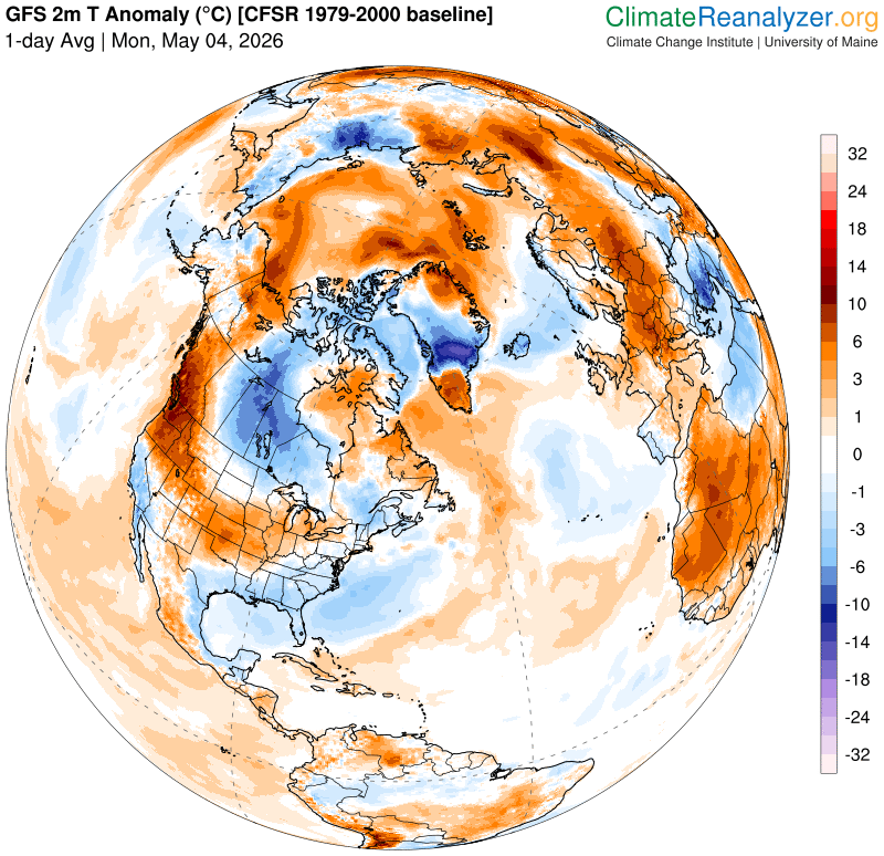
TONIGHT: Mostly clear, partially moonlit with high cloudiness. A low mid to upper 40s Light south winds.
TOMORROW: Mostly cloudy. Showers, & a few thunderstorms becoming likely in the afternoon, one or two possibly strong southern areas. A high in the low 70s. Southwest breeze 10 to 15 mph.
TUESDAY NIGHT: Overcast. Wet. Showers or periods of rain likely, moderate at times. A low around 45. Light northwest winds.
WEDNESDAY: Gray. Good chance for lingering showers…some moderate to heavy. Raw. Temperatures holding 45 to 50. Light north winds.
Looking further ahead
WEDNESDAY NIGHT: Scattered leftover showers winding down gives way to partial clearing. A low upper 30s/around 40
THURSDAY: Morning sun then afternoon clouds. A high 55 to 60.
FRIDAY: More clouds than sun. Chance for showers, with a few wet snow flakes mixed in higher terrain. Lows 35 to 40. Highs around 50.

SATURDAY: Morning sun then increasing clouds. Chance for showers returning late. Lows 30 to 35. Highs around 60.
Average low: mid-30s to around 40 Average high low to mid 60s.
RH/5-4/forecast][end] Fox Trot Delta Tango
