
TONIGHT: Mostly clear and partially moonlit. A low 50 to 55. Little wind.
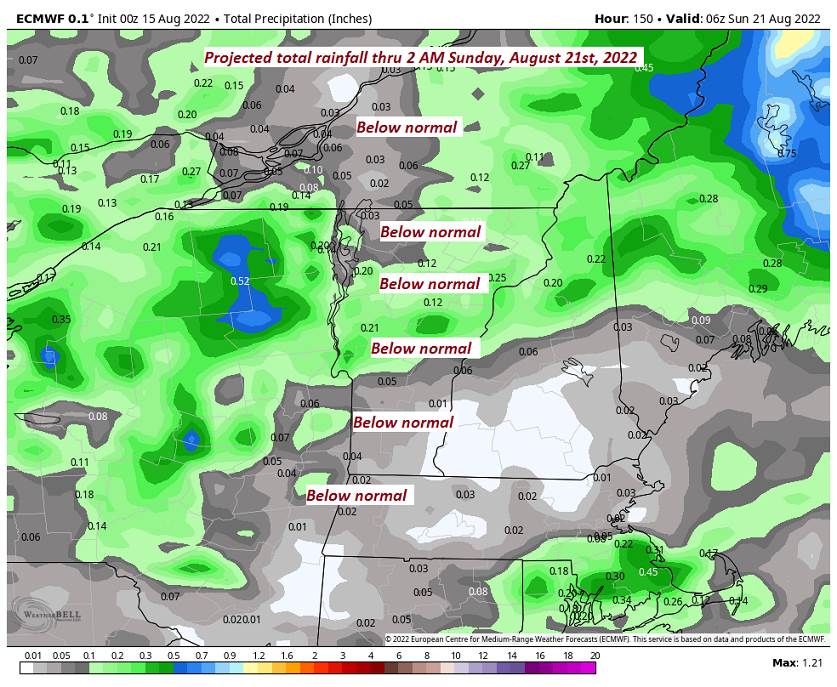
TOMORROW: Brief partial morning sun then clouding up. Scattered showers developing especially northern and eastern areas. Slight risk for thunder. A high about 80. Light northeast winds.
TUESDAY NIGHT: A few evening showers winding down. Otherwise, cloudy. A low about 55. Light northeast winds.
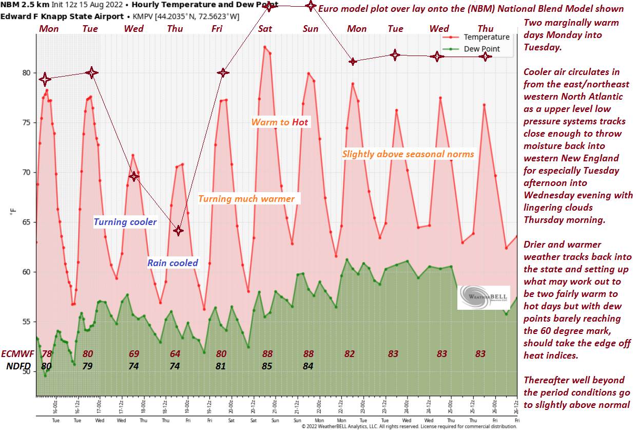
WEDNESDAY: Gray. Scattered showers mainly western areas with a risk for an isolated thunderstorm. A high in the lower 70s. Northeast breeze 10 mph.
Looking Further Ahead…
WEDNESDAY NIGHT: Cloudy, chance for showers. A low mid to upper 50s.
THURSDAY: A lingering chance for showers, otherwise late intervals of sun. A high in the lower 70s.
FRIDAY: Lots of sunshine with a few high clouds. A low 50 to 55. A high around 80.
SATURDAY: Morning fog burns off to partly to mostly sunny skies. A low 55 to 60. A high mid to possibly upper 80s.
SUNDAY: Partly sunny after some morning fog. A low mid-50s to near 60. A high mid to possibly upper 80s.
Average lows in the low to mid 50s. Average highs mid to upper 70s.
RH/8-15[forecast][end]
