
TODAY: Morning sunshine giving way to more clouds this afternoon. A few late day showers with an isolated thunderstorm possible western areas. A high 70 to 75. Light south winds.
TONIGHT: Lots of clouds with widely scattered showers…maybe a rumble of thunder overnight toward Rutland. A low
60 to 65. South breeze 10 mph…but a little stronger near Lake Champlain.
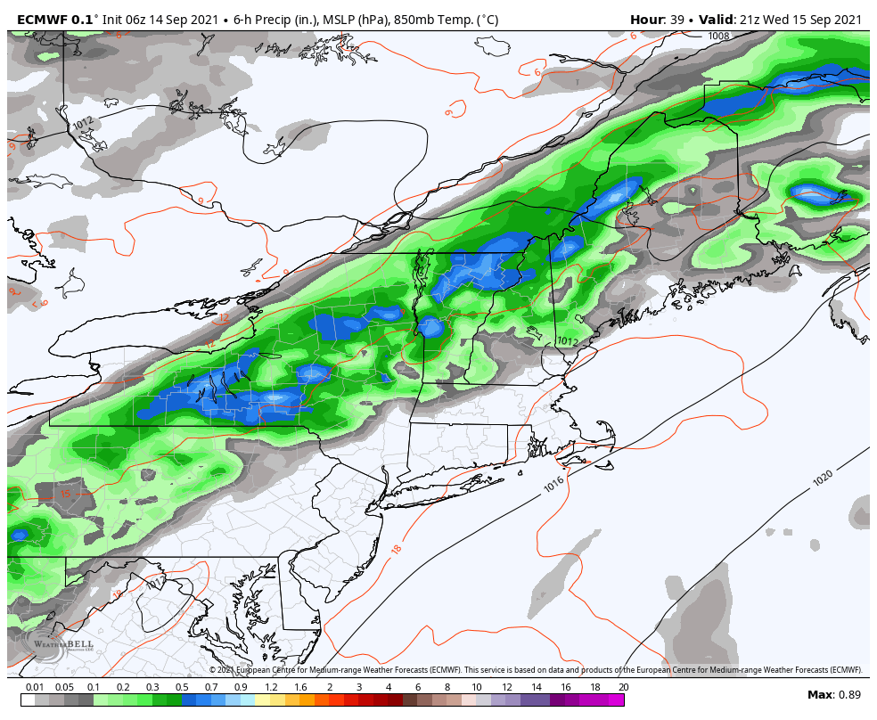
WEDNESDAY: Mostly cloudy & rather sticky. Showers & thunderstorms likely. Some storms possibly strong to locally severe & heavy at times central and southern areas. A high in the mid-70s. South winds becoming westerly in the afternoon 10 mph.
Looking further ahead…
WEDNESDAY NIGHT: Mainly evening showers & thunderstorms likely. Some storms possibly strong & heavy at times southern areas exiting. Turning cooler and less humid. A low around 55.
THURSDAY: Partly to mostly sunny. Moderately humid. A high in the low 70s.
FRIDAY: Considerable cloudiness and damp. Patchy drizzle or light showers near the Green Mountains. Kind of clammy. A low 55 to 60. A high in the mid-70s and again muggy.
SATURDAY: Partly to mostly cloudy. Widely scattered showers, maybe an afternoon thunderstorm. A low around 65. A high near 75.
SUNDAY: Mixed clouds and sun and muggy. A low around 60. A high 75 to 80.
Average low 45 to 50. Average highs upper 60s to low 70s
RH/9-14forecast][end]
