
TODAY: Partial sunshine with mainly high cloudiness. A little bit more humid. A high near 80. South to southwest breeze 10 to occasionally 20 mph.
TONIGHT: Partly cloudy. A little muggier. Maybe an early evening shower Champlain Valley, otherwise dry. A low in the low to mid 60s. Southwest breeze 10 mph, stronger near Lake Champlain.
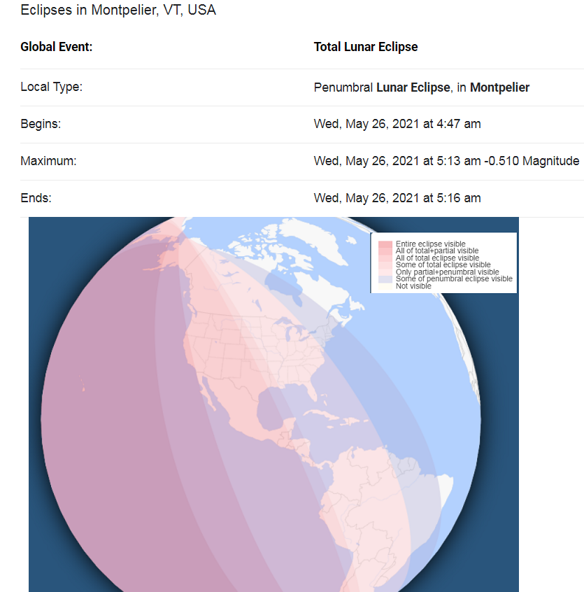
Full Flower Moon Wednesday morning 7:14 AM
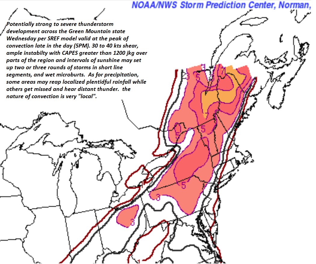
WEDNESDAY: Partial morning sun then more clouds. Warm and muggy. A rising chance for showers and thunderstorms northern areas spreading southward and becoming more numerous in the afternoon. A risk of strong to locally severe storms…with gusty winds and hail. A high in the mid-80s. Southwest breeze 10 to 20 mph, stronger near Lake Champlain.
Looking further ahead…
WEDNESDAY NIGHT: Scattered evening showers and thunderstorms gradually wind down, then another round of showers toward sunrise. Otherwise variable clouds and moonlit at times. A low in the mid-50s to around 60.
THURSDAY: Morning showers, maybe a rumble of thunder early, otherwise becoming mostly sunny, less humid and cooler. A high around 65.
FRIDAY: High cloudiness, but thicker clouds southern areas with a shower possible. Chilly. A low near 40. A high 55 to 60.
SATURDAY: Becoming mostly sunny, gorgeous but cool. A low 32 to 35 with scattered frost colder hollows. A high in the low 60s.
SUNDAY: Partly to mostly sunny. Cool. A low mid-30s to around 40. A high in the mid-60s.
Average low mid-40s to around 50. Average highs upper 60s to lower 70s.
Start of Meteorological Summer June 6th… Summer peaks approx.. July 22nd based off local climatology.
RH/5-25forecast][end]
