
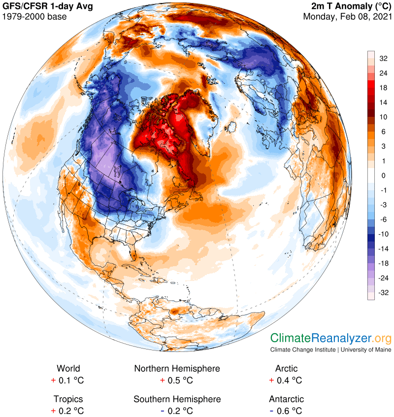
TONIGHT: Mostly clear early this evening, then increasing clouds. Rising chance flurries before daybreak. Little accumulation. Frigid. A low about zero to 10 above. Winds becoming light and southeasterly.
TOMORROW: Overcast and gray. Flurries or very light snow with the bulk of it in the afternoon with a dusting to locally 2” especially southern areas. A high in the low 20s. Light southeast winds.
TUESDAY NIGHT: Scattered flurries or light snow showers. Up to a fluffy inch additional accumulation. A low 5 to 10 above. Light & variable winds.
WEDNESDAY: Clouds, intervals of sun. A few leftover mountain flurries. A high 15 to 20. Northwest winds 10 to 15 mph lowering wind chills.
Looking further ahead…
WEDNESDAY NIGHT: Partly cloudy to mostly clear. Frigid. A low 5 above to 5 below.
THURSDAY: Lots of sunshine with high clouds late. A high around 15.
FRIDAY: Morning clouds then mostly sunny. A low zero to 10 below. Colder. A high 10 to 15.
SATURDAY: Variable high cloudiness. A low 5 to 15 below. A high in the around 15.
SUNDAY: Gray. Chance for snow, a few inches possible. A low zero to 10 above. A high mid to upper teens.
Average low ranging 5 to 15 above, Average highs about 25 into the mid-30s
End of Winter March 9th… based off local climatology.
RH/2-8category forecast][end]
