
TODAY: Clouds mixing with period’s sunshine. A bit milder. A high in the mid to upper 30s. Light southeast winds.
Winter Weather Advisory 1 AM Saturday thru 4 PM Sunday.
TONIGHT: Cloudy. Periods of accumulating wet snow likely after midnight…moderate to heavy at times southern Greens. A dusting to 2” northern areas…with 2 to locally 5” southern Green Mountains. A low about 30. Southeast winds 10 to 15 mph.
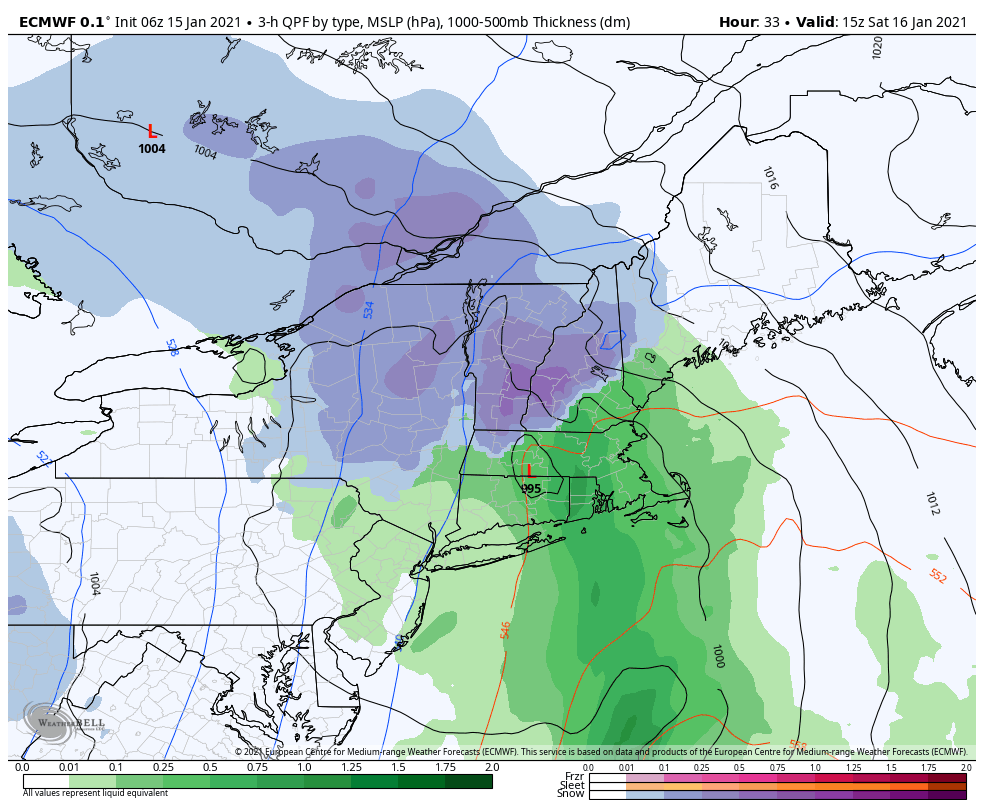
SATURDAY: Gray. Periods of wet snow, moderate at times…mixing with rain valleys in the afternoon. Total accumulation 1 to 4” valleys…about 3 to locally 8” mid to upper slopes of the Green Mountains. A late day high in the mid-30s. East to southeast winds 10 to 20 mph with higher gusts elevated terrain.
Looking further ahead…
SATURDAY NIGHT: Cloudy. Accumulating snow or snow showers. Additional 1 to locally 3” especially northern Green Mountains. A low upper 20s.
SUNDAY: Clouds giving way to intervals of sun away from the mountains. Chance for left-over mountain snow showers or flurries with minor additional accumulation. Turning blustery. A high around 32.
MONDAY: Mostly cloudy, blustery and colder. A widely scattered mountain flurry. A low mid to upper teens. A high mid-20s.
TUESDAY: Partly sunny and colder. A low zero to 10 above. A high around 20.
WEDNESDAY: Mostly cloudy. Chance for mountain snow showers and valley flurries. Minor accumulation. A low in the mid-teens. A high in the mid-20s.
Average low ranging thru the single digits to low teens, Average highs in the 20s.
Peak of Winter End of Winter March 9th… based off local climatology.
RH/1-14 category forecast][end]
