
TONIGHT: Mostly clear. Isolated valley fog. A low upper 50s to around 60. Light north wind.
TOMORROW: Sunshine filtered through high clouds. A high 80 to 85. Light northwest winds.
SATURDAY NIGHT: Mostly clear with high cloudiness. Isolated valley fog. A low around 60. Winds become east to southeast 10 mph.
SUNDAY: Filtered sunshine thru high clouds, thickening up in the afternoon. Widely scattered afternoon showers becoming more numerous late with a chance for thunder. A high near 85. Increasingly more humid late. South to southeast breeze 10 mph.
Looking further ahead…
SUNDAY NIGHT: Lots of clouds. Chance for showers and possible thunderstorms in the evening, then partial clearing overnight. Very muggy a low 65 to 70.
MONDAY: Isolated morning showers, then variable high cloudiness. Oppressively uncomfortable. A high in the mid-80s.
TUESDAY: Clouding up and sultry. Chance for showers or periods of rain…moderate to heavy at times with a risk of thunder. A low 60 to 65. A high in the mid-70s.
WEDNESDAY: Considerable cloudiness. Chance for showers or periods of rain…moderate to heavy at times with a risk of thunder. A low in the 60s. A high in the mid-70s.
Average lows upper 50s to low 60s, average upper 70s to around 80.
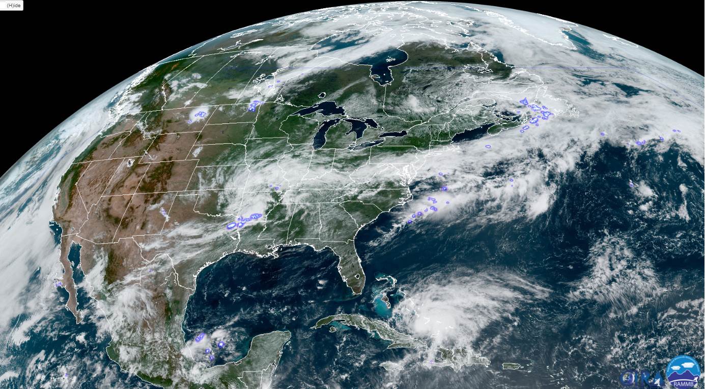
Hurricane Isaias (pronounced “EEE-sah-EE-us”)
RH/7-31[end]
