
TODAY: Lots of clouds, but with intervals of sun southern areas. Widely scattered rain showers, becoming numerous late this afternoon. A few strong thunderstorms especially south of the Barre-Montpelier area…with locally heavy rainfall and gusty winds. A high near 65 northern areas pushing near 70 southern areas. Light southwest winds.
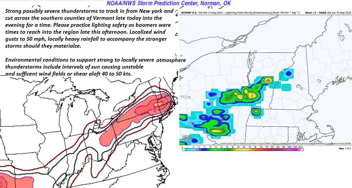
TONIGHT: Leftover showers and isolated thunderstorms exiting southeast this evening a few storms could be strong. A low mid-40s to around 50. Northwest winds 10 mph.
SATURDAY: Chance for a morning sprinkle, otherwise clouds mixed with sunshine later on. A high mid to upper 50s. Northwest winds 10 to 15 mph.
Looking further ahead…
SATURDAY NIGHT: Partly cloudy. A low 40 to 45.
SUNDAY: Filtered sun through high clouds. A high low to mid 60s. Rising chance for showers toward Sunday evening.
MONDAY: Gray damp and chilly. Chance for rain or rain showers, moderate at times. A low around 45. Cooler. A high mid-40s to around 50.
TUESDAY: Becoming mostly sunny. A low dipping into the upper 30s. Warming trend with a high around 60.
WEDNESDAY: Sunshine filtered by increasing high clouds. A low near 40. A high 65 to 70.
Average lows upper-30s to mid-40s, average highs mid to upper 60s.
RH/5-15[end]
