
TODAY: Increasingly sunny…with more clouds arriving late. Light snow showers arriving toward dark. A high upper 20s to low 30s. Light winds.
TONIGHT: Light snow showers and flurries this evening diminishing around midnight. A dusting to half inch accumulation. Otherwise clearing overnight. Blustery. A low in the low to mid teens. West to northwest winds 10 to 20 mph lowering wind chills.
THURSDAY: Bright sunshine, then more clouds arriving late. A high in the mid to upper 20s. Light west winds.
Looking further ahead…
THURSDAY NIGHT: Considerable high cloudiness. A low 20 to 25.
FRIDAY: Partial sunshine, then thickening clouds leading to mixed precipitation transitioning to rain. Milder again with a high 35 to 40.
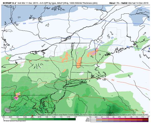
SATURDAY: Cloudy & breezy. Periods of rain…moderate at times in the morning. A low 30 to 35. A high 40 to 45.
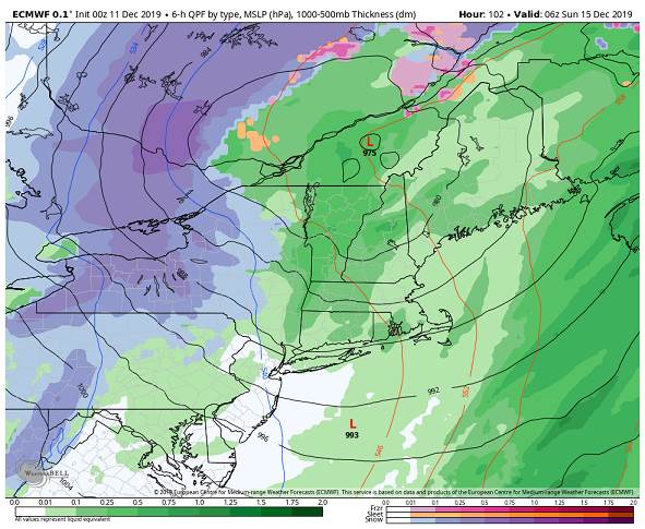
SUNDAY: Mainly cloudy. Chance for rain transitioning to accumulating snow. Becoming breezy to windy. A low near 32. A high mid 40s to 45.
MONDAY: Morning clouds then intervals of sun. A low around 15. A high in the low 30s.
Average lows 15 to 20, average highs 30 to 35.
RH/12-11-19[end]
