
Tonight Old Town Hal Brookfield VT at 7 PM…Climate Change Crises talk.
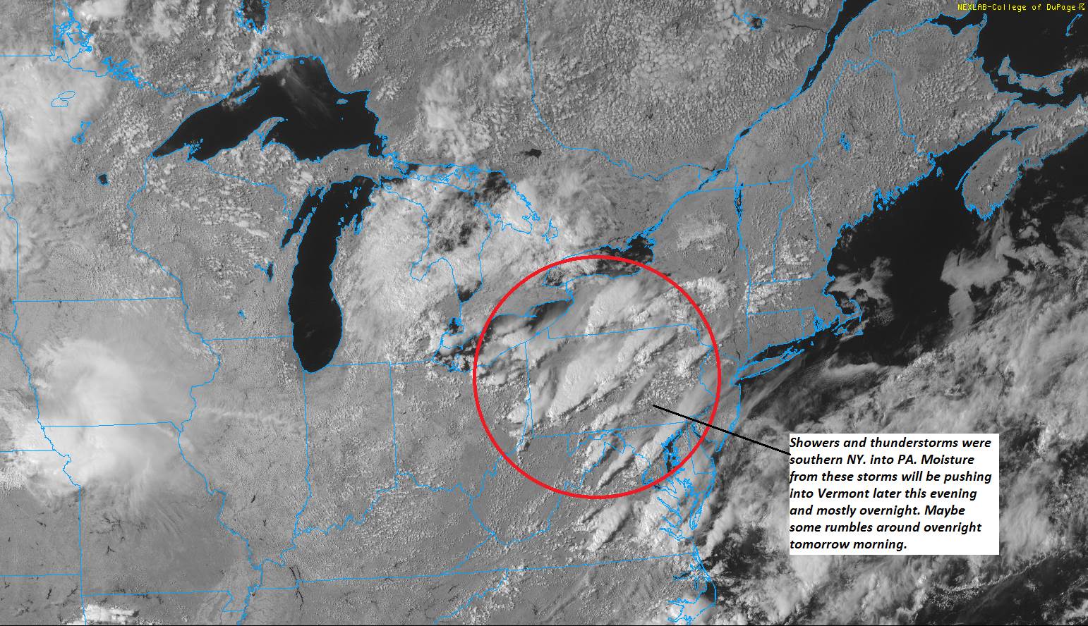
TONIGHT: Partially moonlit, then thickening clouds later on. Showers becoming likely overnight. Maybe a few rumbles of thunder possible. A low upper 50s to around 60. Light southeast wind.
TOMORROW: Morning showers diminishing to isolated in the afternoon. Otherwise clouds mixed with periods of afternoon sunshine. Muggy. A high 75 to 80. South to southwest breeze 10 mph.
FRIDAY NIGHT: Cloudy periods, otherwise partially moonlit. Scattered showers maybe a thunderstorm overnight. Patchy valley fog. A low around 60. Light southeast winds.
SATURDAY: Sunshine mixed with cloudy periods in the afternoon with a chance for showers and afternoon thunderstorms. A high in the mid to upper 70s. South breeze 10 mph.
Looking further ahead…
SATURDAY NIGHT: Chance for showers and thunderstorms…some possibly heavy through the evening, then clearing overnight. Patchy valley fog.A low in the low 60s.
SUNDAY: Partly sunny and continue muggy. Widely scattered showers. A high about 80.
MONDAY: Partly sunny warm and rather sultry. Chance for mainly afternoon showers & thunderstorms. A low 65 to 70. A high around 85.
TUESDAY: Mixed sun and clouds warm and sultry. Chance for mainly afternoon showers and thunderstorms. A low in the mid to upper 60s. A high in the mid to upper 80s.
Average lows ranging through the 50s. Average highs 75 to near 80.
RH/8-15-19[end]
