
TONIGHT: Becoming partly to mostly cloudy turning uncomfortably steamy. An isolated shower or two toward daybreak western Vermont. A low in the upper 60s to near 70. Light southwest winds.
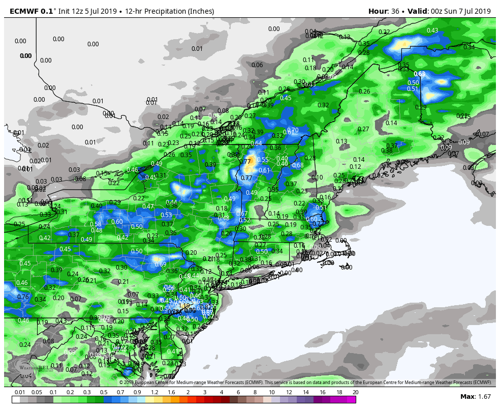
TOMORROW: More clouds than sunshine. Warm and sticky. A couple rounds of showers & thunderstorms likely…briefly heavy. A high around 80. Light southwest winds becoming west to northwesterly 10 mph.
SATURDAY NIGHT: Clear and starlit skies. Patchy valley fog. A low near 55. Light north winds.
SUNDAY: Sunshine and blue skies after morning fog. Refreshingly cooler and less humid. A high in the mid 70s. Northwest breeze 10 mph.
Looking further ahead…
SUNDAY NIGHT: Mostly clear. A low near 50.
MONDAY: Mostly sunny & very pleasant. A high 75 to 80.
TUESDAY: Sunshine filtered with high cloudiness. Pleasant. A low in the mid 50s. A high in the low 80s.
WEDNESDAY: Filtered sunshine through high clouds. Moderate humidity levels. A low 55 to 60. A high 80 to 85.
Average lows 55 to 60. Average highs upper 70s to low 80s.
Warmest 90 days of meteorological summer peaks July 22nd…
RH/7-5-19[end]
