
TODAY: Partial sunshine giving way to cloudy skies in the afternoon. A rising chance for snow showers mixed with rain valley floors late. A high in the mid 30s to around 40. Light south winds.
TONIGHT: Cloudy. Periods of wet accumulating slushy snow…exiting toward midnight. A dusting…to an inch in elevated terrain. A low ranging in the 20s. Light southeast winds.
THURSDAY: Periods of morning sun, then high cloudiness in the afternoon. A high mid 40s to low 50s. Sap run for Sugaring. Light south winds.
Looking further ahead…
THURSDAY NIGHT: Mostly clear giving way to more clouds overnight. A low mid 30s to lower 40s.
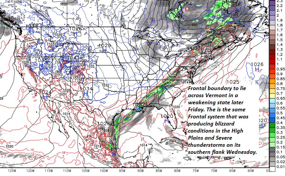
FRIDAY: Clouds with a few breaks of sun. Rain showers becoming likely. Warmer and mild. A high 55 to 60. Possible sap run.
SATURDAY: Mostly cloudy and blustery. Chance for mountain snow showers and valley flurries. A low 30 to 35. A high mid 30s to near 40.
SUNDAY: Clouds mixed periods of sunshine. A low in the teens. A high in the 20s.
MONDAY: Lots of sunshine but cold. A low in the single digits. A high in the 20s.
Average lows in the mid-teens to low 20s. Average highs in the mid 30s to low 40s.
RH/3-13-19[end]
