
TODAY: Morning cloudiness breaking up to increasing amounts of sunshine. A high in the upper 20s to low 30s. Northwest winds 10 to 15 mph.
TONIGHT: Clear and partially moonlit.A low in the single digits.Little wind.
SATURDAY: Sunshine but with some high cloudiness in the afternoon. A high around 35. Light southwest winds.
Looking further ahead…
SATURDAY NIGHT: Thickening clouds. A rising chance for light snow developing southern and western areas. An early low 20 to 25.
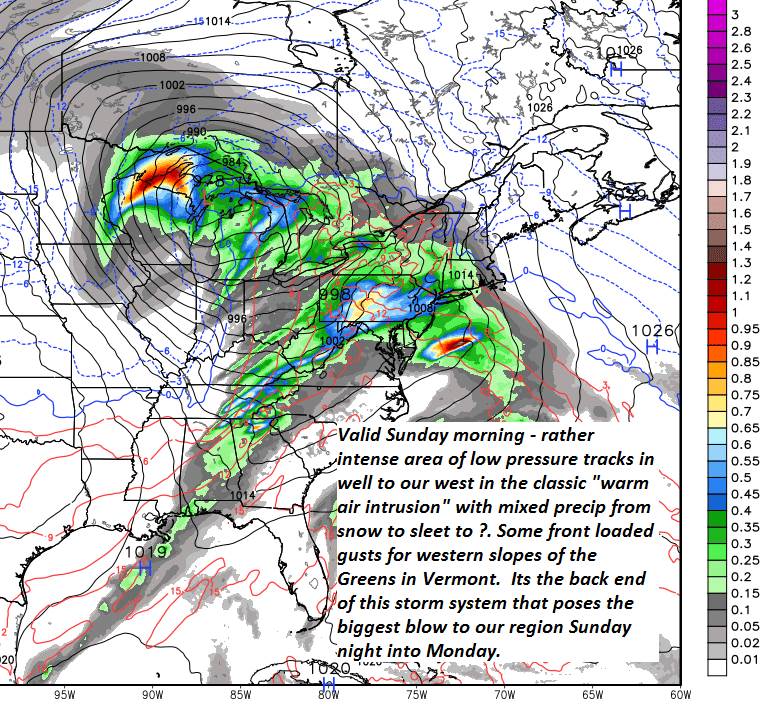
SUNDAY: Gray. Snow…or a wintery mix likely…with slippery travel. A few inches of snow and sleet and possible glazing. Blustery at times. A high eventually reaching near 35. Gusty west winds developing.
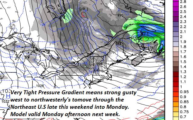
MONDAY: Mainly gray. Blustery to windy. Occasional light accumulating snow/snow squalls. Temperatures holding in the mid to upper 20s. Gusty west to northwest winds.
TUESDAY: Partly to mostly cloudy and blustery at times. A low in the single digits. A high in the teens.
WEDNESDAY: A few clouds but lots of sunshine. Frigid conditions return. A low zero to 10 below. A high just 5 to 10 above.
Average lows upper single digits to mid teens. Average highs in the upper 20s to mid 30s.
RH/2-21-19[end]
