
-
- image001 9
-
- image005 1
Winter Storm Warning 1 PM this afternoon through 4 PM late Wednesday
TODAY: Filtered sunshine briefly then thickening clouds. Light snow developing later this afternoon. A high around 20. Light southeast winds.
TONIGHT: Overcast. Snow… moderate to heavy for a time before mixing with a little sleet overnight and freezing rain toward southern areas. Accumulation 6 to 10” by daybreak” Temperatures holding in the low 20s. Southeast winds 10 to 15 mph.
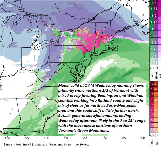
WEDNESDAY: Periods of mostly light accumulating snow…tapering to scattered snow showers mid day on. A few breaks of sunshine in the afternoon. Total accumulation 7 to 13”. A high 30 to 35. Westerly winds 10 to 20 mph later in the afternoon.
Looking further ahead…
WEDNESDAY NIGHT: Partly to mostly cloudy. Occasional mountain flurries minor accumulation. A low mid teens to around 20.
THURSDAY: A stray mountain flurry exiting. Otherwise becoming partly to mostly sunny. A high in the mid 20s to near 32 degrees.
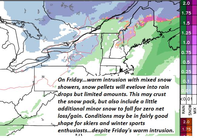
FRIDAY: A period of morning snow showers with minor accumulation, changing to rain showers valley floors, otherwise mainly cloudy. A low 20 to 25. A high mid 30s to low 40s.
SATURDAY: Good chance for morning flurries, then intervals of afternoon sunshine. A low 20 to 25. A high Temperatures mid to upper 20s.
SUNDAY: Sunshine filtered through high clouds. A low in the single digits. A high 20 to 25.
Average lows 5 to 15. Average highs in the upper 20s to mid 30s.
RH/2-12-19[end]
