
TODAY: Brief morning sun, then clouding up. A rising chance for spotty wet snow and sleet late toward Rutland. Back to near seasonable temperatures. A high upper 20s to near 32 degrees. Light northeast winds.
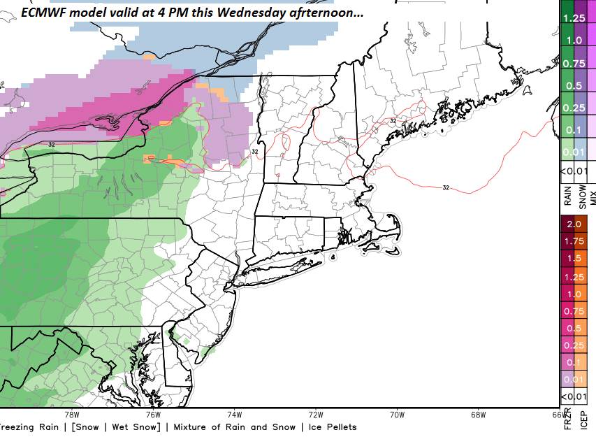
Winter Weather Advisory goes into effect 4 PM Wednesday… into Thursday morning.
TONIGHT: Overcast. Mixed precipitation primarily freezing rain. Glazing tenth up to an ¼ inch in some spots. Expect treacherous travel. A low mid 20s to low 30s. Southeast winds 10 mph.
THURSDAY: Gray…spotty freezing rain early with poor travel early…exiting as sprinkles. A high 35 to 40. Southeast winds 10 to 20 mph.
Looking further ahead…
THURSDAY NIGHT: Fair and dry early, then clouding up. Rain with pockets of freezing rain becoming likely overnight. A low 30 to 35.
FRIDAY: Mainly cloudy and changeable. Good chance for freezing rain early in the morning changing to rain before tapering to rain showers with a few wet snow flakes late. Turning blustery to windy late afternoon into Friday night. A high in the 40s.
SATURDAY: Clouds give way to increasing sunshine. Much colder Blustery to windy. A low in the single digits. A high in the low to mid teens. Gusty west to northwest winds.
SUNDAY: Mostly sunny after a frigid start. A low 5 above to 5 below. A high upper teens to mid 20s.
Average lows 5 to 15 above. Average highs in the 20s.

RH/2-6-19[end]
