
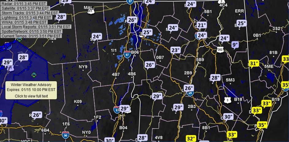
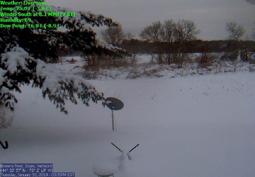
TONIGHT: Considerable cloudiness. A low mid teens to low 20s. Light south winds.
TOMORROW: Mainly cloudy. Scattered light snow showers & flurries developing early to midafternoon. A dusting to less than an inch higher terrain. Flurries exit to breaks of late day sun. Blustery. A high 30 to 35. Southwest winds shifting to northwesterly 10 to 25 mph in the afternoon.
WEDNESDAY NIGHT: Mostly cloudy in the evening then gradual clearing and frigid. A low 5 above 5 below. Northwest winds 10 mph lowering wind chills.
THURSDAY: Mostly sunny and cold with high cloudiness in the afternoon. A high 10 to 15. Little wind.
Looking further Ahead…
THURSDAY NIGHT: Fair early with thickening clouds leading to rising chance for light accumulating snow. A low 5 to 15.
FRIDAY: Gray. Good chance for snow or snow showers. A high upper 20s to around 30.
SATURDAY: Early sunshine then cloudy. Chance for snow arriving toward evening. A low 5 above to 5 below. A high 5 to 10 above.
SUNDAY: Snow…possibly significant…several or more inches…with a risk of mixed precip across southern areas…otherwise gray. Temperatures holding about 10 degrees.
Full Super Wolf Moon 12:16 AM Monday
MONDAY: Lots of clouds. Flurries or snow showers winding down early with some additional minor accumulation. Otherwise partial sunshine, blustery and bitterly cold wind chills. A low zero to 10 below. A high zero to 5 above.
Average lows single digits. Average highs in the 20s.
RH/1-15-19[end]
