
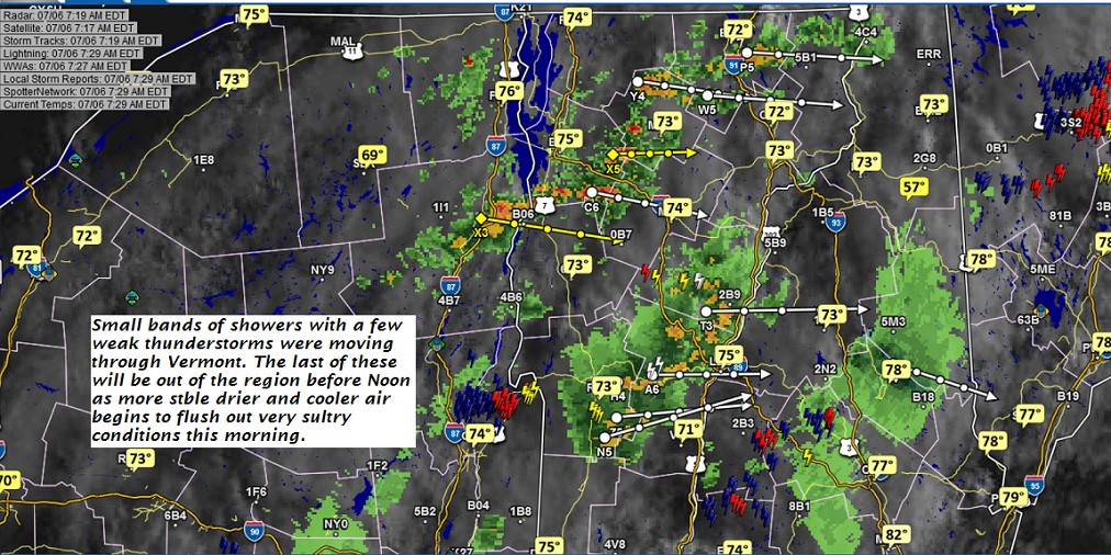
TODAY: Morning showers and thunderstorms exiting to partial sunshine. Mostly sunny, breezy cooler & less humid this afternoon. Temperatures holding in the mid to upper 70s. Northwesterly breeze picking up 10 to 25 mph.
TONIGHT: Clear & starlit and comfortable. A low upper 40s to around 50. Light northwest winds.
SATURDAY: Morning sunshine then afternoon cloudiness. Refreshingly cooler. A high around 75. Northwest winds 10 to 20 mph in the afternoon.
Looking further ahead…
SATURDAY NIGHT: Clear and starlit. A low 50 to 55.
SUNDAY: Mostly sunny. A high near 85.
MONDAY: Morning sunshine giving way to some afternoon clouds. A low 55 to 60. A high around 90.
TUESDAY: Partly to mostly sunny. An isolated late afternoon shower or thunderstorm. A low 60s. A high mid to upper 80s.
WEDNESDAY: Partly sunny. Chance for a shower or thunderstorm. A low in the mid 50s. A high around 85.
Average lows in the mid 50s to around 60, Normal highs in the mid 70s to low 80s.
RH/7-6[end]
| Virus-free. www.avast.com |
