
Winter Storm Warning thru 8 PM Wednesday evening
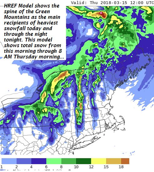
TODAY: Overcast. Periods of snow… heaviest near the near the mountains. Additional snowfall – about 2 to locally 6” especially near the Green Mountains. A high around 32. West winds 10 mph.
TONIGHT: Cloudy. Periods of mostly light snow. About an inch to locally 4” nearest the western slopes of the Green Mountains. A low mid 20s. West to northwest winds 10 to 15 mph.
THURSDAY: Occasional snow showers and valley flurries. A dusting to 2 inches snow accumulation. Otherwise clouds with a few breaks of sun possible and blustery. A high 32 to 35. West winds 10 to 25 mph.
Looking further Ahead…
THURSDAY NIGHT: Occasional snow showers and valley flurries. A dusting to an inch additional accumulation. A low 15 to 20.
FRIDAY: More clouds than sun. Chance for minor coating of snow mainly near the northern Green Mountains. Colder. A high in the mid 20s.
SATURDAY: Morning clouds give way to increasing afternoon sunshine. A low near 10. A high in the low 20s.
SUNDAY: Bright sunshine and blue skies but colder. A low single digits above zero. A high upper teens to mid 20s.
Average lows mid teens to low 20s. Normal highs 32 to 40.
RH/3-14[end]
| Virus-free. www.avast.com |
