
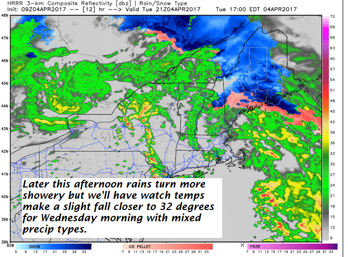
TODAY: Cloudy. Periods of rain, Watch for an isolated slick spots due to sub-freezing ground temperatures for a brief period this morning. Periods of rain this afternoon. Gusty winds western slopes of the Greens. Southeast wind 10 to occasionally 20 mph.
TONIGHT: Periods of rain…transition into a wintry mix east of the Green Mountains overnight with poor traveling due to slick spots developing. A low tonight 32 to 35. Southeast winds 10 to 15 mph.
WEDNESDAY: Scattered rain or mixed precipitation producing slick travel in some areas early. Scattered light rain showers or sprinkles exiting in the afternoon. A high 40 to 45. Possible sap run. Light west winds.
Looking Further ahead…
WEDNESDAY NIGHT: Fair early, then thickening clouds leading to a chance for more mixed precipitation later overnight. Gusty winds western slopes of Greens. A low in the low 30s.
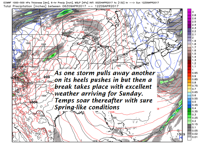
THURSDAY: Periods of rain, moderate at times. Gusty winds western slopes of Greens. A high in the mid to upper 30s.
FRIDAY: Scattered light rain showers or sprinkles. Maybe an intervals of afternoon sunshine. A low around 35. A low in the low to mid 40s.
SATURDAY: Scattered snow showers, perhaps a dusting to an inch in the morning, Otherwise mostly cloudy. A low around 30. A highs in the mid to upper 30s.
SUNDAY: Mostly sunny, gorgeous and spring-like temperatures. A low in the 20s. A high in the 50s.
MONDAY: Sunshine becoming filtered through high clouds. A low in the 30s. A high in the mid 70s.
Average lows in the upper 20s to around 30. Normal highs in the upper 40s to low 50s
RH/4-4[end]
