
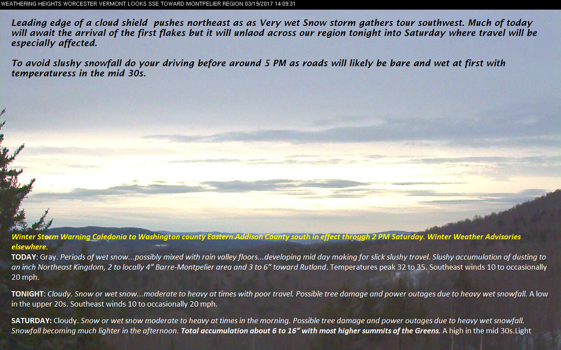
Winter Storm Warning Caledonia to Washington county Eastern Addison County south in effect through 2 PM Saturday. Winter Weather Advisories elsewhere.
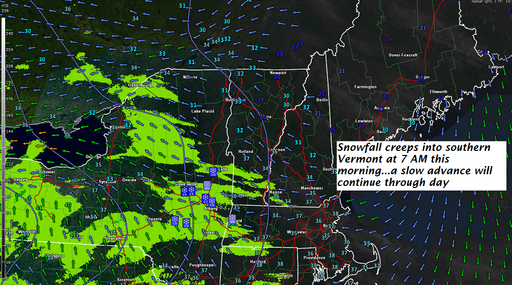
TODAY: Gray. Periods of wet snow…possibly mixed with rain valley floors…developing mid day making for slick slushy travel. Slushy accumulation of dusting to an inch Northeast Kingdom, 2 to locally 4” Barre-Montpelier area and 3 to 6” toward Rutland. Temperatures peak 32 to 35. Southeast winds 10 to occasionally 20 mph.
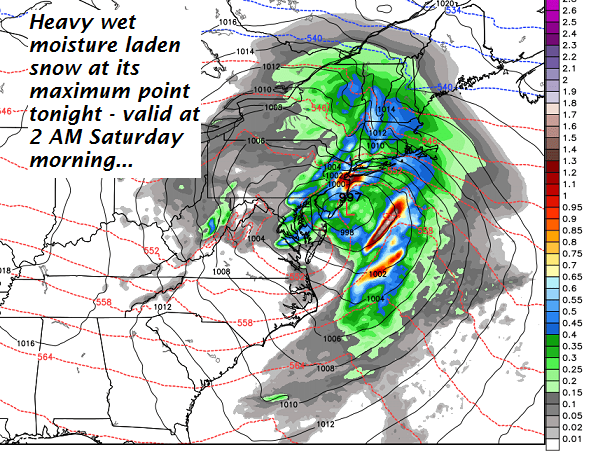
TONIGHT: Cloudy. Snow or wet snow…moderate to heavy at times with poor travel. Possible tree damage and power outages due to heavy wet snowfall. A low in the upper 20s. Southeast winds 10 to occasionally 20 mph.
SATURDAY: Cloudy. Snow or wet snow moderate to heavy at times in the morning. Possible tree damage and power outages due to heavy wet snowfall. Snowfall becoming much lighter in the afternoon. Total accumulation about 6 to 16” with most higher summits of the Greens. A high in the mid 30s.Light northeast winds.
Looking Further ahead…
SATURDAY NIGHT: Occasional light snow or snow showers winding down overnight with minor accumulation. A low in the upper 20s.
SUNDAY: Partly sunny. A high near 45 with sap run likely.
MONDAY: Filtered sunshine through high clouds. A low 10 to 15 with a high around 45. Sap run likely.
TUESDAY: Cloudy. A chance for wet snow, rain mix. A few to several inches possible. A low in the 20s. A high in the mid 30s.
WEDNESDAY: Chance for wet snow showers early then exiting with partial afternoon clearing. A low in the 20s. with a high in the mid 40s. Possible sap run.
Average lows in the mid to upper 20s. Normal highs in the mid to upper 40s
RH/3-31[end]
Roger Hill
Weathering Heights Consulting
186 MacKenzie Dr.
Worcester VT 05682
