
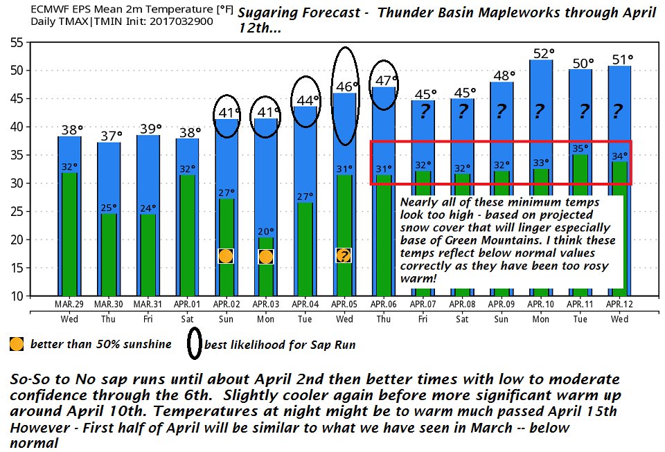
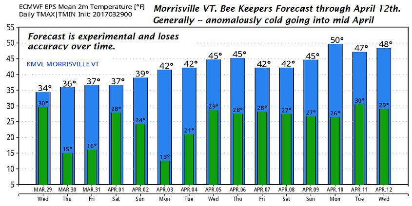
March 30th, 2017
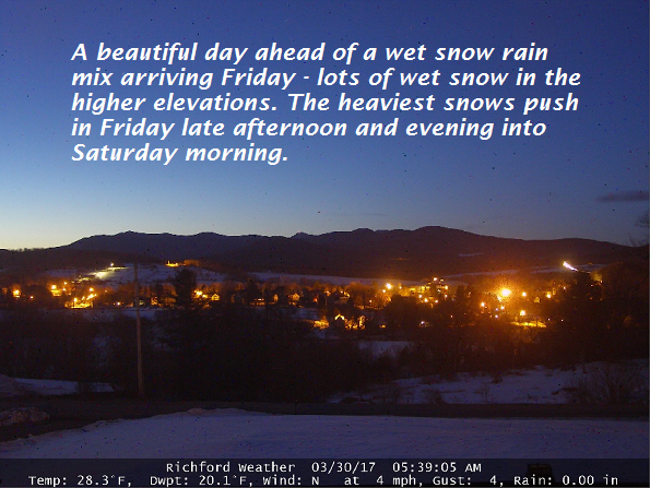
TODAY: Pick of the week. Mostly sunny. Some high clouds southern areas this afternoon. A high near 40. Northwest winds 10 mph.
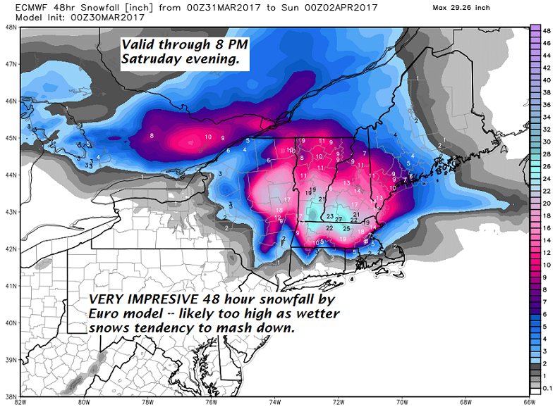
Winter Weather Advisories N half of Vermont. Winter Storm Warning and Watches south go into effect early tomorrow morning through 2 PM Saturday.
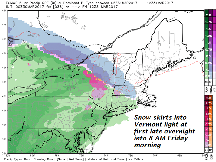
TONIGHT: Fair early, giving way to thickening clouds. A rising chance for very light snow or flurries toward Rutland – Randolph around or before daybreak. A low 20 to 25. Light wind.
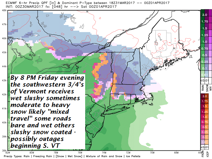
FRIDAY: Gray. Periods of wet snow…possibly mixed with rain valley floors…developing before mid day making for slick slushy travel. Slushy accumulation of dusting to an inch Northeast Kingdom, 2 to locally 4” Barre-Montpelier area and 4 to 8” toward Rutland. Temperatures peak 32 to 35. Southeast winds 10 to occasionally 20 mph.
Looking Further ahead…
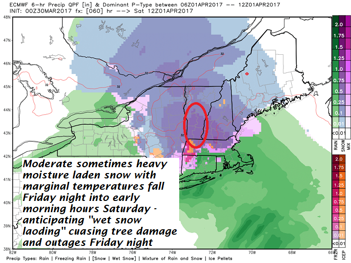
FRIDAY NIGHT: Cloudy. Periods of snow…moderate…possibly heavy at times southern Vermont. A low upper 20s to around 30.
SATURDAY: Cloudy. Snow or wet snow in the morning. Occasional snow showers and flurries continuing into the afternoon. Total accumulation about 4 to 10” with 6 to 14” high elevations central and S. Vermont. A high in the mid 30s.
SUNDAY: Partly sunny. A low 20 to 25. A high in the in upper 30s to low 40s.
MONDAY: Filtered sunshine through high clouds. A low in the single digits with a high near 40.
TUESDAY: Chance for a few sprinkles or flurries. A low in the 20s. A high in the upper 30s.
Average lows in the mid 20s. Normal highs in the mid 40s
RH/3-30[end]
