
March 29th, 2017
-
- image00121
-
- image00221
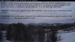
TODAY: Clouds mixing with breaks of afternoon sunshine. Widely scattered wet snow showers northern heights of land with a skiff of accumulation possible. A high mid to upper 30s. North to northwest winds flare up 10 to 20 mph this afternoon.
TONIGHT: Chance for a flurry early, then clearing. A low in the teens. Northwest winds 10 mph.
THURSDAY: Pick of the week. Sunny in the morning, giving way to high cloudiness late. A high near 40. Northwest winds 10 mph.
Looking Further ahead…
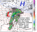
THURSDAY NIGHT: Fair early giving way to thickening clouds. A rising chance for very light snow or flurries developing around daybreak. A low 20 to 25.
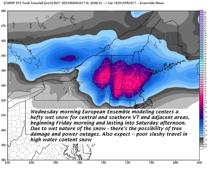
FRIDAY: Gray. Snow or wet snow likely. Accumulations of a few to several inches making for slick travel. A high 32 to 35.
SATURDAY: Cloudy. Snow or wet snow likely with several additional inches…exiting as snow showers or flurries Saturday late afternoon. Total accumulations about 6 to 12”. A low upper 20s to about 30. A high 35 to 40.
SUNDAY: Partly to mostly sunny. A low 20 to 25. A high in the in upper 30s to low 40s.
MONDAY: Lots of sunshine with a few high clouds. A low in the single digits with a high near 40.
Average lows in the mid 20s. Normal highs in the mid 40s
RH/3-29[end]
