
March 28th, 2017
-
- image00120
-
- image00220
-
- image00316
Down Under — 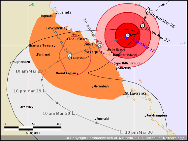
Tropical Cyclone Debbie was bearing down on the coast of Queensland, Australia, Monday afternoon local time.
As of 10 p.m. Australian Eastern Standard Time (1200 UTC), maximum winds near the center of circulation were sustained at 110 mph, making it a Category 4 on Australia’s tropical cyclone category system. Debbie is forecast to make landfall near Bowen as a Category 4 tropical cyclone around 9:00 a.m. local time on Tuesday. However, conditions will deteriorate throughout Monday night between Bowen and Mackay.
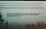
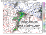
Back in Vermont – A mild push but also dreary conditions…
TODAY: Cloudy. Scattered rain showers. Much milder. A high in the upper 40s to low 50s. Light winds.
TONIGHT: Cloudy. A round of evening rain showers exiting overnight. A low near 32. Light north winds.
WEDNESDAY: Clouds mixing with breaks of afternoon sunshine. Scattered rain showers mixing with wet snow flakes Barre-Montpelier area north with minor accumulation. A high 35 to 40. North to northwest winds 10 to 20 mph.
Looking Further ahead…
WEDNESDAY NIGHT: Chance for an evening mountain flurry, then clearing. A low 10 to 20 degrees.
THURSDAY: Pick of the week. Sunny in the morning, giving way to high cloudiness in the afternoon. A high close to 40.
FRIDAY: Gray. Chance for wet snow or snow showers with a few inches of accumulation. A low in the mid 20s. A high around 32.
SATURDAY: Cloudy. Chance for wet snow early, tapering to scattered snow showers or flurries. Several inches of accumulation possible. A low in the upper 20s. A high around 35.
Average lows in the mid 20s. Normal highs in the mid 40s
RH/3-27[end]
