
March 23rd, 2017

TODAY: Sunshine becoming filtered through high clouds. A high in the mid 20s. Northwest winds 10 to 15 mph.
TONIGHT: Increasing and thickening clouds. A low near 10. Little wind.
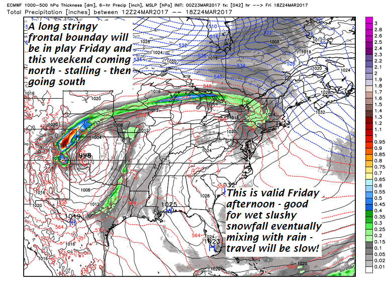
FRIDAY: Gray skies. Periods of wet snow eventually mixing with rain south of the Barre-Montpelier area in the later afternoon. About 2 to locally 5”inches wet slushy accumulation. A high 32 to 35. South winds 10 to 15 mph.
Looking Further ahead…
FRIDAY NIGHT: Wet snow showers north of the Barre-Montpelier area with rain showers south mixing with wet snow. A low around 30.
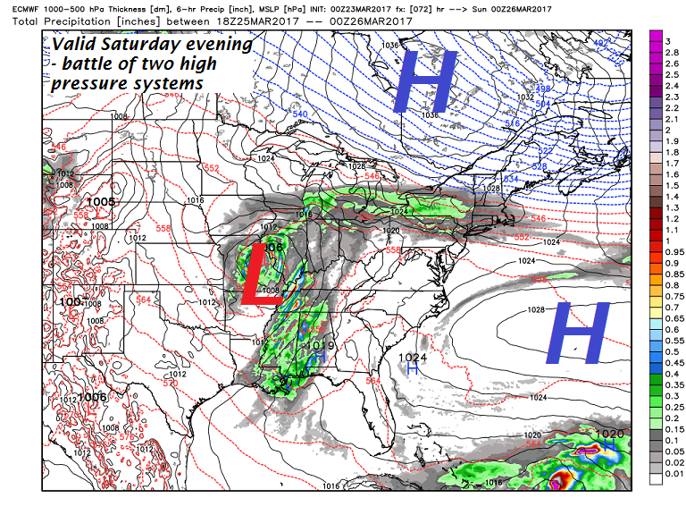
SATURDAY: Chance for wet snow showers early with up to an inch accumulation. Partly sunny skies in the afternoon central and northern areas. Temperatures falling into the upper 20s into the afternoon.
SUNDAY: Morning sunshine gives way to increasing high clouds in the afternoon. A wintry mix develops Sunday night with poor travel. A low around 32. A high in the upper 30s to low 40s.
MONDAY: Gray. Periods of light wintry mix producing slick travel. A low around 30. A high in the mid 30s.
TUESDAY: Spotty mixed precipitation in the morning with slick travel possible, changing to scattered rain showers. A low near 32. A high in the low to mid 40s
Average lows 20 to 25. Normal highs 40 to 45.
RH/3-23[end]
