
March 21st, 2017
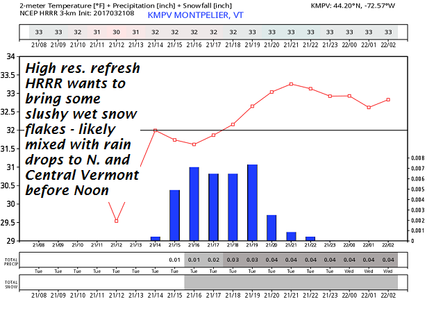
TODAY: Considerable cloudiness. Widely scattered wet snow or rain showers mainly northern areas arriving later this morning into the afternoon. Little if any accumulation. Breaks or intervals of sunshine possible late. A high in the upper 30s to mid 40s maybe a sap run. Light southwest winds.
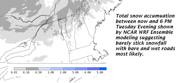
TONIGHT: Fair or partly cloudy in the evening then clouding up. Good chance for a snow shower or snow squall. A dusting to a couple of inches especially near the Green Mountains. A low in the teens. Northwesterly winds becoming 10 to 25 mph overnight.
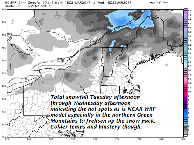
WEDNESDAY: A morning snow squall or snow shower exiting in the afternoon with dusting to an inch. Blustery, sharply colder. A high in the upper teens to lower 20s. Gusty northwesterly winds 10 to 25 mph lowering wind chills.
Looking Further ahead…
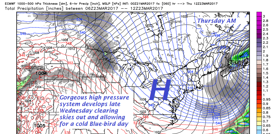
WEDNESDAY NIGHT: Clear and cold. A low 5 below to 10 above.
THURSDAY: Sunshine becoming filtered through high clouds. A high in the mid 20s.
FRIDAY: A little sun in the morning, then thickening clouds. leading to a scattered light accumulating snow showers with minor accumulation. A low 5 to 10. A high near 35.
SATURDAY: Mainly cloudy. Chance for a mountain snow shower or valley flurry southern half of Vermont. A low near 25. A high in the ranging mid 30s to low 40s.
Average lows 20 to 25. Normal highs 40 to 45.
RH/3-21[end]
