
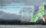
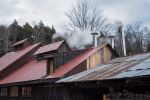
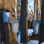
· Boil it – Major Sap flows continue into Satruday – before arresting by a strong Cold front.
-
- image0011
-
- image00313
-
- image0041
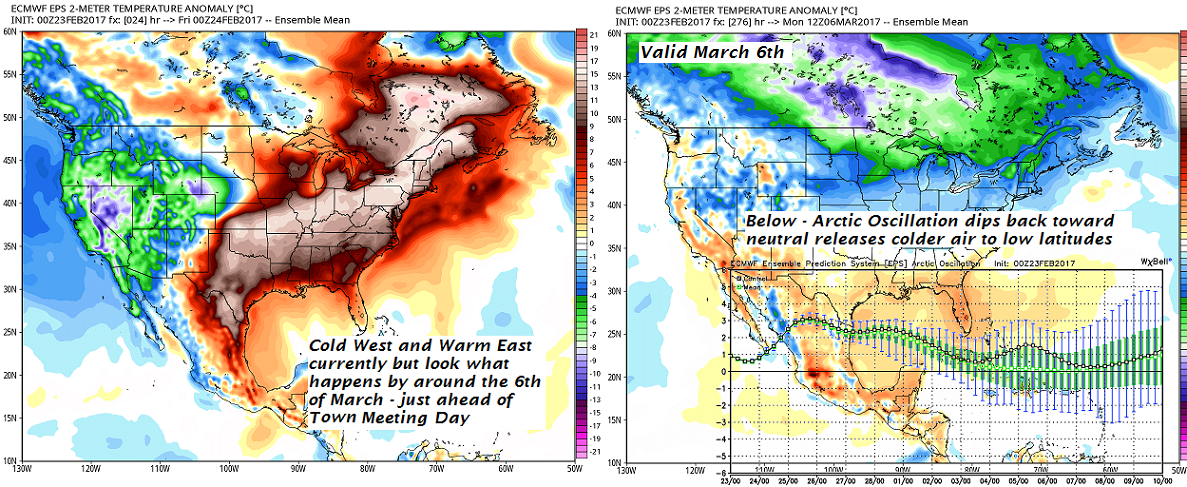
· Big Changes were coming down the road as we head toward Town Meeting but not until after a couple more big warm Oscillations to take place especially next Wednesday.
TODAY: Sunshine mixing with more clouds this afternoon. Scattered light rain showers or sprinkles this afternoon, mainly northern areas. Very mild. A high 55 to 60. Sap run likely! Southwest breeze 10 to 15 mph.
TONIGHT: Mostly cloudy. An isolated sprinkle or two. A low near 35. Light winds.
FRIDAY: Cloudy and gray. Rain showers likely. A high 40 to 45. North winds 10 mph.
Looking Further ahead…
Flood Watch Friday Evening through Sunday Evening…
FRIDAY NIGHT: Cloudy. Scattered rain showers. A low in the mid to upper 30s.
SATURDAY: Mainly cloudy & gray but very mild and breezy. Patchy drizzle especially southern and eastern Vermont…gives way to a round of rain showers in the afternoon. A high around 60. Gusty south winds.
SATURDAY NIGHT: Rain showers transition to a period of wet accumulating snow. Accumulation dusting to 2 “ valley floors up to locally 5” in the mountains making for slippery travel. Temperatures turn sharply colder falling into the mid to upper 20s.Gusty south winds shifting to westerly.
SUNDAY: Chance for a leftover mountain flurry, Otherwise mostly sunny, blustery and colder. A low 25 to 30. A high around 35.
MONDAY: More clouds than sun with occasional light flurries or sprinkles. A low near 25. A high in the low 40s.
TUESDAY: Sunshine gives way to lots of clouds. A low in the 20s. A high in the 40s.
WEDNESDAY: Cloudy and Gray. Chance for rain or showers. A low in the 40s. A high in the 50s to near 60.
Average lows in the upper single digits to mid teens. Normal highs in the low to mid 30s.
RH/2-23[end]
