
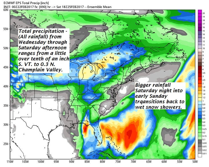
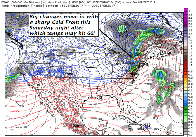
· Biggest weather system moves in Saturday night introducing a change toward winter like conditions again after some minor wet snow accumulations especially higher terrain.
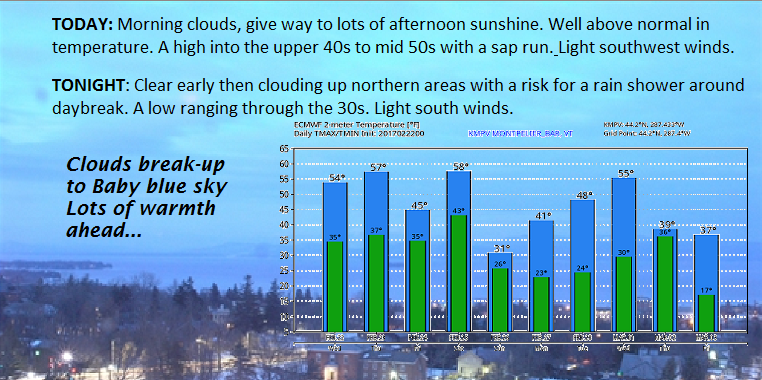
TODAY: Morning clouds, give way to lots of afternoon sunshine. Well above normal in temperature. A high into the upper 40s to mid 50s with a sap run. Light southwest winds.
TONIGHT: Clear early then clouding up northern areas with a risk for a rain shower around daybreak. A low ranging through the 30s. Light south winds.
THURSDAY: Sunshine mixing with clouds. Mild. Scattered light rain showers or sprinkles in the afternoon. A high ranging through the 50s. Sap run likely! Southwest breeze 10 to 15 mph.
Looking Further ahead…
THURSDAY NIGHT: Mostly cloudy. An isolated sprinkle or two. A low near 35.
FRIDAY: Lots of clouds. Rain showers likely. A high near 45.
SATURDAY: Mainly gray. Areas of drizzle give way to a round of rain showers Saturday evening. Rain showers transition to a periods of wet snow in the higher terrain. A morning low 40 to 45. A high pushing toward 60 in the afternoon then sharply colder Saturday night.
SUNDAY: Chance for a morning snow shower or flurry, then mostly sunny in the afternoon, but blustery and colder. A low in the 20s. A high around 32.
MONDAY: Partly sunny. Chance for a rain or snow showers. A low near 25. A high in the low 40s.
Average lows in the upper single digits to mid teens. Normal highs in the low to mid 30s.
RH/2-22[end]
