
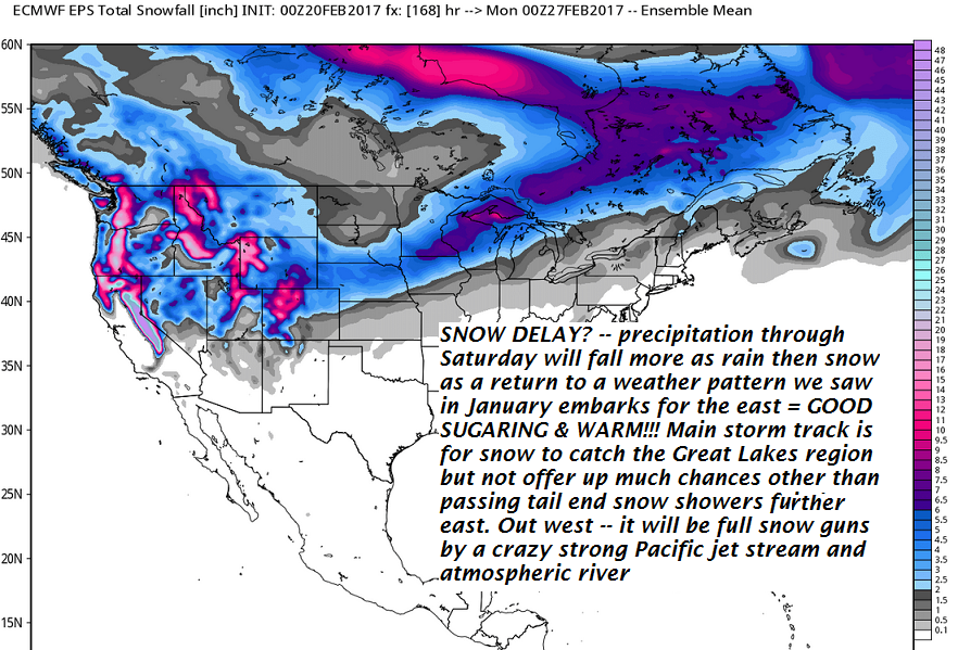
· Large Wave Amplitude – as a moisture starved trough of low pressure tracks out of the region today, a very large ridge of higher pressure will work in from the west and weaken an oncoming trough of lower pressure for Tuesday night.
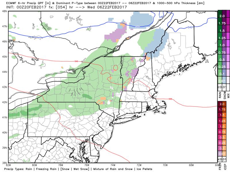
· This next weather system will bring a bit of “touchy” icy travel concern later Tuesday night, with either rain or wet snow showers, but they depart very nicely allowing for more sunhine Wednesday afternoon.
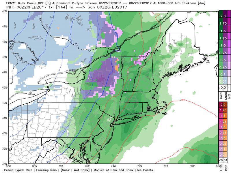
· After a warm front pushes in more rain showers Friday…the next weather maker will likely be the biggest in the line up. This one may be rather wet and windy, transitioning to wet snow showers on its tail end – but I would hang your hat on this one for decent snows. See below.
TODAY: Clouds giving way to mostly sunny skies with near seasonal temperatures. A high around 32. Northwest winds 10 to 15 mph.
TONIGHT: Mostly clear. A low ranging from the single digits to mid teens. Little wind.
TUESDAY: Sunshine becoming filtered by high clouds thickening up in the afternoon. A high in the upper 30s to around 40. South winds 10 to 15 mph.
Looking Further ahead…
TUESDAY NIGHT: Cloudy. Scattered passing showers of snow or rain. Possibly producing slippery travel later overnight. A low in the upper 20s to low 30s.
WEDNESDAY: Clouds with an isolated morning sprinkle, then partial clearing in the afternoon. A high in the upper 40s to around 50. Sap run.
THURSDAY: Partly sunny – well above normal. A low in the 20s with a high in the mid 50s. Sap run!
FRIDAY: Mostly cloudy. Occasional rain showers exiting late to partial clearing. A low around 35. A high in the 40s to low 50s. Possible Sap run.
SATURDAY: Mainly cloudy. Periods of rain developing in the afternoon, breezy to windy. A low in the 40s. A high in the pushing toward 60.
Average lows in the upper single digits to mid teens. Normal highs in the low 30s.
RH/2-20[end]
