
· 50/50 kind of day today with a few flurries flaring…but improvement as flow changes from down-wind of Great Lakes cutting off lake effects clouds and snowflakes to mostly clear skies tonight.
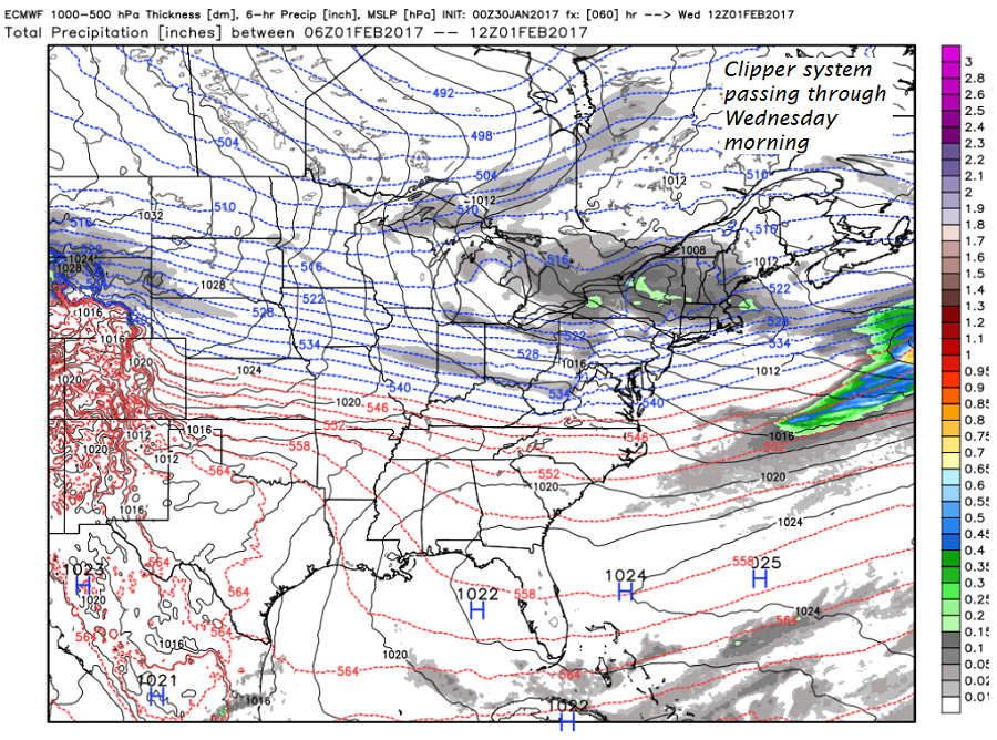
· Tomorrow – decent winter day watching the first of two weather systems train first to our south, and the second through our region arriving late Tuesday night and mostly Wednesday.
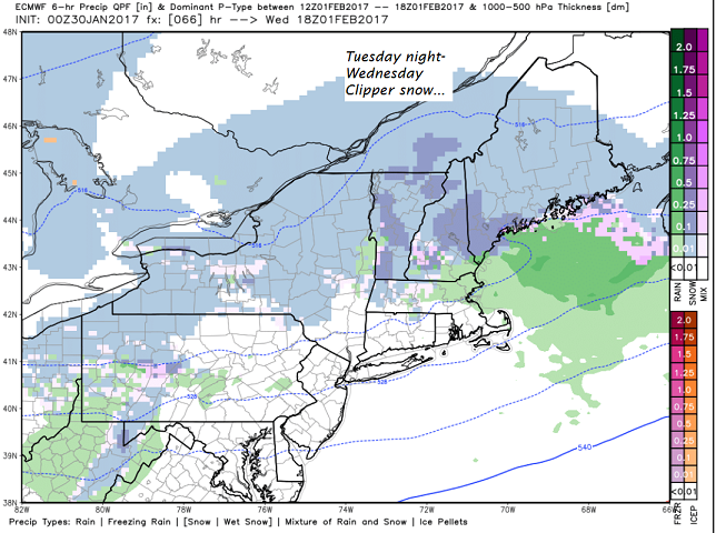
· Above is Wednesday early afternoon precipitation type in a all snow J.
· We in Vermont, have by decree not allowed any immigrating rain drops until fully vetted through the middle part of next month, but all forms of normal nice well being humans are acceptable – especially those persecuted. And we favor snow-lovers over those of warm weather 😉
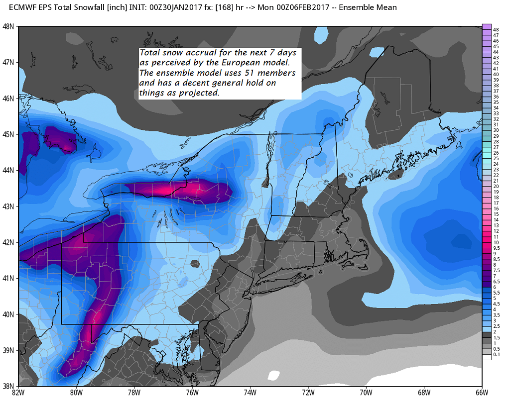
· Below is Euro ensemble project for the next 7 days for snow accrual.
TODAY: Clouds mixed with periods of sunshine. Widely scattered flurries especially mid day. A high in the lower 20s. Northwest winds around 10 mph.
TONIGHT: Mostly clear and cold. A low 5 to 10. Light west winds.
TUESDAY: Partly sunny. A high in the mid 20s. Light southwest winds.
Looking Further ahead…
TUESDAY NIGHT: Increasing and thickening clouds leading to periods of light snow or snow showers with a dusting to an inch accumulation. A low 20 to 25.
WEDNESDAY: Periods of light accumulating snow likely with around 1 to 3” accumulation. A high in the upper 20s to around 30.
THURSDAY: Partly sunny. Chance for a mountain flurry. A low around 10. A high in the low 20s.
FRIDAY: Mostly cloudy. Maybe a late day flurry. A low around 5 above. A high 15 to 20.
SATURDAY: Partly sunny. Chance for a flurry. A low around 5 above. A high in the mid to teens to around 20.
SUNDAY: Partly sunny. A low in the single digits below zero. A high in the 20s.
Average lows in the mid to upper single digits. Normal highs in the mid 20s to around 30.
RH/1-30[end]
