
· Superb day for outdoor ice skating! Sunny with temps reaching above the freezing mark most valley locations.
· Patchy high clouds rolling in ahead of the next weather system will blot out the now waning Wolf moon overnight.
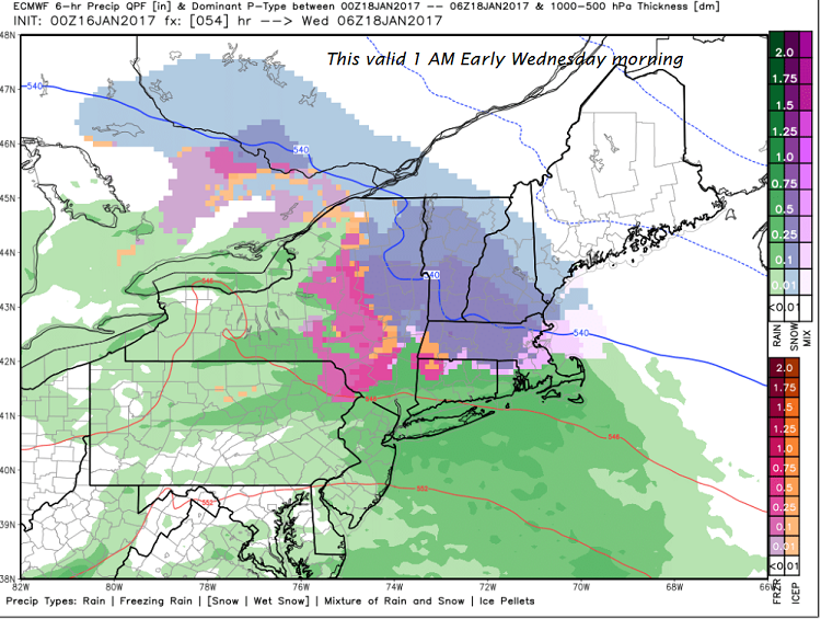
· Nasty central U.S. storm system to bring “mostly snow” – this a change over the weekend from prior computer modeling which had been giving our region a shellacking of ice.
· Around 2 to locally 5” amounts likely across the southern tier counties of Vermont, with lighter amounts further north. The snow to be wet and “Velcro-like” and may affect power if it’s heavy enough weighing on trees and power lines especially far southern Vermont.
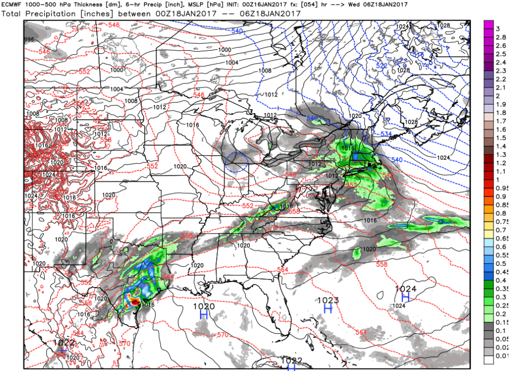
· Northern Vermont precip indicated by ECMWF model at much lighter amounts but still a travel head-ache for Tuesday night/Wednesday morning.
TODAY: Gorgeous. Sunshine with some high cloudiness at times mainly southern areas. A high in the mid 30s. Southwest winds 10 to 15 mph this afternoon.
TONIGHT: Mostly clear with some high cloudiness. A low in the mid teens to low 20s. Little wind.
TUESDAY: Filtered sunshine then thickening clouds. A high about 35 to 40. Southeasterly breeze 10 to 15 mph in the afternoon.
Looking Further ahead…
TUESDAY NIGHT: Good chance wet snow accumulation of 1 to locally 3” and risk for a wintry mix toward daybreak with slippery travel. A low 25 to 30.
WEDNESDAY: Mainly gray. A good chance for wet snow or a wintry mix in the morning. Scattered mountain flurries in the afternoon. A high in the mid 30s.
THURSDAY: Considerable cloudiness, with occasional light snow showers mixed with rain showers on valley floors exiting. Some minor accumulation possible in the mountains. A few breaks of afternoon sunshine. A low upper 20s to near 30. A high around 40.
FRIDAY: Considerable high cloudiness, otherwise fair and dry. A low in the 20s. A high in the low to mid 40s.
Average lows in the single digits. Normal highs in the 20s.
RH/1-16[end]
