
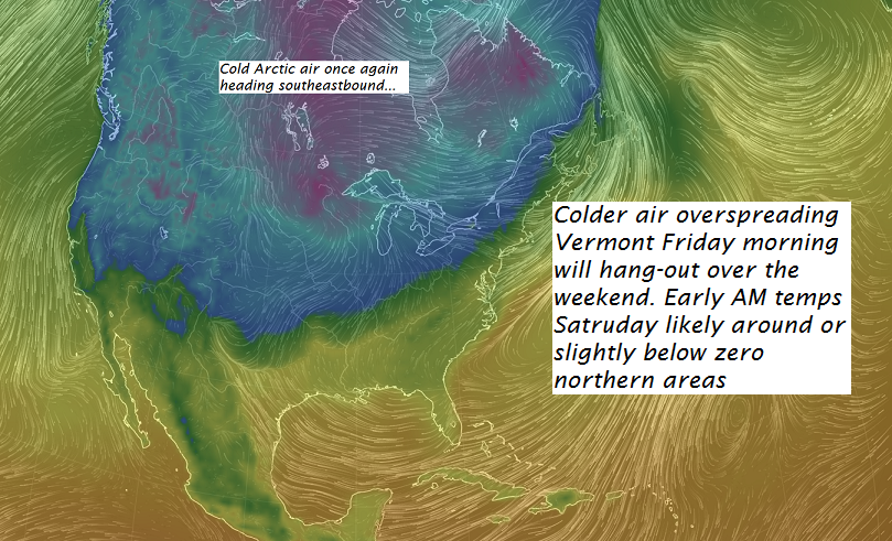
· Colder Transitions – Very nasty ice on untreated roads – many fpolks with drive ways – untreated = aboslute shear ice – some folks are stuck until the sander can make a run.
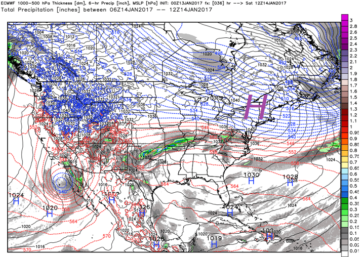
· Gorgeous high pressure builds in for Saturday morning (below) with some pretty cold temperatures.
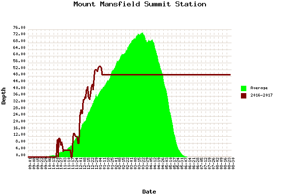
· Even though we have had rain…many northern Green Mountain areas are hold their own in the snow depth department.
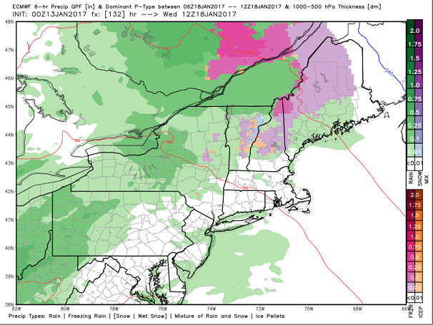
· Our next incoming storm brings a wintery mix to the local mountains and mostly just more rain which means yet more ICE!
· This scheduled for Wednesday morning – plan ahead accordingly.
TODAY: Scattered leftover mountain snow showers and valley flurries across northern areas this morning with a dusting to an inch. Otherwise becoming partly to mostly sunny but blustery. Temperatures holding in the mid 20s. Gusty northwest winds 10 to 20 mph.
TONIGHT: Clear, moonlit and frigid. A low 0 to 10 above. Northwest winds 10 mph.
SATURDAY: Lots of sunshine with a few high clouds. Colder. A high 15 to 20. Southwest winds 10 mph.
Looking Further ahead…
SATURDAY NIGHT: Mostly clear and partially moonlit with a few more clouds arriving overnight and a chance for flurries. A low in the teens.
SUNDAY: A few cloudy periods in the morning, then mostly sunny. Seasonably cold. A high in mid 20s.
MONDAY: Mostly sunny with some high cloudiness. A low around 10. A high 32 to 35.
TUESDAY: Filtered sun then clouding up. A low in the lower 20s A high 40 to 45.
WEDNESDAY: Mainly gray. Mixed precipitation higher terrain, changing to rain. A low near 32 A high in the 40s.
THURSDAY: Lots of clouds with a few intervals of sunshine. A low 35 to 40. A high around 45.
Average lows in the single digits. Normal highs mid to upper 20s.
RH/1-13[end]
