
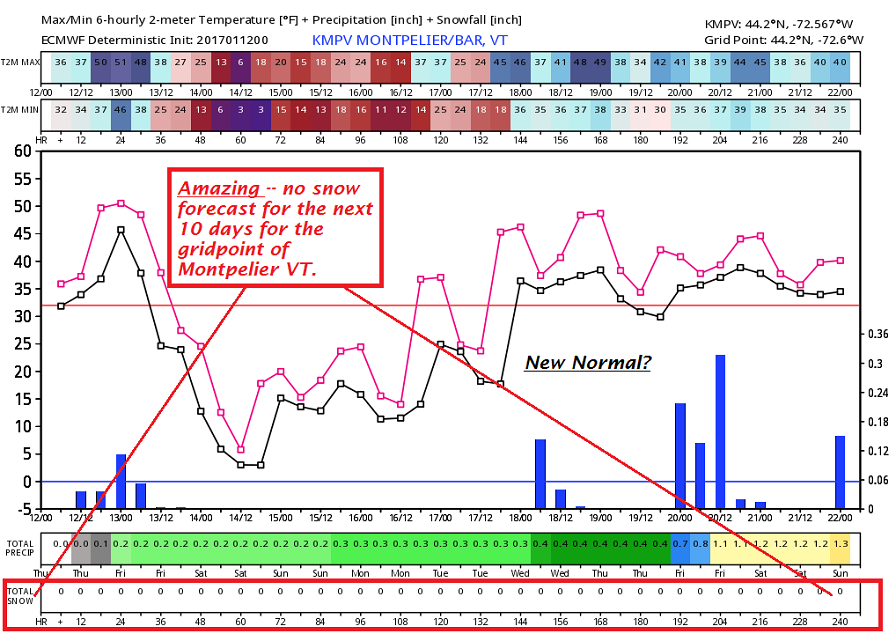
· CO2 readings at 404.48 and rising fast due to little uptake in the northern hemispheres winter, some of this finger print in climate change showing up also in our local Temperature projections for the next 10 days.
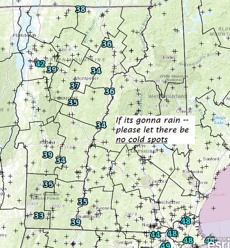
· With rain moving in pavement temperature sensors show frost mostly staying in the ground. This is saving the day – but please watch it for the morning commute.
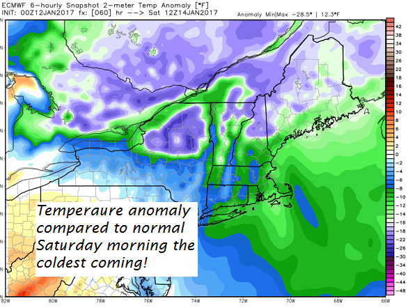
· Coldest weather coming – with very dry air! Friday night and over the weekend.
· This weekend requirement = 
with a big dome of higher pressure, tons of sunshine.
TODAY: Cloudy and gray. Rain showers with a risk for icy spots early on. Areas of fog. Mild and spring-like with a high near 50. South winds 10 to 20 mph.
TONIGHT: Rain showers early, tapering off scattered sprinkles mixed with wet snow flakes. A low 20 to 25.West winds 10 to 20 mph.
FRIDAY: Scattered leftover mountain snow showers and valley flurries across northern areas with a dusting to an inch, otherwise becoming partly to mostly sunny in the afternoon. Blustery. A high in the mid to upper 20s. Gusty northwest winds 10 to 25 mph.
Looking Further ahead…
FRIDAY NIGHT: Clear, fully moonlit and cold. A low 0 to 10 above.
SATURDAY: Lots of sunshine with a few high clouds. Colder. A high in the mid to upper teens.
SUNDAY: A few cloudy periods in the morning then mostly sunny. Seasonably cold. A low 10 to 15. A high in mid 20s.
MONDAY: Mostly sunny with some high cloudiness. A low 10 to 15. A high in the mid 30s.
TUESDAY: Filtered sun then clouding up. A rising chance for showers in the afternoon. A low 15 to 20. A high near 45.
WEDNESDAY: Considerable cloudiness. Chance for rain showers. A low around 35. A high around 50.
Average lows in the single digits. Normal highs mid to upper 20s.
RH/1-12[end]
